Ko Phra Thong
| Ko Phra Thong | ||
|---|---|---|
| Waters | Andaman Sea | |
| Geographical location | 9 ° 6 ' N , 98 ° 17' E | |
|
|
||
| length | 15 km | |
| width | 9 km | |
| surface | 88 km² | |
| Residents | uninhabited | |
Tambon Ko Phra Thong ( Thai : เกาะ พระทอง , other spelling: Koh Pra Thong ) is a municipality ( tambon - administrative unit) in the Amphoe Khura Buri district of the Phang Na province in southern Thailand .
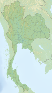
Ko Phra Thong is also the name of an island ("island" in Thai: Ko ) in the Andaman Sea off the coast of the southern Thai province of Phang Na.
The 88 km² island is a natural paradise because of its mangrove forests and its biodiversity (turtles, birds, endangered orchid species ). It is part of the Mu Ko Ra - Ko Phra Thong National Park, which was officially opened on July 19, 2001.
2004 tsunami disaster
Ko Phra Thong was devastated by the 2004 Indian Ocean earthquake .
There were discrepancies in the use of disaster relief, as the infrastructure set up by the Swiss Agency for Development and Cooperation is now partially used for tourism.
Individual evidence
- ↑ UNEP Islands (English)
- ↑ http://www.phangnga.go.th/english/Kuraburi.htm ( Memento from October 11, 2006 in the Internet Archive )
- ↑ Philipp Gut: Ghost Villages in No Man's Land. Weltwoche, accessed on February 8, 2017 .
