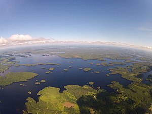
Konnivesi
| Konnivesi | ||
|---|---|---|

|
||
| Geographical location | Päijät-Häme , Kymenlaakso ( Finland ) | |
| Tributaries | Kymijoki | |
| Drain | Kymijoki , Kimola Canal | |
| Places on the shore | Heinola , Iitti | |
| Data | ||
| Coordinates | 61 ° 10 ' N , 26 ° 9' E | |
|
|
||
| Altitude above sea level | 77.4 m | |
| surface | 49.6 km² | |
| scope | 322.3 km | |
| Maximum depth | 53.08 m | |
| Middle deep | 8.05 m | |
The Konnivesi is a Finnish lake near Heinola and Iitti . Its area is approx. 50 km². The height above sea level is about 77 meters. The shore length of the lake extends over 300 km. The Konnivesi is on average 14 meters deep. Its greatest depth is 51 meters. Its maximum length is about 20 km.
In the southwest it has a connection to Lake Pyhäjärvi via the Kimola Canal, which was once important for rafting . The main drainage continues to be the actual course of the Kymijoki .
Individual evidence
- ↑ JÄRVIWIKI - Konnivesi (14.131.1.001)
- ^ Oiva - Environmental and Geo-Information Specialists. Accessed June 10, 2010 (requires registration).
