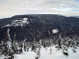
Koruna (Eagle Mountains)
| Koruna | ||
|---|---|---|
|
Roundabout from the Geiersgraben junction |
||
| height | 1101 m | |
| location | Czech Republic | |
| Mountains | Eagle Mountains | |
| Coordinates | 50 ° 16 '54 " N , 16 ° 25' 23" E | |
|
|
||
The Koruna (German Kreiselberg ) is with a height of 1101 m the second highest mountain in the Eagle Mountains ( Orlické hory ), part of the Middle Sudetes . The Kreiselberg is located 3 km southeast of the Velká Deštná ( Deschneyer Großkoppe ) and 5 km from the village Deštné v Orlických horách ( Deschney ).
Despite its height and location, the Koruna is one of the less visited mountains, partly because it is not on any signposted hiking trail. The Jirásek long-distance hiking trail, which crosses most of the peaks of the Eagle Mountains, bypasses the summit of the Kreiselberg to the north.
On the eastern slopes of the mountain there are a number of bunkers of the Czechoslovak Wall from 1936-38 against the former German border with the Glatzer Land . The rock formation Sphinx (Sfinga) is located near the summit of the upstream stone peak ( vapeny vrch ), above the hamlet of Rassdorf ( Kamenec ).
Ascent
From the junction Geiersgraben ( Pod Homolí ) below the Schnittberg ( Homole ) a path leads from the southeast to the summit of the Kreiselberg, which after 2 km leads over the high plateau. The summit has been cut down and offers a good view. The hiking trail to the neighboring Deschneyer Großkoppe leads over the Lotzen-Berg ( Jelenka ), on the slopes of which the source of the Zdobnice ( Stiebnitz ) is located.

