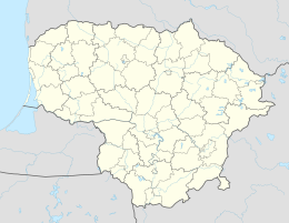
Krekenava
| Krekenava | ||
|
||
| State : |
|
|
| Coordinates : | 55 ° 33 ' N , 24 ° 6' E | |
| Inhabitants (place) : | 1,636 (2011) | |
| Time zone : | EET (UTC + 2) | |
| Postal code : | LT-38043 | |
|
|
||
Krekenava is a small town ( miestelis ) in Lithuania with 1,636 inhabitants in the Rajongemeinde Panevėžys , on the KK195 highway , 13 km northwest of Ramygala , on the right bank of the Nevėžis . It is the center of the Krekenava and Seniūnaitija administrative districts . The Krekenava Regional Park administration is located here .
history
In 1372 Kralinowie was mentioned in a document. From 1409 the place belonged to the Rodai manor , in the same year the Krekenava manor was mentioned in a document. In 1416 the place belonged to the nobles Vizgirdai . The first church in Krekenava was built by Vytautas in 1419 at the request of the priest in Betygala . From 1861 the place was the center of Volost . In 1865 the state primary school was built. In 1902 the Assumption Church , which was elevated to a minor basilica in 2011, was completed. Krekenavos agrofirma has existed since 1993 . In 2007 the middle school became the Krekenava Mykolas Antanaitis Grammar School.
literature
- Algimantas Misskinis. Krekenava. Visuotinė lietuvių enciklopedija , T. X (Khmerai Krelle). - Vilnius: Mokslo ir enciklopedijų Leidybos institutas, 2006. 761 psl.
- Krekenava. Lietuviškoji tarybinė enciklopedija , VI t. Vilnius: Mokslo ir enciklopedijų Leidybos institutas, 1980. T.VI: Kombinacija-Lietuvos, 160 psl.


