Crooked cross street

The Krumme Querstraße was a street in the old town of Lübeck .
location
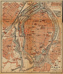
The approximately 60-meter-long Krumme Querstraße was located in the Marien Quartier on the western edge of the old town island and ran in a north-south direction. It began on Alfstrasse , diagonally across from the junction of Straight Querstrasse , and ended on Fischstrasse , across from Einhäuschen Querstrasse .
history
The Krumme Querstraße was first mentioned in 1558 as the Krumme Dwasstraße . The name was derived from the shape of the narrow street, which described a sharp swerve about halfway and was accordingly crooked. For the same reason, the name crooked elbow was still used for the street at the end of the 19th century .
In 1852 the traditional name Krumme Dwasstraße was officially set, but in 1884 it was changed to Krumme Querstraße .
The street, lined with historical buildings along its entire length and spanned by several candle arches , was completely destroyed in the air raid on March 29, 1942 , the ruins were later removed, so that after the end of the war there was actually only a fallow area at the site of the officially still existing Krumme Querstraße. In the course of the reconstruction in the 1950s , a new street was built, but its course was not congruent with the old one; it was not only wider and absolutely straight, but was also laid out as a direct extension of the straight cross street to which it was added in 1956. The Krumme Querstraße was abolished and deleted from the street directory.
literature
- W. Brehmer : The street names in the city of Lübeck and its suburbs. HG Rathgens, Lübeck 1889.
- Klaus J. Groth : World Heritage Lübeck - Listed Houses. Over 1000 portraits of the listed buildings in the old town. Listed alphabetically by streets. Verlag Schmidt-Römhild, Lübeck 1999, ISBN 3-7950-1231-7 .
- Max Hoffmann: The streets of the city of Lübeck. In: Journal of the Association for Lübeck History and Archeology. Jg. 11, 1909, ISSN 0083-5609 , pp. 215-292 (also special print: 1909).
Coordinates: 53 ° 52 ′ 4.9 " N , 10 ° 40 ′ 52.8" E

