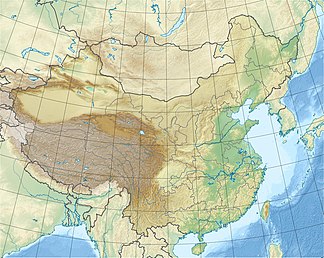
Lüliang Shan
| Lüliang Shan | ||
|---|---|---|
| Highest peak | Guandi Shan ( 2831 m ) | |
| location | Fangshan County in Shanxi ( PR China ) | |
|
|
||
| Coordinates | 37 ° 54 ' N , 111 ° 30' E | |
The Lüliang Shan or Lüliang Mountains (吕梁山) is a mountain range in the west of the Chinese province of Shanxi .
It forms the watershed of Huang He ( Yellow River ) and Fen He . Its main peak, the Guandi Shan , is 2,831 m high and lies in the east of the Fangshan County .
It was the scene of an armed peasant uprising ( Lüliang Shan nongminjun ) towards the end of the Ming Dynasty .
Web links
- Lüliang Shan nongminjun - Chinese
