
Galite Islands
| Galite Islands | ||
|---|---|---|
 |
||
| Waters | Mediterranean Sea | |
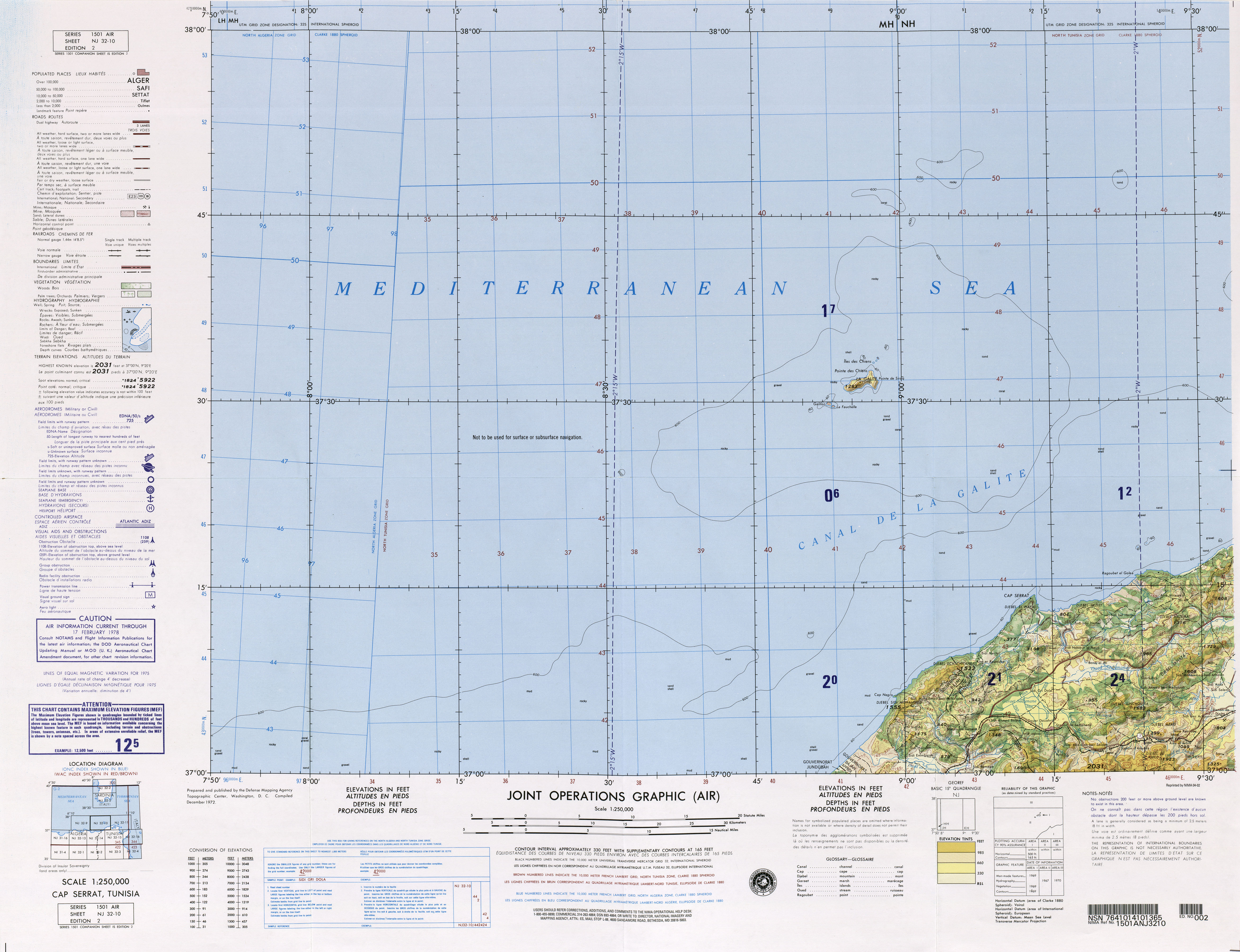
| Geographical location | 37 ° 32 ' N , 8 ° 56' E | |
|
||
| Number of islands | 6th | |
| Main island | La Galite | |
| Total land area | 8.08 km² | |
 |
||


The Galite Islands ( Arabic أرخبيل جالطة Archabil Dschalita , DMG Arḫabīl Ǧāliṭa , French La Galite ) are a rocky Tunisian group of islands.
geography
The islands are 38 km northwest of Cape Serrat , the closest point of the Tunisian mainland coast, from which they are separated by the Galite Channel, as well as almost 80 km north-northeast of the city of Tabarka , and 150 km south of Cape Spartivento in the south of Sardinia . The area of the group is about 8 km², with the lion's share on the main island of La Galite. The islands are of volcanic origin.
Main island of La Galite
The centrally located main island La Galite is 5.4 km long in an east-west direction and almost 2.9 km wide at its widest point in the east. The main island has 200 m high cliffs and is only accessible in the south at the Bay Escueil de Pasque . It is inhabited by a few fishing families. The island reaches a height of 391 m in the Bout de Somme (Grand Sommet), on which there is a yellow observation tower. Piton de l'Est , a cone-shaped peak that can be seen from afar, near the southeasternmost point of the island, reaches a height of 360 m.
In addition to the main island of La Gallite, there are two groups of secondary islands or rocks.
Galitons de l'Ouest
The Galitons de l'Ouest (West Galitons) are 3 km southwest of the main island. They consist of the second largest and third largest of the Galite Islands, the 158 m high island of Le Galiton (0.4 km²) and the 137 m high La Fauchelle , immediately southeast of Galiton. At the top of Le Galiton there is a 14 m high lighthouse. In order to preserve the Mediterranean monk seal , Le Galiton was declared a nature reserve by decree of the Ministry of Agriculture in July 1980.
Galitons de l'Est
The smaller Galitons de l'Est (East Galitons, also called Les Chiens ("The Dogs")) are located 1 to 2 km northeast of the main island. This group consists of three rocks, from north to south Gallo , Pollastro and Gallina. Gallo is the largest of the three rocks and reaches a height of 119 m. It represents the northernmost land mass of Tunisia and Africa.
history
The Tunisian independence leader Habib Bourguiba was the French colonial authorities of 21 May 1952 to 20 May 1954 at La Galite into exile banished .
administration
The Galite Islands form a sector ( L'Ile De La Gualite ) Delegation Bizerte-Nord in the Bizerte Governorate .