La Ligua
| La Ligua | |
|---|---|
|
Coordinates: 32 ° 27 ′ S , 71 ° 14 ′ W
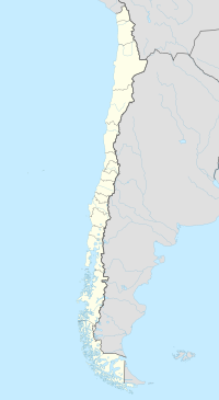
La Ligua on the map of Chile
|
|
|
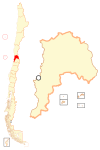
Location of La Ligua in Chile
|
|
| Basic data | |
| Country | Chile |
| region | Región de Valparaíso |
| City foundation | June 21, 1754 |
| Residents | 31,987 (2002) |
| Detailed data | |
| surface | 1163 km² |
| Population density | 27.5 inhabitants / km 2 |
| prefix | +56 33 |
| Time zone | UTC −4 |
| Website | |
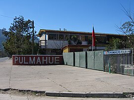
| School: Liceo "Pulmahue", La Ligua, Chile | |
La Ligua is a city in the middle of the South American Andean state of Chile . It is located in the Región de Valparaíso . It has about 32,000 inhabitants (as of 2002).
Geography and climate
The city is located about 154 km northwest of Santiago de Chile and about 110 km north of Valparaíso .
The climate is pleasant in due to the nearby Pacific coast. In summer it is 28 ° C and in winter 4 ° C.
history
The city was founded on June 21, 1754 by Governor Domingo Ortíz de Rozas . At that time the city was still called Villa Santo Domingo de Rozas . The name of the city is derived from the Indian word Lihuén . Gold was mined early on in the area around the city and in Valle Hermoso , followed by agriculture and the knitwear industry.
Attractions
The city has an archaeological museum, the Museo de La Ligua . It shows the history of the city as well as the history of the knitwear industry.
Nearby is Catapilco , where you can visit old gold mines. Ten kilometers east of the city is Las Chorreadas with its thermal springs. In the Valle Hermoso on the Río Ligua there are older workshops for the manufacture of knitwear.
Important incorporated localities on the coast are: Los Molles , La Ballena, Pichicuy, Los Quinquelles and Caleta La Ligua.
economy
La Ligua is known as the textile city of Chile. Every January there is a knitwear fair in the city, the Feria del Tejido .


