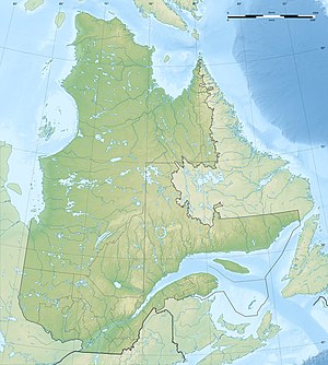
Lac Lapointe
| Lac Lapointe | ||
|---|---|---|
| Geographical location | Côte-Nord in Québec (Canada) | |
| Tributaries | Rivière Caniapiscau | |
| Drain | Rivière Caniapiscau | |
| Data | ||
| Coordinates | 53 ° 27 ′ N , 68 ° 35 ′ W | |
|
|
||
| Altitude above sea level | 573 m | |
| surface | 70 km² | |
| length | 32 km | |
| width | 5 km | |
The Lac Lapointe is a lake in the Administrative Region Côte-Nord of the Canadian province of Quebec .
Lac Lapointe is located in central Labrador 125 km northwest of Fermont . The lake is located in the area of the Canadian Shield at an altitude of 573 m . The Lac Lapointe represents a river broadening of the Rivière Caniapiscau on its upper reaches. The river drains the lake to Lac Chambeaux to the north . The elongated Lac Lapointe has a length of 32 km and a maximum width of 5 km. The area of the lake is 70 km².
The lake was named after Ernest Lapointe (1876–1941), a Canadian politician. There are other lakes of the same name in Québec.
