Lac Le Moyne
| Lac Le Moyne | ||
|---|---|---|
| Geographical location | Nunavik , North du Québec in Québec (Canada) | |
| Tributaries | from Lac Hérodier | |
| Drain | to Lac Kasakamisu | |
| Data | ||
| Coordinates | 57 ° 4 ′ N , 68 ° 24 ′ W | |
|
|
||
| Altitude above sea level | 181 m | |
| surface | 233 km² | |
| length | 64 km | |
| width | 8 kilometers | |
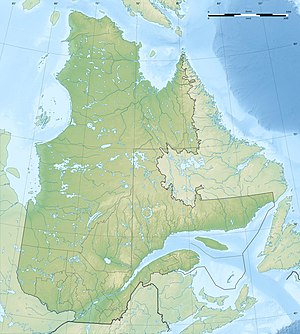
The Lac Le Moyne is a lake in the north of the Canadian province of Quebec .
Lac Le Moyne is 150 km south of Ungava Bay . It is fed by the Lac Hérodier lake to the north . The elongated lake with north-south orientation has a length of 64 km and a maximum width of 8 km. It is located at an altitude of 181 m in the area of the Canadian Shield . The area is 233 km². The Lac Le Moyne is drained southwards via Lac Kasakamisu , Rivière Bouvart , Lac Nachicapau , Rivière Nachicapau and Rivière Swampy Bay to the Rivière Caniapiscau .
The lake was named after Charles Le Moyne (1626–1685).
