
Lac de Melo
| Lac de Melo | ||
|---|---|---|

|
||
| Lac de Melo as seen from Lac de Capitello | ||
| Geographical location | Restonica Valley , Corsica | |
| Tributaries | from Lac Capitello | |
| Drain | Restonica → Tavignano | |
| Location close to the shore | Corte | |
| Data | ||
| Coordinates | 42 ° 12 '47 " N , 9 ° 1' 21" E | |
|
||
| Altitude above sea level | 1710 m | |
| surface | 6.5 ha | |
| Maximum depth | 20 m | |

The Lac de Melo (Corsican Lavu di Melu ) is a lake on Corsica in the Haute-Corse department , located in the Restonica high valley about 15 km from Corte .
geography
The lake, at an altitude of 1710 meters, has an area of 6.5 hectares and a depth of 20 m. It can be reached on foot in around an hour from the Bergerie de Grotelle. From Lac de Melo you can hike to Lac de Capitello in another hour .
The lake is frozen over about six months a year and forms the source of the Restonica river, which flows into the Tavignano near Corte .
Picture gallery
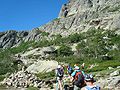
on the way to Lac de Melo

small hurdle on the way to Lac de Melo

