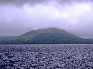
Lake Letas
| Lake Letas | |
|---|---|

|
|
| Mount Garat and Lake Letas | |
| Geographical location | Gaua , Banks Islands , Torba Province , Vanuatu |
| Drain | Mbe Solomul to the Pacific Ocean |
| Data | |
| Coordinates | 14 ° 16 '52 " S , 167 ° 32' 25" E |
| Altitude above sea level | 418 m |
| surface | 19 km² |
| volume | 0.8 km² |
| Maximum depth | 119 m |
| Middle deep | 42 m |
| Catchment area | 58 km² |
The Lake Letas is a lake in the island state of Vanuatu . With an area of 19 square kilometers, it is the largest lake in the small country in the South Pacific .
Location and dates
The lake is located in the center of the volcanic island of Gaua at the foot of the active volcano Mount Garat . The island of Gaua is located in the northern part of the national territory of Vanuatus. The lake has an area of 19 square kilometers and an average depth of 42 meters. At its deepest point, Lake Letas is 119 meters deep. The water volume of the lake is around 0.8 cubic kilometers. The lake's only outflow is the short Mbe Solomul with the Siri waterfall , which drains the lake's water into the Pacific Ocean .
UNESCO World Natural Heritage
Lake Letas, the Siri Waterfall and the surrounding rivers have been on Vanuatu's tentative list as candidates for UNESCO World Natural Heritage since 2004 .
use
The use of Lake Letas is a subject of Vanuatu politics. There are proposals to build a hydropower plant or to set up a nature reserve. A decision is still pending.
Individual evidence
- ↑ a b c d e f Lake Letas - 19 km2 - Facts, Map, Activities. Retrieved April 3, 2017 .
- ↑ Google Maps. Retrieved April 3, 2017 .
- ↑ UNESCO World Heritage Center: Lake Letas - UNESCO World Heritage Center. Retrieved April 3, 2017 .
