Lake Murchison
| Lake Murchison | |||||||||
|---|---|---|---|---|---|---|---|---|---|
|
|||||||||
|
|
|||||||||
| Coordinates | 41 ° 50 '3 " S , 145 ° 41' 36" E | ||||||||
| Data on the structure | |||||||||
| Construction time: | 1974-1987 | ||||||||
| Data on the reservoir | |||||||||
| Altitude (at congestion destination ) | 222 m | ||||||||
| Water surface | 4.5 km² | ||||||||
| Reservoir length | 20 km | ||||||||
| Reservoir width | 330 m | ||||||||
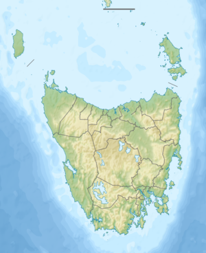
The Lake Murchison is a reservoir in the northwest of the Australian state of Tasmania , about 13 km southeast of Rosebery . It lies in the course of the Murchison River .
The southeast part of the lake lies in the Cradle Mountain Lake St. Clair National Park , while the northwest part borders the Granite Tor Conservation Area in the east .
Some of the water from this reservoir is channeled through the Sophia Tunnel into the Sophia River and thus into Lake Mackintosh , where it is used to generate electricity at the Mackintosh power station .
Web links and sources
- Lake Murchison - TAS . ExplorOz.com
- Map of Lake Murchison, TAS . Bonzle.com
- Steve Parish: Australian Touring Atlas . Steve Parish Publishing Pty. Ltd. Archerfield QLD (2007). ISBN 978-1-74193-232-4 . P. 60
