Lake Mackintosh
| Lake Mackintosh | |||||||||||
|---|---|---|---|---|---|---|---|---|---|---|---|
|
|||||||||||
|
|
|||||||||||
| Coordinates | 41 ° 41 ′ 0 ″ S , 145 ° 40 ′ 0 ″ E | ||||||||||
| Data on the structure | |||||||||||
| Construction time: | 1974-1987 | ||||||||||
| Power plant output: | 79.9 MW | ||||||||||
| Data on the reservoir | |||||||||||
| Altitude (at congestion destination ) | 219 m | ||||||||||
| Water surface | 31 km² | ||||||||||
| Reservoir length | 17.5 km | ||||||||||
| Reservoir width | 3.5 km | ||||||||||
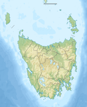
The Lake Mackintosh is a reservoir in the northwest of the Australian state of Tasmania , about 12 km northeast of Rosebery . It lies in the course of the Mackintosh River , whose entire upper and middle reaches it occupies.
While the Mackintosh River forms the northern half of the lake, the southern half is created by the damming of its tributary Sophia River . The Mackintosh River emerges again below the dam on the west side of the lake, north of the small town of Tullah , drives the turbines of the Mackintosh power plant and flows into Lake Rosebery . The lake is dammed at two dams, the Mackintosh Dam and the Tullabardine Dam . At the deepest point near the main dam, the lake is about 65 m deep and 83 km of shoreline. There are three larger and five smaller islands in the lake.
To the east, the reservoir borders the Granite Tor Conservation Area . In the southern third, the Murchison Highway accompanies the lake on its western side. There is also the small town of Tullah , which served as a workers' settlement during the construction phase.
literature
- The Pieman River power development . Tasmania Hydro-Electric Commission, Hobart TAS (1987)
