Rosebery (Tasmania)
| Rosebery | |||||||
|---|---|---|---|---|---|---|---|
 Mine at Mount Black in Rosebery (2009) |
|||||||
|
|||||||
|
|||||||
|
|||||||
|
|||||||
|
|
|||||||
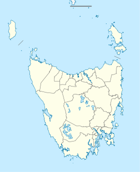
Rosebery is a city in the northwest of the Australian state of Tasmania . It is located at the north end of the West Coast Range at the foot of Mount Black . The Stitt River flows through the city, which is surrounded by reservoirs of Lake Rosebery , Lake Mackintosh , Lake Murchison, and Lake Pieman .
The Murchison Highway crosses the city. From Burnie it is 109 km away, while Hobart km 315th At the last census in 2016, the population was 708.
The population of Rosebury decreased by 22% from 1996 to 2006. The western district on Lake Pieman and on the banks of the Pieman River is called Primrose .
history
Like most other settlements on Tasmania's west coast, Rosebery is a mining town. In 1893 prospector Tom McDonald discovered alluvial gold with zinc-lead clumps in the dense rainforests on the slopes of Mount Black. McDonald staked various claims on behalf of the Rosebery Prospecting Association . This company later became the Rosebery Gold Mining Company . The South Rosebery Mining Company was founded a little later to exploit the southern continuation of the ore vein.
In 1896 the Rosebery Gold Mining Company renamed the Tasmanian Copper Company and the South Rosebery Mining Company became the Primrose Mining Company .
The most abundant metal in the ore vein was zinc; But since the techniques for isolating zinc from the ore were not yet known at that time, little could be done to exploit the ore vein. One company established for the experimental processing of zinc ore was the Tasmanian Metals Extraction Company (TME), which built a large facility on the Williamsford runway in 1912 . However, the experiments did not lead to success and so the plant closed again in 1914.
The Rosebery mines were owned by the Mount Lyell Mining and Railway Company in 1916 and were later merged with the Electrolytic Zinc Company of Australasia (EZ), which had found an effective way to extract zinc. In 1926 the construction of a mill in Rosebery began and in 1931 a cable car for the transport of ore from the '' Hercules Mine '' at Williamsford was completed. Due to the global economic crisis , the mill was not completed until 1936. Since then the mines in Rosebery have operated continuously; In February 2011 the company celebrated its 75th anniversary. The mines are currently operated by the Minerals and Metals Group Ltd. (MMG) operated; Zinc, lead, copper, silver and gold are extracted.
Before the Murchison Highway was built, the city was only connected to Burnie on Tasmania's north coast by the Emu Bay Railway .
Known residents
- Richard Flanagan - writer, historian and filmmaker
Gallery images
Stitt Falls on Rosebery Creek
literature
- Geoffrey Blainey: The Peaks of Lyell . 6th edition. St. David's Park Publishing, Hobart 2000, ISBN 0-7246-2265-9 .
- Lou Rae: The Abt Railway and Railways of the Lyell region . Lou Rae, Sandy Bay 2001, ISBN 0-9592098-7-5 .
- Charles Whitham: Western Tasmania - A land of riches and beauty . Municipality of Queenstown, Queenstown 2003.
- Edition 2003 - Queenstown: Municipality of Queenstown.
- 1949 edition - Hobart: Davies Brothers.
- 1924 edition - Queenstown: Mount Lyell Tourist Association.
Web links
- Stay in Authentic Miners Accommodation in the heart of Rosebery . Crib & Cradle
- Zinifex Rosebery Mine . Mineral Resources Tasmania
- Tourist information from 2004 (English)
- The Minerals and Metals Group website (English)
- MMG Rosebery provides feedback on workforce testing . MMG Group (April 2010)
Individual evidence
- ^ Bureau of Meteorology . Retrieved November 14, 2007.
- ↑ a b Australian Bureau of Statistics : Rosebery (L) ( English ) In: 2016 Census QuickStats . June 27, 2017. Retrieved April 3, 2020.


