Landhaus (Bad Freienwalde)
The Landhaus , a lodging and bath house in Bad Freienwalde (Oder) in Brandenburg, is located on the northern edge of the Gesundbrunnen area. It is a listed building.
history
In 1788, on the advice of his State Minister, Friedrich Wilhelm II decided to improve the treatment and accommodation options in Bad Freienwalde for noble guests. He bought it from the owner of the mill Pape opposite the Gesundbrunnen street the property at the Well. The so-called Landhof was located on the property of today's country house. The construction according to plans and building supervision by Carl Gotthard Langhans under building inspector Dornstein was completed in 1790. The house consisted of 15 guest rooms on two floors, each with a bath tub. There was a dining room in the house. The cook lived in the basement, and the kitchen was also located here - in addition to a copper kettle for heating the bath water. The servants lived in eight rooms under the roof.
Spa cures were carried out here until the middle of the 19th century, the exact time at which the spa cures ended is not known. The Progymnasium used the building from 1865 to 1867 . During the First and Second World Wars the house was used as a hospital . A vocational school was located here from 1945, and a secondary school from 1961. From 1976 the building was used as a boarding school. From 1997 the house was rebuilt as part of the specialist clinic, based on the earlier appearance of the building including the original color scheme.
The House
The country house is an early classical building with a mansard hipped roof . The roof supports four dormers with curved gables. In the middle of the symmetrical facade with nine axes there is a three-axis central projection . The center of the risalit forms a round-arched entrance niche with a dome over both storeys, and a triangular gable is located above the central risalit. There is a staircase with seven steps in front of the entrance. There are depictions by Christian Bernhard Rode above the entrance . The entrance can be approached from both sides with slopes. The facade is structured by cornices in such a way that the building appears to consist of a high first floor and a low upper floor.
Little of the original furnishings has been preserved inside. The basement has been developed according to today's standards, the roof structure has been almost completely renewed. A mural by Bernhard Rode is no longer available. Essentially, only the staircase with railing has been preserved from the first furnishing.
The environment
There is a sundial directly in front of the country house and the driveway. This sundial can already be seen on an engraving from around 1800. It can therefore be assumed that the sundial was erected with the construction. The original dial was made of marble, it was renewed around 1900. In 2000 the sundial was renovated again.
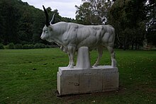
The country house is located on the northern side of the Gesundbrunnen and its park. There is a wooded slope behind the house. The address is Gesundbrunnenstraße 33a. The sculpture "The Bull" by Louis Tuaillon is located south of the country house in the spa gardens , but the sculpture has remained unfinished. The street Heilige Hallen with several former inns and pensions begins right at the house . The street Heilige Hallen ends at Papengrund below the ski jumps of Bad Freienwalde.
literature
- Ilona Rohowski, Ingetraud Senst: Monument topography Federal Republic of Germany, monuments in Brandenburg. Volume 9.1: District of Märkisch-Oderland. Part 1: towns of Bad Freienwalde and Wriezen, villages in Niederoderbruch. Wernersche Verlagsgesellschaft, Worms am Rhein 2006, ISBN 3-88462-230-7 , pp. 106-108.
Web links
Individual evidence
- ↑ List of monuments of the state of Brandenburg: Landkreis Märkisch-Oderland (PDF) Brandenburg State Office for Monument Preservation and State Archaeological Museum
- ^ Building description from 1795
Coordinates: 52 ° 46 ′ 36 ″ N , 14 ° 1 ′ 21 ″ E

