Langesee
| Langesee | ||
|---|---|---|

|
||
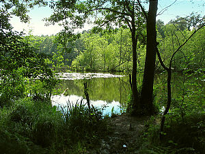
| At the Langen See in the Schlaubetal near Müllrose | ||
| Geographical location | Germany , Brandenburg , Oder-Spree district | |
| Tributaries | Schlaube | |
| Drain | Schlaube | |
| Data | ||
| Coordinates | 52 ° 10 '7 " N , 14 ° 25' 57" E | |
|
|
||
| surface | 12 ha | |
| Maximum depth | 2.5 m | |
The Langesee is a lake south of Müllrose and east of Beeskow . It is a popular fishing water and is located in the Schlaubetal Nature Park . The Schlaube flows through it. Colloquially also Langersee or Langer See .
fishing
There are mainly stocks of eel , perch , pike , carp , tench , catfish and pikeperch . Fishing is permitted under special consideration of the protection provisions of the Schlaubetal Nature Park.
