Lapche Kang
| Lapche Kang I. | ||
|---|---|---|
|
View from Cho Oyu to Lapche Kang |
||
| height | 7367 m | |
| location | Tibet Autonomous Region ( China ) | |
| Mountains | Lapche Himal ( Himalaya ) | |
| Dominance | 38.31 km → Cho Oyu | |
| Notch height | 1947 m ↓ Phuse La | |
| Coordinates | 28 ° 18 '15 " N , 86 ° 21' 3" E | |
|
|
||
| First ascent | October 26, 1987 by a Sino-Japan. expedition | |
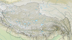
The Lapche Kang (also Lapche Kang I or Labuche Kang I Lobuche Kang I or Choksiam ) is a glaciated mountain in the Himalayas in the autonomous region of Tibet .
The mountain has a height of 7367 m . It is located in the Lapche Himal . The Shishapangma is 55 km further west, the Cho Oyu is 38 km southeast of the Lapche Kang. To the west of Lapche Kang is the 7,072 m high Lapche Kang II , while to the east is the 7,250 m high, unclimbed Lapche Kang III .
The first ascent of Lapche Kang was achieved on October 26, 1987 by a Sino-Japanese expedition (the Japanese Hidekatsu Furukawa, Keiichi Sudo, Osamu Tanabe and Ataru Deuchi and the Tibetans Wanjia, Diaqiog, Gyala and Lhaji). The ascent route led from the northeast up the west ridge to the summit.
While trying to climb the Lapche Kang of the two American climbers Joe Puryear and David Gottlieb , Puryear had a fatal accident on October 27, 2010.
Web links
- Labuche Kang, China on Peakbagger.com (English)

