Lapche Kang II
| Lapche Kang II | ||
|---|---|---|
|
in the middle Gauri Sankar , right of it Colangma , pyramid far right Lapche Kang II |
||
| height | 7072 m | |
| location | Tibet Autonomous Region ( PR China ) | |
| Mountains | Lapche Himal ( Himalaya ) | |
| Dominance | 2.88 km → Lapche Kang I. | |
| Notch height | 772 m ↓ (6300 m) | |
| Coordinates | 28 ° 18 '15 " N , 86 ° 19' 16" E | |
|
|
||
| First ascent | April 30, 1995 by a Swiss expedition | |
The Lapche Kang II (also Labuche Kang II or Lobuche Kang II or Choksiam II ) is a glaciated mountain in the Himalayas in the Tibet Autonomous Region .
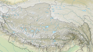
The pyramid-shaped mountain has a height of 7072 m . It is located in the Lapche Himal on the border of the Nyalam and Tingri counties . The Lapche Kang I ( 7367 m ) rises 2.88 km further east. The 6952 m high Colangma massif lies 3.75 km west-northwest. A glacier flows north from Lapche Kang II to the high mountain lake Colangma, 6 km away .
The first ascent was made on April 30, 1995 by a Swiss expedition of the Swiss Alpine Club (Christian Meillard, Thierry Bionda and André Müller). The ascent route led over the 6300 m high saddle between Lapche Kang I and Lapche Kang II and over the east ridge up to the summit. The other expedition participants followed a few days later - Simon Perritaz, André Geiser and Pierre Robert on May 2nd and Dominique Gouzi, Carole Milz, Heinz Hügli and Doris Lüscher on May 5th.
Web links
- Labuche Kang II, China on Peakbagger.com (English)
- Photo of the Lapche Kang massif at summitpost.org
- Lapche Kang II at mountainsoftravelphotos.com

