Lata (American Samoa)
| Lata | ||
|---|---|---|
| height | 963 m | |
| location | Ta'u , Manu'a Islands | |
| Coordinates | 14 ° 14 ′ 0 ″ S , 169 ° 27 ′ 0 ″ W | |
|
|
||
| particularities | Highest mountain American Samoas | |
|
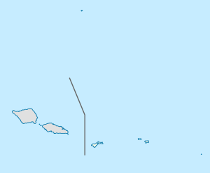
Location of the Lata in the National Park and on Taʻū |
||
Mount Lata on the Samoan island of Taʻū in the southern Pacific reaches a height of 963 m , according to other sources 966 m, making it the highest elevation of both the Manu Islands and American Samoas .
The mountain is located in the east of the island and is part of the American Samoa National Park . Most of it is covered by thick forests. The cliffs on the cliffs south of the Lata are among the highest in the world.
Taʻū is the remainder of the tip of a shield volcano , half of the caldera of which has slipped into the sea . To the east of the rim of this caldera lies the Lata, which consists of volcanic rock.
Individual evidence
- ↑ Elevations and Distances ( Memento of the original from November 20, 2010 on WebCite ) Info: The archive link was inserted automatically and has not yet been checked. Please check the original and archive link according to the instructions and then remove this notice. , United States Geological Survey , accessed January 15, 2011
- ↑ Lata Mountain on Peakbagger.com (English)
- ↑ The Park on nps.gov, accessed 15 January 2011
- ↑ American Samoa National Park Sights Page , accessed January 15, 2011

