
Dew
| Dew | ||
|---|---|---|
 |
||
| Waters | Pacific Ocean | |
| Archipelago | Manua Islands | |
| Geographical location | 14 ° 14 ′ 0 ″ S , 169 ° 28 ′ 0 ″ W | |
|
||
| length | 10 km | |
| width | 6 km | |
| surface | 45.7 km² | |
| Highest elevation |
Lata 966 m |
|
| Residents | 790 (2010) 17 inhabitants / km² |
|
| main place | Dew | |
 |
||

Taʻū , also called Tau , is the largest of the Manu’s islands in American Samoa . The island of volcanic origin was also called Opoun in the 19th century . Taʻū is the remainder of the tip of a shield volcano , half of the caldera of which has slipped sideways into the sea. The edge of the caldera forms the highest mountain in American Samoa, the Lata , with a height of 966 m.

The island is also home to Fitiuta Airport, the largest airfield in the Manua Islands ( IATA airport code : FTI ) with a runway length of 960 meters. A road connects all the villages on the island, and there is also a port from which all the surrounding islands can be approached. The most important places on the island are Fitiʻuta , Faleāsao , Taʻū and Lumā .
On the island lies part of the National Park of American Samoa with the ancient holy site of Saua, which is considered by the Polynesians to be one of their birthplaces.
Since the end of 2016, the island's power supply has been ensured by a solar park with 1.4 MW output and 6 MWh battery storage from SolarCity and Tesla . The storage unit can bridge three sunny days and is fully charged in seven hours. The system replaces the previous power supply with diesel generators .
administration
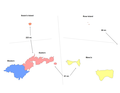
The island forms the main part of the Manua district
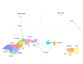
The three counties Faleāsao, Fitiʻuta and Taʻū are located on the island

Two of the counties are further subdivided into villages


Counties and Villages
- Faleāsao
- (31) Faleāsao
- Fiti'uta
- (39) Leusoaliʻi
- (41) Maia
- Dew
- (40) Lumā
- (63) Si'ufaga
Web links
- Pictures and information ( Memento from October 30, 2013 in the Internet Archive )
- Picture and short description ( memento from December 23, 2010 in the Internet Archive )
- Taʻū in the Global Volcanism Program of the Smithsonian Institution (English)
Individual evidence
- ↑ Amelia Heathman: This island is powered entirely by solar panels and batteries thanks to SolarCity. In: wired.co.uk . November 23, 2016. Retrieved November 23, 2016 .