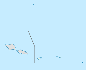
Tutuila
| Tutuila | ||
|---|---|---|
| Tutuila, Amalu Bay | ||
| Waters | Pacific Ocean | |
| Archipelago | Samoa Islands | |
| Geographical location | 14 ° 18 ′ S , 170 ° 44 ′ W | |
|
|
||
| surface | 140.3 km² | |
| Highest elevation |
Matafao 653 m |
|
| Residents | 54,359 (2010) 387 inhabitants / km² |
|
| main place | Pago Pago | |
| Map of Tutuila | ||
Tutuila (old name: Tienhoven , French also Maouna ) is a volcanic island and with 135 square kilometers the largest island in the area of American Samoa . On it lies the main town , Pago Pago .
In 2010, 54,400 people lived on Tutuila. The main sources of income are the copra and fish industries as well as handicraft products. The highest point on the island and all of American Samoas is the 653 m high Matafao . To the east of Tutuila is the Aunu'u island .
The island was discovered for Europe in 1722 by the Dutchman Jakob Roggeveen . He gave her the name "Tienhoven" after his escort ship Tienhoven . In 1887, the French expedition led by Jean-François de La Pérouse reached the island. In a clash with the locals on December 12, 1787, Captain de Langle and the doctor de Lamanon were killed.
On September 29, 2009, a seaquake measuring 8.0 on the Richter scale occurred around 200 kilometers to the south , triggering a tsunami . Large parts of the south coast were flooded, around 30 people died and serious property damage was caused. The tsunami warning system in the South Pacific had issued a warning via SMS , but the tsunami had already accumulated after 15-20 minutes , so that many people could no longer get to safety.
Web links
- Tutuila in the Global Volcanism Program of the Smithsonian Institution (English)
- Map of Tutuila
Individual evidence
- ^ Carl Friedrich Behrens: The well-attempted southerner, trip around the world 1721/22, reprinted by Brockhaus-Verlag Leipzig 1923, p. 92
- ^ Augustin Krämer , Emil Krauss : Samoa . In: Heinrich Schnee (Ed.): Deutsches Kolonial-Lexikon , Volume III, Leipzig 1920, pp. 214 f ..


