Lenkoraner lowland
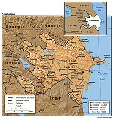
The Lenkoran Lowlands ( Azerbaijani Lənkəran ovalığı ) is a lowland in southeastern Azerbaijan , located between the Talysh Mountains and the Caspian Sea .
The Lenkoraner lowland is 25 to 30 km wide in the north and 5 to 6 km in the south. It is one of the areas with a humid subtropical climate restricted to Transcaucasia , but smaller in area compared to Colchis . The soil consists of yellow and podsolized yellow earth as well as swamp and meadow soils.
In the 20th century, the lowland was largely transformed from a swampy, malaria-infested area into a cultivation zone for subtropical intensive crops. Tea, citrus fruits, rice and vegetables are grown.
The lowland was originally covered with Hyrcania jungle until the beginning of the 20th century . These primeval forests (with the exception of the "Moscow Forest", which is now part of the Hirkan National Park) were cleared in the lowlands for the cultivation of subtropical crops. Today's forests, which grew again in abandoned cultivation areas, are young secondary forests with little undergrowth.
Tea leaves and wood are processed industrially and canned fruits and fish are produced. The urban centers of the area are the port cities of Lənkəran , Astara and Masallı .
Coordinates: 39 ° 7 '17.4 " N , 48 ° 42' 26.6" E
Individual evidence
- ↑ a b Environmental Impact Assessment , Ministry of Transport of the Republic of Azerbaijan, Asian Development Bank , September 2011 (English)
