Liangkang Kangri
| Liangkang Kangri | ||
|---|---|---|
|
Liangkang Kangri (left) and Gangkhar Puensum (right) |
||
| height | 7534 m | |
| location | Gasa ( Bhutan ), Tibet ( PR China ) | |
| Mountains | Himalayas | |
| Dominance | 2 km → Gangkhar Puensum | |
| Notch height | 234 m ↓ (7300 m) | |
| Coordinates | 28 ° 3 '50 " N , 90 ° 26' 36" E | |
|
|
||
| First ascent | May 9, 1999 by a japan. expedition | |
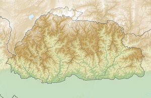
The Liangkang Kangri (also Liankang Kangri ) is a peak in the Himalayas on the border between Bhutan and the People's Republic of China and at the south-eastern end point of a territory claimed by both states.
The Liangkang Kangri is 7534 m high. A ridge leads south to the 7570 m high Gangkhar Puensum 2 km south-southeast . Due to the low notch height of 234 m, the Liangkang Kangri is not considered a separate mountain. To the west, a ridge leads to the 6680 m high Chumhari Kang . The Liangkang Glacier on the northwest flank and the Namsang Glacier on the eastern flank of the Liangkang Kangri form the headwaters of the Lhobrak Chhu , a headwaters of the Kuri Chhu . The glacier on the southwest flank belongs to the Mangde Chhu catchment area .
Ascent history
The Liangkang Kangri was first climbed by a Japanese expedition in 1999. On May 4, 1999, Kiyohiko Suzuki reached the summit over the northeast ridge together with four other expedition members. On the following day, A. Yamamoto also climbed the summit with four companions.
Web links
- Liangkang Kangri, Bhutan on Peakbagger.com (English)

