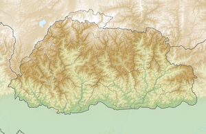
Gangkhar Puensum
| Gangkhar Puensum | ||
|---|---|---|
|
Gangkhar Puensum as seen from Ura La |
||
| height | 7570 m | |
| location | Bhutan , Tibet ( PR China ) | |
| Mountains | Himalayas | |
| Dominance | 228.14 km → Zemu Kang | |
| Notch height | 3049 m ↓ Tang La | |
| Coordinates | 28 ° 2 '49 " N , 90 ° 27' 18" E | |
|
|
||
| First ascent | unclimbed | |
The Gangkhar Puensum (also Kangkar Pünzum , Kankar Punsum ) is the highest mountain in Bhutan before the Kula Kangri and at the same time the highest unclimbed mountain on earth.
Different sources give partly divergent information about the exact height of the mountain. The specified 7570 meters were determined by a British expedition who failed to climb Gangkhar Puensum in 1986.
It is also unclear whether the mountain belongs entirely to Bhutanese territory, on the one hand because maps of the region are generally very imprecise, and on the other because there is a conflict between Bhutan and the People's Republic of China over the course of the common border.
In 1983, mountaineering was temporarily allowed in Bhutan. In 1985/86 a total of four expeditions failed when attempting to climb Gangkhar Puensum. In 1994, mountaineering above 6000 m was prohibited by law by the Bhutanese state, as the local population regards the mountain peaks as the abode of spirits and gods. In 1998, however, a Japanese expedition secured a license to climb the mountain from the Mountaineering Association of the PRC. The expedition dared the ascent from the north, but was only able to fully climb one northern secondary peak, the Liangkang Kangri ( 7534 m ).
Web links
- Gangkar Punsum, Bhutan / China on Peakbagger.com (English)
- Tsuguyasu Itami: Gankar Punsum & first ascent of Liankang Kangri. Mountain in dispute on China-Bhutan Border (PDF; 301 kB)
- Satellite image of the Kangkar Pünsum (Google Maps)
Individual evidence
- ↑ Foreign Policy. Country information - Bhutan. Federal Foreign Office, accessed on July 28, 2017 .

