Licola (Victoria)
| Licola | |||||||
|---|---|---|---|---|---|---|---|
 Macalister Bridge over the Macalister River |
|||||||
|
|||||||
|
|||||||
|
|||||||
|
|||||||
|
|
|||||||
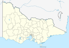
Licola is a place in Victoria , Australia , located on Licola Road in the Shire of Wellington , 254 km east of Melbourne .
The place is the southern gateway to the Alpine National Park .
Tourism, forestry and agriculture create employment. There is a trading house, a post office and a gas station and a few houses in the village. It is the only place in Victoria that is not connected to the electricity network. The place is frequented by motorcyclists, campers and hikers.
The Lions Club owns a large area of land near Licola and runs a youth camp there, which is surrounded by agricultural land.
The first post office was renamed Glenfalloch on September 14, 1908 and 1912. The post office was reopened in the years 1914–1919, 1920–1923 and 1954–1993.
In July 2007, masses of water in and around Licola wreaked havoc on roads, farms and in the national park area. The main road to Heyfield was then closed for two months and the listed Cheynes Bridge was destroyed and had to be recreated.
Web links
Individual evidence
- ↑ Australian Bureau of Statistics : Licola ( English ) In: 2016 Census QuickStats . June 27, 2017. Retrieved April 19, 2020.
- ^ Premier Postal History: Post Office List . Retrieved April 11, 2008.
- ↑ Clean-up begins as Vic flood crisis eases , Posted Mon Nov 5, 2007, ABC News (Australian Broadcasting Corporation)
