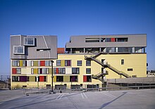
Lincoln Heights (Los Angeles)

Lincoln Heights is a northeastern downtown neighborhood of Los Angeles , California .
geography
Geographically, Lincoln Heights is bounded to the west by the Los Angeles River , to the south by the San Bernardino Freeway , to the east by Soto Street and to the north by hilly land. The Interstate 5 goes through the quarter. The Metro Gold Line connects the district to public transport via the Lincoln / Cypress Park stop. Lincoln Heights is bordered by Boyle Heights , Chinatown , Cypress Park , Downtown Los Angeles , El Sereno , Elysian Park , Elysian Valley , Highland Park , Montecito Heights, and Mount Washington .
history
The history of Lincoln Heights dates back to the 1870s. The neighborhood was one of the first in Los Angeles. Initially, mostly wealthy citizens lived here who built a number of Victorian houses. Today these are looked after by the preservation department . Because of the pollution caused by industrial development at the beginning of the 20th century, wealthy citizens moved on to Hollywood. Lincoln Heights was henceforth characterized by an Italian-American and Hispanic population. After the end of World War II , many established residents moved to the surrounding middle-class residential areas. The construction of the Golden State Highway divided the area in half, accelerating the population exodus. Today, Lincoln Heights is considered a barrio with a Hispanic and Asian population.
Demographics
In 2005 Lincoln Heights had about 80,000 residents. 89.1% of them are Latinos and 17.3% Asians. The proportion of the white and black population is 3.6%.
Infrastructure
- The Los Angeles Fire Department maintains Fire Station 1 in Lincoln Heights.
- The Central Health Center in Downtown cares for the residents.
- There are two high schools, two middle schools, six elementary schools and some private schools in the district.
Web links
- History of Lincoln Heights (English)
Individual evidence
- ^ Lincoln Heights in the Los Angeles Times Mapping LA project
Coordinates: 34 ° 4 ′ 9.4 " N , 118 ° 10 ′ 35.9" W.
