Interstate 5
| Basic data | ||||||||||||||||||||||||||||||||||||||||||||||||||||||||||||||||||||||||||||
|---|---|---|---|---|---|---|---|---|---|---|---|---|---|---|---|---|---|---|---|---|---|---|---|---|---|---|---|---|---|---|---|---|---|---|---|---|---|---|---|---|---|---|---|---|---|---|---|---|---|---|---|---|---|---|---|---|---|---|---|---|---|---|---|---|---|---|---|---|---|---|---|---|---|---|---|---|
| Length: | 1381 mi / 2222 km | |||||||||||||||||||||||||||||||||||||||||||||||||||||||||||||||||||||||||||
| States: |
California Oregon Washington |
|||||||||||||||||||||||||||||||||||||||||||||||||||||||||||||||||||||||||||
| map | ||||||||||||||||||||||||||||||||||||||||||||||||||||||||||||||||||||||||||||

|
||||||||||||||||||||||||||||||||||||||||||||||||||||||||||||||||||||||||||||
|
course
|
||||||||||||||||||||||||||||||||||||||||||||||||||||||||||||||||||||||||||||
The Interstate 5 (abbreviated I-5 ) is part of the Interstate Highway System in the United States. It runs along the west coast between the Mexican and Canadian borders and connects u. a. the most important metropolises of California (San Diego, Los Angeles, Sacramento), Oregon (Eugene, Salem, Portland) and Washington (Olympia, Tacoma, Seattle).
The only exception is San Francisco ; this city is about 80 miles or 130 kilometers west of the I-5.
length
| miles | km | Country | |
| 796.53 | 1,281.89 | California | |
| 308.14 | 495.90 | Oregon | |
| 276.62 | 445.18 | Washington | |
| 1,381.29 | 2,222.97 | Total | |
history
Between Stockton and Portland there is a 965 km (600 mi) stretch of the Siskiyou Trail . The Siskiyou Trail was based on the paths of the North American Indians that connected the Pacific Northwest and the California Long Valley . In the 1820s, the roads between what is now Washington and California were first used by fur hunters and trappers for the Hudson's Bay Company . During the second half of the 19th century, mule trains, stagecoaches and the Central Pacific Railroad followed the course of the Siskiyou Trail. In the early 20th century, with the increase in automobiles, roads were also built along the paths of the trail, such as California State Route 1 or US Highway 101 . These Pacific Highways run from the Canadian province of British Columbia to San Diego before the border with Mexico.
From 1977 to 1987, two independent serial killers roamed Interstate 5. The two men, identified as Randall Brent Woodfield , aka The I-5 Killer , in 1981 and Roger Reece Kibbe, aka The I-5 Strangler , in 2008 , have committed at least 25 murders and numerous other crimes. On May 14, 1983, serial killer Randy Steven Kraft was also stopped and arrested on I-5 at Mission Viejo . He murdered at least 16 men between 1971 and 1983, and is suspected of killing 51 other people. When the officers checked him for his lurching driving style, one of his victims was still in the car. Kraft awaits his execution at San Quentin State Prison today .
On October 13, 2007, there was a serious accident with several dead and injured near the Newhall Pass Interchange with California State Route 14 . The scene of the accident was about 48 km north of downtown Los Angeles, in a 170 meter long bypass tunnel for trucks.
Since February 26, 2008, traffic data has been collected on a section north of Los Angeles with the help of the German TerraSAR-X satellite in order to develop new traffic monitoring methods.
On May 23, 2013 at around 7:00 p.m. (local time), the bridge over the Skagit River between Burlington and Mount Vernon collapsed in Washington State . Several people were dragged into the river approx. 5 m below in their vehicles and some of them had to be rescued by rescue workers.
On December 18, 2017, in the DuPont railway accident, a locomotive and several wagons of Amtrak train 501 crashed onto Interstate 5 after derailing from a bridge southwest of Tacoma. Several people were killed and injured.
course
California

Interstate 5 begins, seen from the south, on the Mexican border at the border crossing at San Ysidro , one of the most used border crossings in the world. It then heads towards San Diego as the John J. Montgomery Freeway and through the suburbs of National City and Chula Vista before the interstate reaches downtown San Diego. I-5 then runs parallel to the Pacific coast across the University of California San Diego campus and 45 km (25 miles) through Marine Corps Base Camp Pendleton in northern San Diego County .
At Dana Point , I-5 moves from the coast inland in a northerly direction to Mission Viejo . To the southeast of Irvine is El Toro Y , where Interstate 405 branches off. After the junction, the interstate is called the Santa Ana Freeway , which runs through many towns and suburbs, such as Santa Ana or Anaheim , into Orange and Los Angeles Counties. From the East Los Angeles Interchange , where I-5 meets Interstate 10 , it is referred to as the Golden State Freeway to California State Route 14 south of Santa Clarita .
After the interstate has left the San Fernando Valley and the greater Los Angeles area, it runs over the Newhall Pass through the Santa Susana Mountains into the Santa Clarita Valley . Before the I-5 leads into the San Joaquin Valley , it crosses the Tehachapi Mountains with the Tejon Pass . Over the next 19 kilometers, the height of the road decreases from 1250 meters to 488 meters above sea level at Grapevine on the edge of the San Joaquin Valley. A few miles further, California State Route 99 branches off the interstate and leads to Bakersfield . With the exception of shorter six-lane sections in the Los Angeles area, Interstate 5 from the Mexican border to the junction with CA 99 has almost eight, sometimes even up to twelve, lanes.
From the junction of the CA 99 to Tracy , the I-5 runs four lanes in a north-easterly direction on the edge of the valley. This section is often used as a bypass around large cities like Bakersfield or Fresno . Interstate 580 , which leads to the San Francisco Bay Area and ends at San Rafael , begins a few kilometers before Tracy . Interstate 5 continues north to Tracy, passing cities such as Stockton and Sacramento , the capital of California. Interstate 505 branches off near Dunnigan and ends at Vacaville on Interstate 80 . In the area around the cities of Stockton and Sacramento, I-5 has six lanes over a length of around 40 kilometers, and even eight lanes on a section near Sacramento. The remaining sections in Northern California are four-lane.
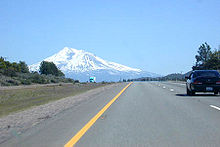
At Red Bluff , the I-5 reaches the northern tier of the Sacramento Valley and also reaches the Shasta Cascade . After passing Redding and the Pit River Bridge near the Shasta Dam , it leads to the base of Mount Shasta . One of the last towns before the Oregon border is Yreka .
Oregon
About five kilometers after the border, Interstate 5 reaches the Siskiyou Summit . At 1,314 meters, this pass is the highest point on the entire interstate. After crossing the Rogue River Valley , the road meets larger towns such as Ashland , Medford and Grants Pass . It then heads north through the Umpqua Valley to Roseburg . To Eugene I-5 passes through the Willamette Valley ; I-5 crosses the river several times in the further course. At Eugene, the highway meets Interstate 105 , which is used together with Oregon State Route 126 as a feeder from the greater Eugene area. After the cities of Albany and Corvallis , Interstate 5 crosses Salem , the capital of Oregon. There were plans to build a bypass route called Interstate 305. This road was later built with the name Oregon State Route 99E Business .
Interstate 5 leaves Salem in a northeast direction. Shortly before Portland , Interstate 205 branches off from it, which is used as a bypass in the greater Portland area. It crosses the Willametter River at Wilsonville via the six-lane Boone Bridge . The I-5 passes the towns of Tualatin and Tigard and meets Oregon State Route 99W , which until 1972 had the status of a US highway. In the center, Interstate 405 branches off before I-5 crosses the Willamette River on the Marquam Bridge . Before I-405 ends at I-5, Interstate 84 begins , which leads to Echo , Utah . With the crossing of the Columbia River on the Interstate Bridge in the north of Portland, she crosses the border to Washington State.
Washington
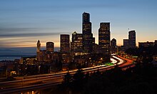
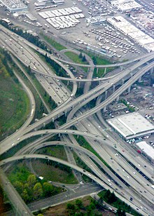
The first Washington city that Interstate 5 passes through is Vancouver . About eleven kilometers (seven miles) after the border, I-205 ends in the Salmon Creek metropolitan area , and I-5 leaves the greater Portland and Vancouver area. It then heads north to Kelso and Longview parallel to the Columbia River and then through the Willapa Hills to Olympia , the capital of Washington state. From there it runs in a north-easterly direction to Tacoma , where it affects Fort Lewis and McChord Air Force Base . From Tacoma I-5 leads north again. Interstate 90 begins in Seattle , the largest city in the state of Washington, and ends in Boston after almost 5000 kilometers . After the cross she crosses Portage Bay with the Ship Canal Bridge . With Everett , the interstate leaves the greater Seattle area again in a northerly direction. After towns like Mount Vernon and Bellingham , it ends in the north of Blaine . From the Canadian border , the I-5 merges into British Columbia Highway 99 .
Feeders and bypasses
- Interstate 805 near San Diego
- Interstate 905 near San Diego (planned)
- Interstate 105 near Los Angeles
- Interstate 605 near Los Angeles
- Interstate 405 near Los Angeles
- Interstate 205 at Tracy
- Interstate 305 at Sacramento
- Interstate 505 at Zamora
- Interstate 105 at Eugene
- Interstate 205 (Oregon-Washington) near Portland (Oregon)
- Interstate 405 near Seattle
- Interstate 705 at Tacoma
See also
Web links
- California Highways (English)
- aaroads.com: Interstate 5 in California , Oregon, and Washington (English)
Individual evidence
- ↑ Museum of the Siskiyou Trail ( Memento of the original from April 15, 2012 in the Internet Archive ) Info: The archive link was inserted automatically and has not yet been checked. Please check the original and archive link according to the instructions and then remove this notice.
- ↑ Randy Kraft, the Freeway Killer ( Memento from October 14, 2013 in the Internet Archive )
- ↑ New York Times: Pileup in California Freeway Tunnel Kills at Least 3, October 14, 2007
- ↑ DLR Portal: Overview even in the dark and fog - traffic information via radar satellite from March 4, 2008
- ↑ Highway bridge in Washington state collapses. Spiegel Online, accessed May 24, 2013 .
- ↑ Interstate Guide


