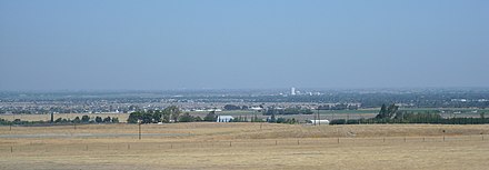
California Long Valley

The California Long Valley ( English California Central Valley ) is over 600 kilometers long and up to 80 kilometers wide valley in Central California .
It is bounded on all sides by mountain ranges : the California Coast Mountains in the west, the Sierra Nevada in the east, the Klamath Mountains in the north and the Tehachapi Mountains in the south. The valley is drained by the Sacramento River to the north and the San Joaquin River to the south. After these rivers the northern part of the valley is also called the Sacramento Valley , the southern part the San Joaquin Valley . Both rivers join a little north of the middle of the valley and flow west through the valley's only natural opening into San Francisco Bay .
The Californian long valley lies in the area of the subtropical winter rain climate ; all precipitation falls almost exclusively from December to April. In summer, on the other hand, there is an arid climate . In the north there is more rain (moderate precipitation) than in the low-precipitation south. The Pacific high, which is located west of the coastal mountains in southwestern California in summer, cannot bring any precipitation to the southern part of the valley because access is denied by the mountains. Originally, almost the entire valley was made up of grassland , remnants of which are only preserved in the Carrizo Plain National Monument , as intensive agriculture is practiced today.
The valley lies west of the agronomic dry line , which means that rain-fed farming is no longer possible. Artificial irrigation is possible thanks to the groundwater reserves in the south, but this harbors dangers such as salinisation and decline in soil fertility. The temperatures in the long valley rarely fall below 8 ° C, even in winter, which enables year-round cultivation. The typical form of vegetation latitudinal valley is that of California white oak ( Quercus lobata ), California Evergreen Oak ( Quercus agrifolia embossed) California oak savanna that of endemic species like the yellow-billed magpie ( Pica nuttalli is used).
The valley is often referred to as the fruit garden of America . The whole of the USA is supplied from here, and goods are also exported to other countries. The crops are particularly popular in the US because they are very rare. This can be dates , almonds , rare fruits and vegetables or wine . In the area of more than 50,000 square kilometers, around 250 different agricultural products are grown, with a turnover of 17 billion US dollars (2009).
Special methods have been devised to protect the crops. These include ovens that are set up in winter and are intended to stir up the cold air, since frequent cold downward winds could otherwise cause the fruit to freeze to death. Alternatively, the fruit and vegetables are sprayed with water. When the water freezes, heat is released (heat of crystallization ), so that the temperature of the fruit can be kept at freezing point for a long time - the juice only freezes at lower temperatures because of the dissolved substances.
However, a major problem is irrigation . Since there are differences in altitude of up to 600 meters, the water often has to be pumped uphill. The farmers have installed almost 200 electric pumps for this purpose , but they consume a lot of energy and are very expensive to purchase and maintain. There are also canals , but there is a high risk of evaporation because they run unprotected over the site and are exposed to the sun. This can be remedied by underground water tunnels, which are mostly in the mountains and take the water with them from there. Another option are dams . Every year they catch the water from the snowmelt and store it. This water is then used to generate electricity, which can then drive the pumps.
The fruit orchard is one of the largest energy and groundwater consumers in the USA, which is a problem in the arid south of California.
The location between the two parallel mountain chains across the main wind direction leads to frequent inversion weather conditions . Since the population growth from the middle of the 20th century, this has often resulted in smog . The particulate matter is in the Central Valley because of this climate of high: half of all cities in the US, which the WHO exceed limit value, are in California's Central Valley.
The Central Valley is threatened by disastrous Arkstorms .
literature
- Mark Bittman: Everyone Eats There , New York Times Magazine, Oct 10, 2012
Web links
- Central Valley Tourism Association
- CA Central Valley & Foothills , project area of the American Land Conservancy
- Great Valley Center
- Valley vision
Individual evidence
- ↑ www.faz.net, Aktuell, Wissen, Erde, Grundwasser, January 7, 2010, Horst Rademacher: Dowsing rods in space
- ↑ atlanticcities: Why Does California's Central Valley Have Such Bad Air Pollution? , September 28, 2011
Coordinates: 38 ° N , 121 ° W


