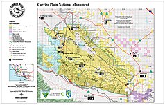
Carrizo Plain National Monument
| Carrizo Plain National Monument | ||
|---|---|---|
| Soda Lake in the plain | ||
|
|
||
| Location: | California , United States | |
| Next city: | San Luis Obispo | |
| Surface: | 1,100.7 km² | |
| Founding: | January 17, 2001 | |
Carrizo Plain National Monument is a protected area of the National Monument type in the US state of California . It lies on a plain between two mountain ranges and preserves an ecosystem as it originally existed in the whole of southern California's Central Valley . The area was placed under protection by President Bill Clinton in the final days of office in early 2001 and is administered by the Bureau of Land Management , an agency of the US Department of the Interior .
description
The Carrizo Plain (after the Spanish word for reed ) is located in the southern California coastal mountains between the small mountain ranges Caliente Range and Temblor Range . It has no natural runoff , all precipitation accumulates in Soda Lake , a lake in the northwest of the area that has dried up almost all year round. It is characterized by a steppe climate and contains the only extensively preserved grassland in California. This enables the potentially natural vegetation of the neighboring valley of the San Joaquin River in California's long valley to be reproduced. Thanks to artificial irrigation, it is now one of the world's most important fruit-growing areas and the most intensively used agricultural area in the United States.
The predominant vegetation consists of panicle grasses , whereby the terrain structure creates a small-scale mosaic of various plant communities depending on soil moisture, height and location. In the lowest elevations, at Soda Lake, salt-tolerant logs and other foxtail plants grow . Even the slightest elevations protect the ground from the salts, here are various composites . Drier, higher locations are populated by lupins . Junipers and oaks grow here and there in somewhat more protected central locations . Several small ranges of hills are loosely made up of different species from the genus of the seaweed . Shortly after rainfall, which occurs mainly in the winter half-year, the plain appears as a sea of flowers, mainly the daisy family and lupins.
The sanctuary is the largest contiguous habitat of the desert subspecies of the kit fox . The pronghorn and the Thule subspecies of the elk were released back into the wild before they were placed under protection . Since the 1990s, Californian condors that have been released further north can be seen foraging in the Carrizo Plain. The plain is a resting place and winter quarters for the sandhill crane , the curlew and the ringed plover as well as a large number of birds of prey . Several plant species that are specially protected and critically endangered under federal law by the Endangered Species Act and California state law also grow here . That is why the plain was classified as a high priority area by the US Fish and Wildlife Service, which is responsible for species protection , even before it was designated a National Monument .
The San Andreas Fault runs on the northeast side of the area, under the flank of the Temblor Range . Because of the dry climate, it is hardly eroded in this section , so that it can be perfectly observed in the Carrizo plain.
Carrizo Plain National Monument today
The plain was settled by homesteaders in the second half of the 19th century . In addition, several small ore mines were set up in the adjacent mountain ranges. They were abandoned because the region was neither lucrative for agriculture nor for mining. Large parts of the area were used as a cattle farm with low intensity before they could be bought by the non-profit conservation organization The Nature Conservancy . This sold the land on to the federal government for the establishment of the National Monument.
Painted Rock , a sandstone rock on the edge of the plain is sacred to the Chumash Indians and is given special consideration in the protection and maintenance concept of the area. The rock and other places in the area, as well as artifacts , were recognized as a Historic District in 2012 with the status of a National Historic Landmark .
Web links
- Bureau of Land Management: Carrizo Plain National Monument (official site )
- Nature Conservancy: Carrizo Plain National Monument (official site )
- Friends of Carrizo Plain
- Biotope mapping: Plant species in Carrizo NM (PDF file; 362 kB)
Individual evidence
- ^ Department of the Interior: Secretary Salazar Designates Thirteen New National Historic Landmarks , March 6, 2012
- ↑ Listing of National Historic Landmarks by State: California. National Park Service , accessed July 24, 2019.


