
Interstate 64
 |
|||||||||||||||||||||||||||||||||||||||||||||||||||||||||||||||||||||||||||||||||||||
| Basic data | |||||||||||||||||||||||||||||||||||||||||||||||||||||||||||||||||||||||||||||||||||||
|---|---|---|---|---|---|---|---|---|---|---|---|---|---|---|---|---|---|---|---|---|---|---|---|---|---|---|---|---|---|---|---|---|---|---|---|---|---|---|---|---|---|---|---|---|---|---|---|---|---|---|---|---|---|---|---|---|---|---|---|---|---|---|---|---|---|---|---|---|---|---|---|---|---|---|---|---|---|---|---|---|---|---|---|---|---|
| Length: | 960 mi / 1547 km | ||||||||||||||||||||||||||||||||||||||||||||||||||||||||||||||||||||||||||||||||||||
| States: |
Missouri Illinois Indiana Kentucky West Virginia Virginia |
||||||||||||||||||||||||||||||||||||||||||||||||||||||||||||||||||||||||||||||||||||
| map | |||||||||||||||||||||||||||||||||||||||||||||||||||||||||||||||||||||||||||||||||||||

|
|||||||||||||||||||||||||||||||||||||||||||||||||||||||||||||||||||||||||||||||||||||
|
course
|
|||||||||||||||||||||||||||||||||||||||||||||||||||||||||||||||||||||||||||||||||||||
Interstate 64 (abbreviation I-64 ) is part of the US interstate highway system . Its western end is located in O'Fallon (Missouri) west of the exit to Missouri Supplemental Route , its eastern end is at Bowers Hill in Chesapeake ( Virginia ) at the junction with Interstate 264 and Interstate 664 .
Major cities along the route
- St. Louis
- Mount Vernon
- Louisville
- Frankfort
- Lexington
- Ashland
- Huntington's
- Charleston
- Beckley
- Lewisburg
- Lexington
- Staunton
- Charlottesville ( Virginia )
- Richmond
- Williamsburg
- Newport News
- Hampton
- Norfolk
- Virginia Beach ( Virginia )
- Chesapeake
Feeders and bypasses
- Interstate 164 at Evansville
- Interstate 264 near Louisville
- Interstate 264 in the Hampton Road area
- Interstate 464 in the Hampton Road area
- Interstate 564 in the Hampton Road area
- Interstate 664 in the Hampton Road area
gallery

Transition to I-64 at Lexington
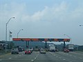
Paying point on I-64

Enter West Virginia on I-64


literature
- Rand McNally : The Road Atlas 2005 . 2005.
Web links
- American Byways article on Interstate 64
- Official website of the West Virginia Turnpike
- Roads to the Future
- Missouri Department of Transportation to extend I-64
| Main Interstates |
2 • 4 • 5 • 8 • 10 • 12 • 15 • 16 • 17 • 19 • 20 • 22 • 24 • 25 • 26 • 27 • 29 • 30 • 35 • 37 • 39 • 40 • 43 • 44 • 45 • 49 • 55 • 57 • 59 • 64 • 65 • 66 • 68 • 69 • 70 • 71 • 72 • 73 • 74 • 75 • 76 (west) • 76 (east) • 77 • 78 • 79 • 80 • 81 • 82 • 83 • 84 (West) • 84 (East) • 85 • 86 (West) • 86 (East) • 87 • 88 (West) • 88 (East) • 89 • 90 • 91 • 93 • 94 • 95 • 96 • 97 • 99 |

|
|---|---|---|
| Hawaii | ||
| Alaska | ||
| Puerto Rico |