Chesapeake, Virginia
| Chesapeake | ||
|---|---|---|
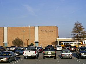
 Western Branch High School |
||
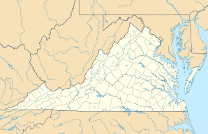
| Location in Virginia | ||
|
|
||
| Basic data | ||
| Foundation : | 1963 | |
| State : | United States | |
| State : | Virginia | |
| Coordinates : | 36 ° 43 ′ N , 76 ° 14 ′ W | |
| Time zone : | Eastern ( UTC − 5 / −4 ) | |
|
Inhabitants : - Metropolitan Area : |
222,209 (status: 2010) 1,381,583 (status: 2004) |
|
| Population density : | 251.8 inhabitants per km 2 | |
| Area : | 908.8 km 2 (approx. 351 mi 2 ) of which 882.5 km 2 (approx. 341 mi 2 ) are land |
|
| Height : | 9 m | |
| Postcodes : | 23320-23328 | |
| Area code : | +1 757 | |
| FIPS : | 51-16000 | |
| GNIS ID : | 1496841 | |
| Website : | www.cityofchesapeake.net | |
| Mayor : | Dr. Alan P. Krasnoff | |
 Prince of Peace Catholic Church |
||
Chesapeake is an independent city in the South Hampton Roads region in the east of the US state Virginia . The population in 2010 was 222,209.
history
The city was only created in 1963 from the merger of the city of South Norfolk with Norfolk County . The name City of Chesapeake was chosen by popular vote.
Population development
| year | Residents¹ |
|---|---|
| 1980 | 114,486 |
| 1990 | 151.982 |
| 2000 | 199.184 |
| 2010 | 222.209 |
¹ 1980–2010: Census Results
Adjacent counties and cities
- Portsmouth, Virginia (north)
- Norfolk, Virginia (north)
- Virginia Beach (east)
- Currituck County (south)
- Camden County, North Carolina (south)
- Suffolk, Virginia (west)
sons and daughters of the town
- Orlandus Wilson (1917–1998), gospel singer and arranger
- Kenny Easley (born 1959), American football player
- Alonzo Mourning (* 1970), basketball player
- Dré Bly (born 1977), American football player
- Edward Seward (born 1978), basketball player
- Spencer Ross (born 1981), basketball player
- Michael Copon (* 1982), actor, model and singer
- Percy Harvin (born 1988), American football player
- Chris Rumble (* 1990), ice hockey player
- Grant Holloway (* 1997), track and field athlete
Web links
Commons : Chesapeake, Virginia - Collection of Pictures, Videos, and Audio Files
