Danville, Virginia
| Danville | ||
|---|---|---|
| Nickname : River City, City of Churches | ||
 View of downtown Danville looking north |
||
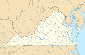
| Location in Virginia | ||
|
|
||
| Basic data | ||
| Foundation : | 1792 | |
| State : | United States | |
| State : | Virginia | |
| Coordinates : | 36 ° 35 ′ N , 79 ° 24 ′ W | |
| Time zone : | Eastern ( UTC − 5 / −4 ) | |
| Residents : | 41,130 (as of 2017) | |
| Population density : | 368.9 inhabitants per km 2 | |
| Area : | 113.8 km 2 (approx. 44 mi 2 ) of which 111.5 km 2 (approx. 43 mi 2 ) is land |
|
| Height : | 162 m | |
| Postcodes : | 24540-24544 | |
| Area code : | +1 434 | |
| FIPS : | 51-21344 | |
| GNIS ID : | 1492837 | |
| Website : | www.danville-va.gov | |
| Mayor : | Alonzo Jones (until June 30, 2022) |
|
Danville is a city in the south of the US state Virginia that does not belong to any county ( independent city ). According to the results of the 2010 census , the city had 48,411 inhabitants and an area of 113.8 km².
history
Danville was the last capital of the Confederate States of America . From April 3 to 10, 1865, Jefferson Davis and his cabinet were billeted in the house of Major William T. Sutherlin. During that short time Danville was also the capital of Virginia.
| year | 1980 | 1990 | 2000 | 2005 | 2010 | 2015 |
|---|---|---|---|---|---|---|
| Residents | 45,642 | 53,056 | 48,411 | 46.143 | 43,055 | 41,910 |
sons and daughters of the town
- Nancy Astor (1879–1964), British politician
- Camilla Williams (1919–2012), opera singer (soprano)
- Charles Tyner (1925-2017), actor
- Tony Rice (* 1951), bluegrass musician
- Ricky Van Shelton (born 1952), country singer
- Terrell Edmunds (born 1997), football player
- Tremaine Edmunds (born 1998), football player
Web links
Commons : Danville, Virginia - Collection of pictures, videos, and audio files
- City of Danville (English)
Individual evidence
- ↑ a b American FactFinder - Danville City, Virginia , accessed October 10, 2018

