
Harrisonburg, Virginia
| Harrisonburg | |||
|---|---|---|---|
Location in Virginia
|
|||
| Basic data | |||
| Foundation : | 1779 | ||
| State : | United States | ||
| State : | Virginia | ||
| Coordinates : | 38 ° 27 ′ N , 78 ° 52 ′ W | ||
| Time zone : | Eastern ( UTC − 5 / −4 ) | ||
|
Inhabitants : - Metropolitan Area : |
53,078 (as of 2016) 132,822 (as of 2016) |
||
| Population density : | 1,166.5 inhabitants per km 2 | ||
| Area : | 45.6 km 2 (approx. 18 mi 2 ) of which 45.5 km 2 (approx. 18 mi 2 ) is land |
||
| Height : | 404 m | ||
| Postcodes : | 22801-22807 | ||
| Area code : | +1 540 | ||
| FIPS : | 51-35624 | ||
| GNIS ID : | 1498489 | ||
| Website : | www.harrisonburgva.gov | ||
| Mayor : | Ted Byrd | ||

Harrisonburg is a US-based independent city in the state of Virginia and the county seat ( the county seat ) of Rockingham County . The place is in the Shenandoah valley .
geography
The city has an area of 45.6 km², of which 45.5 km² is land and 0.1 km² (0.17%) is water. Harrisonburg is completely surrounded by Rockingham County.
Population development
| year | Residents¹ |
|---|---|
| 1980 | 19,671 |
| 1990 | 30,707 |
| 2000 | 40,468 |
| 2010 | 48,907 |
| 2016 | 53,078 |
¹ 1980–2010: census results; 2016: Update of the US Census Bureau
sons and daughters of the town
- James H. Cravens (1802–1876), politician
- John Paul (1839–1901), lawyer and politician
- Samuel B. Avis (1872-1924), politician
- Jacob A. Garber (1879–1953), politician
- John Paul II (1883–1964), lawyer and politician
- Henry G. Blosser (1928–2013), physicist
- John H. Gibbons (1929-2015), physicist
- Eugene Sensenig-Dabbous (* 1956), Austrian-American historian and political scientist
- Ralph Sampson (born 1960), basketball player
- Dell Curry (born 1964), basketball player
- Dan Forest (* 1967), politician
- Maggie's stepfather (* 1981), writer
photos
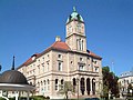
Rockingham County Courthouse, Court Square, Harrisonburg

Interstate 81 as seen from the James Madison University Bridge in Harrisonburg
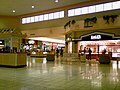
Valley Mall, Harrisonburg


.jpg)
Web links
List of counties and independent cities in Virginia
counties:
Accomack |
Albemarle |
Alleghany |
Amelia |
Amherst |
Appomattox |
Arlington |
Augusta |
Bath |
Bedford |
Bland |
Botetourt |
Brunswick |
Buchanan |
Buckingham |
Campbell |
Caroline |
Carroll |
Charles City |
Charlotte |
Chesterfield |
Clarke |
Craig |
Culpeper |
Cumberland |
Dickenson |
Dinwiddie |
Essex |
Fairfax |
Fauquier |
Floyd |
Fluvanna |
Franklin |
Frederick |
Giles |
Gloucester |
Goochland |
Grayson |
Greene |
Greensville |
Halifax |
Hanover |
Henrico |
Henry |
Highland |
Isle of Wight |
James City |
King and Queen |
King George |
King William |
Lancaster |
Lee |
Loudoun |
Louisa |
Lunenburg |
Madison |
Mathews |
Mecklenburg |
Middlesex |
Montgomery |
Nelson |
New Kent |
Northampton |
Northumberland |
Nottoway |
Orange |
Page |
Patrick |
Pittsylvania |
Powhatan |
Prince Edward |
Prince George |
Prince William |
Pulaski |
Rappahannock |
Richmond |
Roanoke |
Rockbridge |
Rockingham |
Russell |
Scott |
Shenandoah |
Smyth |
Southampton |
Spotsylvania |
Stafford |
Surry |
Sussex |
Tazewell |
Warren |
Washington |
Westmoreland |
Wise |
Wythe |
York
Independent cities: Alexandria | Bedford | Bristol | Buena Vista | Charlottesville | Chesapeake | Colonial Heights | Covington | Danville | Emporia | Fairfax | Falls Church | Franklin | Fredericksburg | Galax | Hampton | Harrisonburg | Hopewell | Lexington | Lynchburg | Manassas | Manassas Park | Martinsville | Newport News | Norfolk | Norton | Petersburg | Poquoson | Portsmouth | Radford | Richmond | Roanoke | Salem | Staunton | Suffolk | Virginia Beach | Waynesboro | Williamsburg | Winchester