Waynesboro, Virginia
| Waynesboro | ||
|---|---|---|
 Downtown Waynesboro |
||
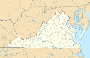
| Location in Virginia | ||
|
|
||
| Basic data | ||
| Foundation : | 1798 | |
| State : | United States | |
| State : | Virginia | |
| Coordinates : | 38 ° 4 ′ N , 78 ° 54 ′ W | |
| Time zone : | Eastern ( UTC − 5 / −4 ) | |
| Residents : | 21,006 (as of 2010) | |
| Population density : | 527.8 inhabitants per km 2 | |
| Area : | 39.8 km 2 (approx. 15 mi 2 ) of which 39.8 km 2 (approx. 15 mi 2 ) are land |
|
| Height : | 392 m | |
| Postal code : | 22980 | |
| Area code : | +1 540 | |
| FIPS : | 51-83680 | |
| GNIS ID : | 1500288 | |
| Website : | www.waynesboro.va.us | |
| Mayor : | Thomas W. Reynolds | |
Waynesboro is a city in the state of Virginia in the United States . It has around 21,000 inhabitants (as of 2010 ) and an area of 39.8 km² .
history
The city was founded by Amish and Mennonites , whose lifestyle is still present today. In addition, the last battle of the American Civil War in northern Virginia took place in Waynesboro.
Population development
| year | Residents¹ |
|---|---|
| 1980 | 15,329 |
| 1990 | 18,549 |
| 2000 | 19,520 |
| 2010 | 21.006 |
¹ 1980 - 2000: census results; 2010: Update of the US Census Bureau
Attractions
One of the city's sights is the P. Buckley Moss Museum (Rte. 64, Exit 94), opened in 1989 , which shows the work of the internationally known artist, who often depicted Amish and Mennonites .
Partnerships
Waynesboro has had a partnership with the Wanzhou District of Chongqing , People's Republic of China , since 2008 .
sons and daughters of the town
- Mac Wiseman (1925-2019), bluegrass musician
