Winchester (Virginia)
| Winchester | ||
|---|---|---|
 |
||
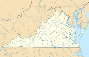
| Location in Virginia | ||
|
|
||
| Basic data | ||
| Foundation : | 1802 | |
| State : | United States | |
| State : | Virginia | |
| Coordinates : | 39 ° 11 ′ N , 78 ° 10 ′ W | |
| Time zone : | Eastern ( UTC − 5 / −4 ) | |
|
Inhabitants : - Metropolitan Area : |
27,516 (as of 2016) 135,238 (as of 2016) |
|
| Population density : | 1,137 inhabitants per km 2 | |
| Area : | 24.2 km 2 (approx. 9 mi 2 ) of which 24.2 km 2 (approx. 9 mi 2 ) is land |
|
| Height : | 221 m | |
| Postcodes : | 22601-22604 | |
| Area code : | +1 540 | |
| FIPS : | 51-86720 | |
| GNIS ID : | 1498552 | |
| Website : | www.winchesterva.gov | |
| Mayor : | Elizabeth Minor | |
Winchester is an independent city in Virginia , United States , with a population of 27,516. It is the seat of Frederick County , which completely encloses the city. During the Civil War the city was in the most contested area; In total, it changed hands 72 times during the fighting.
geography
The city has an area of 24.2 km², almost the entire area is land. The US Highway 50 crosses the city from east to west direction, and in North-South direction of running US Highway 11 and Interstate 81 through Winchester.
Winchester Regional Airport is six kilometers southeast of the central business district .
Personalities
- Will Accooe (1874–1904), pianist, organist, songwriter and conductor
- David Arquette (born 1971), actor
- Joseph Glover Baldwin (1815–1864), writer
- Brian Benben (born 1956), actor
- Richard Evelyn Byrd (1888–1957), polar explorer
- John S. Carlile (1817–1878), politician
- Willa Cather (1873–1947), writer
- Patsy Cline (1932-1963), singer
- Charles Magill Conrad (1804–1878), politician
- Holmes Conrad (1840–1915), lawyer, politician and United States Solicitor General
- James William Denver (1817-1892), politician
- Hamilton Gamble (1798–1864), politician
- Burr Powell Harrison (1904–1973), politician
- Frederick Holliday (1828–1899), politician
- John Kirby (1908–1952), jazz musician
- John Otho Marsh (1926-2019), politician
- Rick Santorum (* 1958), politician
- James Wood (1741-1813), politician
Population development
| year | Residents¹ |
|---|---|
| 1980 | 20,217 |
| 1990 | 21,947 |
| 2000 | 23,585 |
| 2010 | 26,201 |
| 2016 | 27,516 |
¹ 1980–2010: census results; 2016: Update of the US Census Bureau
Web links
Commons : Winchester (Virginia) - Collection of pictures, videos, and audio files
Wikivoyage: Winchester, Virginia Travel Guide
