Colonial Heights, Virginia
| Colonial Heights | ||
|---|---|---|
 Colonial Heights Boulevard, with the courthouse on the right |
||
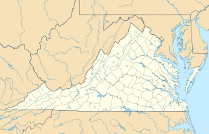
| Location in Virginia | ||
|
|
||
| Basic data | ||
| Foundation : | 1620 | |
| State : | United States | |
| State : | Virginia | |
| County : | independently | |
| Coordinates : | 37 ° 16 ′ N , 77 ° 24 ′ W | |
| Time zone : | Eastern ( UTC − 5 / −4 ) | |
| Residents : | 17,676 (as of 2006) | |
| Population density : | 911.1 inhabitants per km 2 | |
| Area : | 20.2 km 2 (approx. 8 mi 2 ) of which 19.4 km 2 (approx. 7 mi 2 ) is land |
|
| Height : | 29 m | |
| FIPS : | 51-18448 | |
| GNIS ID : | 1496852 | |
| Website : | www.colonial-heights.com | |
| Mayor : | John T. Wood | |
Colonial Heights is an independent city in Virginia , United States . 16,897 people live here. Although the city is independent, it and the equally independent city of Petersburg are often included in Dinwiddie County .
geography
surface
The city has an area of 20.2 km², of which 19.4 km² is land and 0.8 km² (3.9%) is water.
location
The city is located on the Appomattox River across from the city of Petersburg near a waterfall. It is south of Chesterfield County .
Web link
Commons : Colonial Heights (Virginia) - Collection of pictures, videos, and audio files
- Official website of the city of Colonial Heights ( English )
