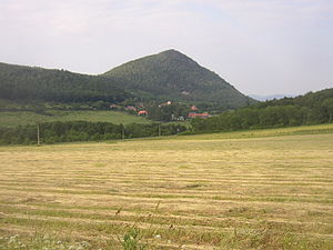
Lipská hora
| Lipská hora | ||
|---|---|---|
| height | 688.5 m nm | |
| location | Ústecký kraj , Czech Republic | |
| Mountains | Central Bohemian Uplands | |
| Coordinates | 50 ° 30 '33 " N , 13 ° 54' 49" E | |
|
|
||
| Type | Kegelberg | |
| rock | Phonolite | |
The Lipská hora (German Horst or Hora ) is a prominent mountain in the Bohemian Central Mountains on the left Elbe , southwest of Medvědice and north of the settlement Lhota. The mountain has the typical shape of a cone for the mountains. The summit region is rocky and allows a comprehensive view that is only somewhat restricted to the north.
The southern flank (22.2 hectares) of the mountain has been a nature reserve since 1951 because of the special plant population (heat-loving species).
A path leads to the summit, which begins in the village of Lhota and is marked in red and finally climbs steeply on the western flank.
Web links
Commons : Lipská hora (České středohoří) - collection of images, videos and audio files

