List of architectural monuments in Natendorf
In the list of architectural monuments in Natendorf , all architectural monuments of the Lower Saxony community of Natendorf are listed. The status of the list is August 1, 1984.
Architectural monuments
Group monuments in Natendorf
| location | designation | description |
ID |
image |
|---|---|---|---|---|
| August-Möller-Strasse 4, 6 53 ° 4 ′ 47 ″ N, 10 ° 28 ′ 26 ″ E |
Workers' house with outbuildings | |||
| Golster Strasse 1, 2, 4, 5, 6 53 ° 4 ′ 51 ″ N, 10 ° 27 ′ 56 ″ E |
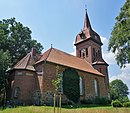
Church and courtyards | The church of Natendorf shapes the townscape of Natendorf with the eye-catching roof dome of its west tower. The nave was built between 1789 and 1791 and a west tower was added in 1905. |
 More pictures |
|
| Golster Straße 9, 11, 13, 15, 17, 19, 21, 23, 27, 44 |
Courtyards |
Individual monuments in Natendorf
| location | designation | description |
ID |
image |
|---|---|---|---|---|
| Golster Straße 22 |
barn | |||
| Golster Straße 36 |
Staircase storage |
Group monuments in Gut Golste
| location | designation | description |
ID |
image |
|---|---|---|---|---|
| Well 53 ° 4 ′ 42 "N, 10 ° 29 ′ 12" E |
Courtyard with access avenue and group of trees | The Golste estate was founded in 1870. It is located about one kilometer east of Natendorf on the road to Bad Bevensen . The estate is south of the road. The mansion was built in 1911 in the classic style. The architect was W. Matthies. |
Individual monuments in Haarstorf
| location | designation | description |
ID |
image |
|---|---|---|---|---|
| No. 3 53 ° 4 ′ 18 ″ N, 10 ° 26 ′ 45 ″ E |
Residential building | |||
| Poster rest home 53 ° 4 ′ 15 ″ N, 10 ° 26 ′ 39 ″ E |
Former villa with park |
Individual monuments in Hohenbünstedt
| location | designation | description |
ID |
image |
|---|---|---|---|---|
| No. 4 |
barn | |||
| No. 7 |
barn | |||
| No. 8 |
Residential building | |||
| No. 10 |
Residential building |
Group monuments in Luttmissen
| location | designation | description |
ID |
image |
|---|---|---|---|---|
| No. 1 |
Courtyard |
Group monuments in Nienbüttel
| location | designation | description |
ID |
image |
|---|---|---|---|---|
| Well 53 ° 4 ′ 35 ″ N, 10 ° 27 ′ 26 ″ E |
Courtyard |
Individual monuments in Oldendorf II
| location | designation | description |
ID |
image |
|---|---|---|---|---|
| No. 1 |
barn |
Individual monuments in Vinstedt
| location | designation | description |
ID |
image |
|---|---|---|---|---|
| No. 2 53 ° 2 ′ 23 ″ N, 10 ° 29 ′ 3 ″ E |
Water tower |
 More pictures |
Group monuments in Wessenstedt
| location | designation | description |
ID |
image |
|---|---|---|---|---|
| No. 6 |
Courtyard |
Individual monuments in Wessentorf
| location | designation | description |
ID |
image |
|---|---|---|---|---|
| No. 5 |
Residential building |
literature
- Wilhelm Lucka: Uelzen district. In: Monument topography of the Federal Republic of Germany . Architectural monuments in Lower Saxony. Volume 27, Friedrich Vieweg & Sohn, Braunschweig 1986, ISBN 3-528-06205-3
Individual evidence
- ↑ Falk-Reimar singer: Lüchow-Dannenberg district. In: Monument topography of the Federal Republic of Germany. Architectural monuments in Lower Saxony. Volume 27, Friedrich Vieweg & Sohn, Braunschweig 1986, ISBN 3-528-06205-3 , page 136

