List of architectural monuments in Twistringen
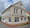
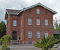
The list of architectural monuments in Twistringen contains the listed architectural monuments in the area of the city of Twistringen in the district of Diepholz , Lower Saxony (as of August 3, 2009). These architectural monuments are entered in the list of monuments, the basis for inclusion is the Lower Saxony Monument Protection Act (§3 NDSchG).
| image | designation | location | description | construction time | Registered since |
Monument number |
|---|---|---|---|---|---|---|
| Wayside shrine |
Altenmarhorst Colnrader Strasse |
25104200003 |
||||

|
Residential building | Altenmarhorst Grabhorststrasse 32 map |
Former "mansion" of the old brickworks Twistringen | 25104200020 |
||

|
Storage | Altenmarhorst Marienstraße 3 map |
25104200002 |
|||

|
Bakehouse |
Heiligenloh Alte Dorfstraße 9 map |
Bakehouse with oven. Half-timbering, loam stacks partially replaced by brick infills. Gable roof with pantile cover. | Probably early 19th century. | 25104200043 |
|

|
Residential / farm buildings | Heiligenloh Alte Dorfstraße 19 map |
with: courtyard paving, trees, two-tiered hall house, FW building with brick infill, half-hipped roof in S-pan covering, slight disturbance in the structure (threshold missing), interior framework changed, type comprehensible, characterizing the street image. Meaning: historical, urban planning. essential reason: 1.06 historical significance due to the testimony and display value through exemplary characteristics of a style and / or building type | 1830 | 25104200025M001 |
|

|
church | Heiligenloh Am Pfarrgarten map |
Ev. church | 25104200005 |
||

|
Warrior Memorial | Heiligenloh Am Pfarrgarten map |
25104200004 |
|||

|
Storage | Heiligenloh An der Henckemühle 2 card |
2-tier Solid construction, almost original. Inside: Part of the ceiling open (formerly silo) Meaning: Historic. Main reason: 1.06 historical significance based on the testimony and display value through exemplary characteristics of a style and / or building type | 25104200036 |
||
| Residential / farm buildings | Heiligenloh Borwede 1 |
251042000006 |
||||
| Landmark | Heiligenloh Ehrenburger Damm |
Obelisk-shaped boundary stone, erected around 1811 on the border of the Oberms and Weser estuary departments, at its current location since 1900. Meaning: Historically. essential reason: 1.02 historical significance in the context of national history | 251042000007 |
|||

|
Storage |
Lerchenhausen Lerchenhausen 1 map |
Two-story massive brick building under a gable roof in S-pan roofing. The brick masonry has simple, time-typical designs. Meaning: historical, scientific. Main reason: 1.05 historical significance due to the testimony and display value for the history of architecture and art | according to inscription 1851 | 25104200022 |
|
| Residential / farm building, former |
Natenstedt Lerchenhausen 4 |
Two-post construction, structure of the residential gable severely attacked, structure otherwise largely in order. Gable roof with pantile cover (good condition). About residential area Halbwalmd. Meaning: Historically. Main reason: 1.06 historical significance based on the testimony and display value through exemplary design of a style and / or building type | Erb. M. 18th century, built here according to the residential gable inscription in 1882 | 25104200028 |
||
| Residential building | Natenstedt Lerchenhausen 4 |
1-sch. Raw brick construction in solid, time-typical, average. Design quality, largely preserved in its original form, including windows and interior doors. Meaning: historical, urban planning. essential reason: 1.06 historical significance due to the testimony and display value through exemplary characteristics of a style and / or building type | around 1930 | 25104200029 |
||
| Residential / farm buildings |
Soot soot 9 |
Elongated two-column construction. Structure largely preserved except for light beams and parts of the left. Stand row. Meaning: Historically. Main reason: 1.06 historical significance based on the testimony and display value through exemplary characteristics of a style and / or building type. | Completely gutted around 1985, not yet repaired in 2001. | 25104200009 |
||

|
Chapel (wayside chapel) |
Scharrendorf Alter Kirchweg map |
The Stöttinghausen Kreuzkapelle was mentioned in a document as early as 1805. The chapel is also known under the name "Stubben Krütz". The inscription on the cross reads: “I pray to the Lord Jesus Christ, this picture is in your memory” | 25104200010 |
||

|
Ringwall (Hühnenburg) | Scharrendorf Am Ringwall map |
Meaning: historical, scientific. Main reason: 1.09 historical significance due to the testimony and display value for the history of settlements and urban construction | 25104200042 |
||

|
Wayside cross | Scharrendorf Paradiesweg map |
25104200011 |
|||

|
Landmark | Scharrendorf (GMK) L341, km 3,340 on the map |
Cuboid stone with parallel vertical edges, flat roof scraped. Hist. District boundary Syke / District Sulingen. Meaning: Historically. Main reason: 1.13 historical significance due to the testimony and display value for political history | 25104200027 |
||
 more pictures |
Catholic Church of St. Anna |
Twistringen Am Kirchhof 7 map |
25104200016 |
|||

|
Warrior Memorial | Twistringen Am Markt map |
Inscription: "The fallen heroes as an honoring memory, the fellow combatants for grateful recognition, the coming generations for emulation. Warrior Association Twistringen" | 25104200017 |
||

|
school | Twistringen Am Markt 1 card |
2-tier Plaster / brick construction | 25104200018 |
||

|
Heuerlingshaus, former | Twistringen Bachstrasse 4 map |
Kl. Ndt. Hall house in half-timbered, two-column construction. Meaning: Historically. Main reason: 1.06 historical significance based on the testimony and display value through exemplary characteristics of a style and / or building type | 1832 | 25104200034 |
|

|
Residential / commercial building | Twistringen Bahnhofsstraße 6 map |
25104200023 |
|||

|
Church (ev. Parish church) | Map of Twistringen Bahnhofsstraße 46 |
Martin Luther Church
Laying of the foundation stone: April 4, 1893 Inauguration: July 15, 1894 Architect: Conrad Wilhelm Hase (1818–1902) Construction management: Friedrich Jacob Brick neo-Gothic |
1893-1894 | 25104200019 |
|

|
villa | Twistringen Harpstedter Strasse 22 map |
25104200021 |
|||

|
Stations of the Cross | Map of Twistringen Kolpingstrasse |
In the Twistringen cemetery there are a total of 14 steles of the stations of the cross: 1. Jesus is sentenced to death; 2. Jesus takes the cross on his shoulders; 3. Jesus falls under the cross for the first time; 4. Jesus meets his mother; 5. Simon of Cyrene helps Jesus carry the cross; 6. Veronica gives Jesus the handkerchief; 7. Jesus falls the second time under the cross; 8. Jesus meets the weeping women; 9. Jesus falls the third time under the cross; 10. Jesus is stripped of his clothes; 11 Jesus is nailed to the cross; 12. Jesus dies on the cross; 13. Jesus is taken down from the cross and placed in his mother's lap; 14. The holy body of Jesus is placed in the tomb. | 25104200013 |
||

|
Mausoleum I. | Map of Twistringen Kolpingstrasse |
25104200014 |
|||

|
Mausoleum II | Map of Twistringen Kolpingstrasse |
25104200015 |
|||

|
Storage | Twistringen Steller Strasse 21 map |
2-storey. FW construction. W-eaves side on the ground floor and 1 wide compartment on the first floor massively renewed. Inside both layers of beams completely preserved. Orig. Bachwerk m. leafed collarbones preserved. Meaning: Historically. Main reason: 1.05 historical significance due to the testimony and display value for the history of architecture and art | Probably 16th century, massive S-gable renewed in 1834 | 25104200035 |
|

|
Residential building | Twistringen Wildeshäuser Straße 1 map |
Stately 2-tier Brick building m. eye-catching decorations in above average Quality characterized by its position in the road fork. Meaning: historical, urban planning. Main reason: 1.06 historical significance based on the testimony and display value through exemplary characteristics of a style and / or building type | 25104200030 |
||
 more pictures |
Cemetery (Jewish cemetery) | Twistringen To the Poggenmühle |
Jewish cemetery (Twistringen) ; Triangle. Plot, freely located in the countryside, surrounded by sparse buildings. Plain, upright tombstones d. late 19th and early 20th century. Occupied since 1805. with graves of Russian prisoners of war. Meaning: Historically. Main reason: 1.01 historical significance in the context of local history | 25104200012 |
Web links
Commons : Twistringen - collection of images, videos and audio files
Commons : Monuments in Twistringen - Collection of pictures, videos and audio files

