from Wikipedia, the free encyclopedia

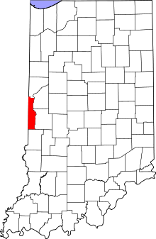
Location of Vermillion County in Indiana
The list of entries in the National Register of Historic Places in Vermillion County in Indiana performs all monuments and historical sites in Vermillion County , which in the National Register of Historic Places were taken.
Legend
|
NRHP
|
Historic Place
|
|
HD
|
Historic District
|
Current entries
|
|
Surname
|
image
|
Entry date
|
location
|
place
|
description
|
|
1
|
Clinton Downtown Historic District
|
|
50,000,000 ♠2000
ID no. 00000205
|
Bounded by South Water Street, South 3rd Street, Elm Street and the CSX tracks
39 ° 39 ′ 33.5 ″ N , 87 ° 23 ′ 53.8 ″ W39.659306 -87.398278
|
Clinton |
|
|
2
|
Eugene Covered Bridge
|
|
49940000 ♠1994
ID no. 94000585
|
Bridge of the former County Road 00 over the Big Vermilion River at Eugene
39 ° 58 ′ 9 ″ N , 87 ° 28 ′ 23 ″ W39.969167 -87.473056
|
Eugene |
|
|
3
|
Hill Crest Community Center
|
|
49970000 ♠1997
ID no. 97001555
|
505 North 8th Street
39.673611 -87.406944
|
Clinton |
|
|
4th
|
Newport Covered Bridge
|
|
49940000 ♠1994
ID no. 94000589
|
County Road 50N bridge over the Little Vermilion River , northwest of Newport
39 ° 53 ′ 29 ″ N , 87 ° 26 ′ 0 ″ W39.891389 -87.433333
|
Newport |
|
|
5
|
Possum Bottom Covered Bridge
|
|
49940000 ♠1994
ID no. 94000584
|
North side of US 36 , about 300 m east of the junction with East Road
39 ° 47 ′ 50 ″ N , 87 ° 27 ′ 12 ″ W39.797222 -87.453333
|
Dana |
|
|
6th
|
Salem Methodist Episcopal Church
|
|
49790000 ♠1979
ID no. 79000022
|
North of Clinton at IN 63
39 ° 43 ′ 55 " N , 87 ° 23 ′ 58" W.39.731944 -87.399444
|
Clinton |
|
|
7th
|
Vermillion County Courthouse
|
|
50070000 ♠2007
ID no. 07001283
|
255 South Main Street
39 ° 53 ′ 5 " N , 87 ° 24 ′ 34" W.39.884722 -87.409444
|
Newport |
|
|
8th
|
Vermillion County Jail and Sheriff's Residence
|
|
49990000 ♠1999
ID no. 99000305
|
220 East Market Street
39 ° 51 ′ 27 ″ N , 87 ° 24 ′ 22 ″ W.39.8575 -87.406111
|
Newport |
|
Previous entries
See also
Individual evidence
-
↑ Extract from the National Register of Historic Places - Vermillion County.Retrieved November 29, 2012
-
↑ a b The numbering in this list column is based on the order of the entries presented by the National Park Service ; the colors distinguish different types of protected areas of the National Park System with national significance (e.g. National Historic Landmarks ) from the other entries in the National Register of Historic Places .
-
↑ a b National Register Information System . In: National Register of Historic Places . National Park Service . Retrieved July 9, 2010.
-
↑ Bridgehunter.com Accessed on November 29, 2012


