|
Serial No.
|
Name in the NRHP
|
image
|
Date of registration
|
Address / location
|
NRHP ID
|
description
|
|
192
|
Majestic Hotel
|

|
49840126 ♠January 26, 1984
|
1017-23 Pine Street and 200-10 North 11th Street
38 ° 37 ′ 43 "N, 90 ° 11 ′ 45" W.
|
84002653
|
|
|
193
|
Majestic Manufacturing Company Buildings
|

|
49981231 ♠December 31, 1998
|
2014 Delmar Boulevard and 2011-2017 Lucas Avenue
38 ° 38 ′ 14 ″ N, 90 ° 12 ′ 28 ″ W.
|
98001562
|
|
|
194
|
Horace Mann School
|

|
49920902 ♠02nd September 1992
|
4047 Juniata Street
38 ° 36 ′ 8 ″ N, 90 ° 15 ′ 16 ″ W.
|
92001095
|
|
|
195
|
Marine Villa Neighborhood Historic District
|

|
50091218 ♠December 18, 2009
|
Bounded by South Broadway, Chippewa Street Cahokia Street, Kosciusko Street, and Winnebago Street
38 ° 35 ′ 12 ″ N, 90 ° 13 ′ 24 ″ W
|
09001099
|
|
|
196
|
Marquette Hotel
|

|
49850926 ♠September 26, 1985
|
1734 Washington Avenue
38 ° 37 ′ 39 ″ N, 90 ° 12 ′ 14 ″ W.
|
85002557
|
Demolished in 1988.
|
|
197
|
Marshall School
|
|
49990917 ♠September 17, 1999
|
4342 Aldine Avenue
38 ° 39 ′ 31 "N, 90 ° 14 ′ 38" W.
|
99001162
|
|
|
198
|
Marshall School Neighborhood in The Ville Historic District
|

|
50120117 ♠17th January 2012
|
4300 Avenue, Cote Brilliante Avenue, 1500 and 1700 Billups Avenue
38 ° 39 ′ 27 ″ N, 90 ° 14 ′ 36 ″ W.
|
11001022
|
|
|
199
|
Maryland Hotel
|
|
49960216 ♠February 16, 1996
|
205 North Ninth Street
38 ° 37 ′ 42 "N, 90 ° 11 ′ 37" W.
|
96000044
|
|
|
200
|
May Company Department Store Building
|
|
49830623 ♠June 23, 1983
|
509-23 Washington Avenue
38 ° 37 ′ 50 ″ N, 90 ° 11 ′ 20 ″ W.
|
83001050
|
|
|
201
|
Mayfair Hotel
|
|
49790917 ♠17th September 1979
|
806 St. Charles Avenue
38 ° 37 ′ 48 ″ N, 90 ° 11 ′ 31 ″ W.
|
79003638
|
|
|
202
|
William Cullen McBride Catholic High School
|

|
50080129 ♠January 29, 2008
|
1909-1915 North Kingshighway Boulevard
38 ° 39 ′ 57 ″ N, 90 ° 15 ′ 35 ″ W.
|
07001493
|
|
|
203
|
McKinley Fox District
|
|
49840907 ♠0September 7, 1984
|
Bounded by 18th Street, Interstate 44, Jefferson Avenue and Gravois Avenue
38 ° 36 ′ 33 ″ N, 90 ° 13 ′ 6 ″ W
|
84002655
|
|
|
204
|
Measuregraph Company Building
|

|
50051014 ♠October 14, 2005
|
4245 Forest Park Boulevard
38 ° 38 ′ 16 ″ N, 90 ° 15 ′ 1 ″ W.
|
05001163
|
|
|
205
|
Medart's
|

|
50110422 ♠April 22, 2011
|
7036 Clayton Avenue
38 ° 37 ′ 59 ″ N, 90 ° 18 ′ 22 ″ W.
|
09000410
|
|
|
206
|
Melrose Apartments
|

|
50070418 ♠April 18, 2007
|
4065 W. Pine Boulevard
38 ° 38 ′ 26 "N, 90 ° 15 ′ 0" W.
|
07000324
|
|
|
207
|
Midtown Historic District
|
|
49780707 ♠0July 7, 1978
|
Lindell and Grand Boulevards
38 ° 38 ′ 19 ″ N, 90 ° 14 ′ 9 ″ W.
|
78003392
|
|
|
208
|
Eugene and Mary A. Miltenberger House
|

|
50020509 ♠0May 9, 2002
|
3218 Osceola Street
38 ° 34 ′ 43 "N, 90 ° 14 ′ 28" W.
|
02000471
|
|
|
209
|
Mississippi Valley Trust Company Building
|
|
50010525 ♠May 25, 2001
|
401 Pine Street
38 ° 36 '38 "N, 90 ° 11' 21" W.
|
01000544
|
|
|
210
|
Missouri Athletic Club
|

|
50070416 ♠April 16, 2007
|
405-409 Washington Avenue
38 ° 37 ′ 54 "N, 90 ° 11 ′ 14" W.
|
07000325
|
|
|
211
|
Missouri Botanical Gardens
|

|
49711119 ♠19th November 1971
|
2345 Tower Grove Avenue
38 ° 36 ′ 45 ″ N, 90 ° 15 ′ 33 ″ W.
|
71001065
|
|
|
212
|
Missouri Electric Light and Power Co.
|

|
50050906 ♠0September 6, 2005
|
1906-32 Locust Street
38 ° 38 ′ 4 ″ N, 90 ° 12 ′ 28 ″ W.
|
05000996
|
|
|
213
|
Missouri Pacific Building
|

|
50011127 ♠November 27, 2001
|
210 North 13th Street
38 ° 37 ′ 53 "N, 90 ° 11 ′ 56" W.
|
02001441
|
|
|
214
|
Moloney Electric Company Building
|

|
50020328 ♠March 28, 2002
|
1141-1151 South 7th Street
38 ° 37 ′ 3 ″ N, 90 ° 11 ′ 47 ″ W.
|
02000270
|
|
|
215
|
Moon Brothers Carriage Company Building
|

|
50050928 ♠September 28, 2005
|
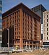
1706 Delmar Boulevard
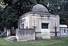
38 ° 38 ′ 10 ″ N, 90 ° 12 ′ 11 ″ W.
|
05001094
|
|
|
216
|
More Automobile Company Building
|
|
50081203 ♠0December 3, 2008
|
2801 Locust Street
38 ° 38 ′ 6 ″ N, 90 ° 13 ′ 6 ″ W.
|
08001130
|
|
|
217
|
Mount Cabanne-Raymond Place Historic District
|
|
50020913 ♠September 13, 2002
|
Bounded by Kingshighway Boulevard, Page Boulevard, Union Boulevard and Delmar Boulevard
38 ° 39 ′ 23 ″ N, 90 ° 16 ′ 3 ″ W
|
02000984
|
|
|
218
|
Mount Pleasant School
|

|
49850502 ♠0May 2, 1985
|
4528 Nebraska Avenue
38 ° 33 ′ 19 ″ N, 90 ° 14 ′ 12 ″ W.
|
85000943
|
|
|
219
|
Mullanphy Historic District
|

|
49830214 ♠February 14, 1983
|
Bounded by North 14th Street, Mullanphy Street, Howard Street, North 13th, Howard Street, and Tyler Street
38 ° 38 ′ 36 ″ N, 90 ° 11 ′ 40 ″ W
|
83001051
|
|
|
220
|
Municipal Service Building
|

|
50050112 ♠January 12, 2005
|
Bounded by Clark, Spruce, 11th ond Tucker Street
38 ° 37 ′ 35 ″ N, 90 ° 11 ′ 55 ″ W.
|
04001474
|
|
|
221
|
Murphy-Blair District
|

|
49840126 ♠January 26, 1984
|
Bounded by Interstate 70 , Florissant Avenue, Chambers Street, and Branch Street
38 ° 39 ′ 1 ″ N, 90 ° 11 ′ 49 ″ W
|
84002658
|
|
|
222
|
National Candy Company Factory
|

|
50091105 ♠0November 5, 2009
|
4230 Gravois Avenue
38 ° 35 ′ 18 ″ N, 90 ° 15 ′ 30 ″ W.
|
09000889
|
|
|
223
|
Negro Masonic Hall
|
|
49930415 ♠April 15, 1993
|
3615-3619 Dr. Martin Luther King Boulevard
38 ° 38 ′ 49 ″ N, 90 ° 13 ′ 37 ″ W.
|
93000262
|
|
|
224
|
Neighborhood Gardens Apartments
|

|
49860131 ♠January 31, 1986
|
1205 North Seventh Street
38 ° 38 ′ 12 ″ N, 90 ° 11 ′ 20 ″ W.
|
86000143
|
|
|
225
|
Nooter Corporation Building
|
|
50080516 ♠May 16, 2008
|
1400 South 3rd Street
38 ° 36 ′ 48 ″ N, 90 ° 11 ′ 39 ″ W.
|
08000404
|
|
|
226
|
North Broadway Wholesale and Warehouse District
|
|
50100618 ♠June 18, 2010
|
1400-1600 and 1609-1629 North Broadway
38 ° 38 ′ 25 ″ N, 90 ° 11 ′ 9 ″ W.
|
10000352
|
|
|
227
|
North Riverfront Industrial Historic District
|

|
50030501 ♠0May 1, 2003
|
Bounded by O'Fallon Street, Lewis Street and Mississippi Rivers
38 ° 38 ′ 18 ″ N, 90 ° 10 ′ 55 ″ W
|
03000320
|
|
|
228
|
Oak Hill Historic District
|

|
50110110 ♠January 10, 2011
|
3171-3179 Bent Ave
38 ° 36 '6 "N, 90 ° 15' 30" W.
|
10001120
|
|
|
229
|
Oakherst Place Concrete Block District
|

|
49870505 ♠0May 5th 1987
|
Bounded by Julian Avenue, Oakley Place, Plymouth Avenue and Oakherst Place
38 ° 40 ′ 1 ″ N, 90 ° 17 ′ 19 ″ W
|
87000642
|
|
|
230
|
Oakview Place Apartments
|

|
50080613 ♠June 13, 2008
|
1014-1038 Oakview Pl.
38 ° 37 ′ 49 ″ N, 90 ° 17 ′ 6 ″ W.
|
08000508
|
|
|
231
|
Oehler Brick Buildings
|
|
50080801 ♠0August 1, 2008
|
3542-48 South Broadway
38 ° 35 ′ 24 ″ N, 90 ° 13 ′ 5 ″ W.
|
08000749
|
|
|
232
|
Old Laclede Gas and Light Company Building
|

|
49801126 ♠November 26, 1980
|
1017 Olive Street
38 ° 37 ′ 45 ″ N, 90 ° 11 ′ 43 ″ W.
|
80004392
|
|
|
233
|
Old Weber Implement and Automobile Company
|

|
50080228 ♠February 28, 2008
|
1900 Locust Street
38 ° 38 ′ 3 ″ N, 90 ° 12 ′ 26 ″ W.
|
08000093
|
|
|
234
|
Olive and Locust Historic Business District
|
|
50071107 ♠0November 7, 2007
|
Bounded by North Jefferson Avenue, Olive Street, 21st Street, and St. Charles Street
38 ° 38 ′ 0 ″ N, 90 ° 12 ′ 42 ″ W
|
07001158
|
|
|
235
|
Olive Street Terra Cotta District
|
|
49860102 ♠02nd January 1986
|
600-622 Olive Street
38 ° 37 ′ 40 ″ N, 90 ° 11 ′ 27 ″ W.
|
86000006
|
|
|
236
|
Otzenberger House
|
|
49800529 ♠May 29, 1980
|
7827 Reilly Street
38 ° 32 ′ 37 ″ N, 90 ° 15 ′ 27 ″ W.
|
80004515
|
|
|
237
|
Our Lady of Perpetual Help Parish Hall, School, Convent, and Rectory
|

|
50091105 ♠0November 5, 2009
|
5217 North 21st Street
38 ° 40 ′ 28 "N, 90 ° 12 ′ 49" W.
|
09000890
|
|
|
238
|
Armando Pacini Restaurant
|
|
50050726 ♠July 26, 2005
|
8 South Sarah Street
38 ° 38 ′ 19 ″ N, 90 ° 14 ′ 48 ″ W.
|
04001162
|
|
|
239
|
Page Boulevard Police Station
|
|
49800911 ♠September 11, 1980
|
Page Boulevard Eceke Union Boulevard
38 ° 39 ′ 40 ″ N, 90 ° 16 ′ 17 ″ W
|
80004504
|
|
|
240
|
Parkview Historic District
|
|
49860314 ♠March 14, 1986
|
Bounded by Delmar Avenue, Skinker Boulevard, Millbrook Boulevard, and Mellville Avenue
38 ° 39 ′ 8 ″ N, 90 ° 18 ′ 11 ″ W
|
86000788
|
|
|
241
|
DL Parrish Laundry Company Building
|

|
50040128 ♠January 28, 2004
|
3100-28 Olive Street
38 ° 38 ′ 14 ″ N, 90 ° 13 ′ 31 ″ W.
|
03001506
|
|
|
242
|
Peabody Coal Company National Headquarters
|

|
50081203 ♠0December 3, 2008
|
301 N. Memorial Drive
38 ° 37 ′ 39 ″ N, 90 ° 11 ′ 12 ″ W.
|
08001131
|
|
|
243
|
Pendennis Club Apartment Building
|
|
50080716 ♠July 16, 2008
|
3737 Washington Avenue
38 ° 38 ′ 26 ″ N, 90 ° 14 ′ 2 ″ W.
|
08000665
|
|
|
244
|
Pet Plaza
|

|
50041019 ♠October 19, 2004
|
400 South 4th Street
38 ° 37 ′ 24 ″ N, 90 ° 11 ′ 22 ″ W.
|
04000749
|
|
|
245
|
Peters Shoe Company Building
|

|
49840126 ♠January 26, 1984
|
1232-36 Washington Avenue
38 ° 37 ′ 56 "N, 90 ° 11 ′ 53" W.
|
84002663
|
|
|
246
|
Pevely Dairy Company Buildings
|
|
50060719 ♠July 19, 2006
|
3301 and 3305 Park Avenue
38 ° 37 ′ 19 ″ N, 90 ° 13 ′ 59 ″ W.
|
06000628
|
|
|
247
|
Pevely Dairy Company Plant
|

|
50091118 ♠November 18, 2009
|
1021 South Grand Boulevard
38 ° 37 ′ 31 ″ N, 90 ° 14 ′ 15 ″ W.
|
09000937
|
|
|
248
|
Homer G. Phillips Hospital
|

|
49820923 ♠23rd September 1982
|
2601 Whittier Street
38 ° 39 ′ 31 ″ N, 90 ° 14 ′ 7 ″ W.
|
82004738
|
|
|
249
|
Homer G. Phillips House
|

|
50090220 ♠February 20, 2009
|
4524 Cottage Avenue
38 ° 39 ′ 46 ″ N, 90 ° 14 ′ 44 ″ W.
|
09000036
|
|
|
250
|
Phipps-Wallace Store Building
|

|
50001122 ♠November 22, 2000
|
312-316 North Eighth Street
38 ° 37 ′ 50 ″ N, 90 ° 11 ′ 32 ″ W.
|
00001398
|
|
|
251
|
Plaza Hotel Complex
|
|
49850507 ♠0May 7, 1985
|
3319 Olive Street
38 ° 38 ′ 11 ″ N, 90 ° 13 ′ 39 ″ W.
|
85001007
|
|
|
252
|
Plaza Square Apartments Historic District
|

|
50070712 ♠July 12, 2007
|
Bounded by 15th Street, Olive Street, 17th Street and Chestnut Street
38 ° 37 ′ 48 ″ N, 90 ° 12 ′ 12 ″ W
|
07000705
|
|
|
253
|
Polar Wave Ice and Fuel Company, Plant No. 6th
|
|
50060719 ♠July 19, 2006
|
502 LaSalle Street
38 ° 37 ′ 5 ″ N, 90 ° 11 ′ 39 ″ W.
|
06000629
|
|
|
254
|
Portland and Westmoreland Places
|
|
49740212 ♠February 12, 1974
|
Northeast Eceke of Forest Park
38 ° 38 ′ 48 ″ N, 90 ° 16 ′ 10 ″ W
|
74002276
|
|
|
255
|
Principia Page-Park YMCA High School
|

|
49820902 ♠02nd September 1982
|
5569 Minerva Avenue
38 ° 39 ′ 46 "N, 90 ° 16 ′ 23" W.
|
82004739
|
|
|
256
|
Pundt Brothers-Garavaglia Grocery Buildings
|

|
50100331 ♠March 31, 2010
|
2857 Lafayette Avenue
38 ° 36 '57 "N, 90 ° 13' 39" W.
|
10000117
|
|
|
257
|
Quinn Chapel AME Church
|

|
49741016 ♠October 16, 1974
|
227 Bowen Street
38 ° 33 ′ 32 ″ N, 90 ° 14 ′ 51 ″ W.
|
74002277
|
|
|
258
|
Railway Exchange Building
|
|
50090611 ♠June 11, 2009
|
600 Locust Street
38 ° 37 ′ 43 ″ N, 90 ° 11 ′ 24 ″ W.
|
09000411
|
|
|
259
|
Ramsey Accessories Manufacturing Corporation
|
|
50080416 ♠April 16, 2008
|
3693 Forest Park Boulevard
38 ° 38 ′ 3 ″ N, 90 ° 14 ′ 15 ″ W.
|
07000813
|
|
|
260
|
Riggio Building
|

|
50040514 ♠May 14, 2004
|
5145-5149 Shaw Avenue
38 ° 37 ′ 12 ″ N, 90 ° 16 ′ 19 ″ W.
|
04000428
|
|
|
261
|
Robert, Johnson and Rand-International Shoe Company Complex
|

|
49840823 ♠23rd August 1984
|
Mississippi Street and Hickory Street
38 ° 37 ′ 10 ″ N, 90 ° 12 ′ 47 ″ W.
|
84002670
|
|
|
262
|
Roberts Chevrolet
|
|
50070622 ♠June 22, 2007
|
5875-91 Delmar Boulevard
38 ° 39 '17 "N, 90 ° 17' 22" W.
|
07000617
|
|
|
263
|
Rock Spring School
|

|
49920902 ♠02nd September 1992
|
3974 Sarpy Avenue
38 ° 37 ′ 50 ″ N, 90 ° 14 ′ 46 ″ W.
|
92001097
|
|
|
264
|
Royal Tire Service Inc. Building
|

|
50070622 ♠June 22, 2007
|
3229 Washington Avenue
38 ° 38 ′ 22 "N, 90 ° 13 ′ 33" W.
|
07000616
|
|
|
265
|
S. Pfeiffer Manufacturing Company Headquarters
|
|
50100830 ♠August 30, 2010
|
3965 Laclede Avenue
38 ° 38 ′ 13 "N, 90 ° 14 ′ 39" W.
|
10000598
|
|
|
266
|
St. Augustine's Roman Catholic Church
|

|
49861002 ♠02nd October 1986
|
3114 Lismore Street
38 ° 39 ′ 24 ″ N, 90 ° 12 ′ 41 ″ W.
|
86002819
|
|
|
267
|
St. Boniface Neighborhood Historic District
|

|
50020509 ♠0May 9, 2002
|
Bounded by Koeln Street, Tesson Street, Broadway and Alabama Avenue
38 ° 32 ′ 59 ″ N, 90 ° 15 ′ 41 ″ W
|
01000948
|
|
|
268
|
St. Cecilia Historic District
|

|
50090108 ♠0January 8, 2009
|
Bounded by South Grand Boulevard, Delor Street, Virginia Avenue, and Bates Street
38 ° 34 ′ 9 ″ N, 90 ° 14 ′ 58 ″ W
|
08001286
|
|
|
269
|
St. Francis de Sales Church
|

|
49781102 ♠0November 2nd 1978
|
2653 Ohio Street
38 ° 36 ′ 15 ″ N, 90 ° 13 ′ 33 ″ W.
|
78003393
|
|
|
270
|
St. John Nepomuk Parish Historic District
|

|
49720619 ♠June 19, 1972
|
11th and 12th Streets between Carroll Street and Lafayette Avenue
38 ° 36 ′ 45 ″ N, 90 ° 12 ′ 17 ″ W.
|
72001558
|
|
|
271
|
St. Joseph's Roman Catholic Church
|

|
49780519 ♠May 19, 1978
|
1220 North 11th Street
38 ° 38 ′ 14 "N, 90 ° 11 ′ 33" W.
|
78003396
|
|
|
272
|
St. Liborius Church and Buildings
|
|
49791011 ♠October 11, 1979
|
1835 North 18th Street
38 ° 38 ′ 48 ″ N, 90 ° 11 ′ 59 ″ W.
|
79003637
|
|
|
273
|
St. Louis Air Force Station
|

|
49750117 ♠17th January 1975
|
2nd Street and Arsenal Street
38 ° 35 ′ 6 ″ N, 90 ° 12 ′ 33 ″ W.
|
75002139
|
|
|
274
|
St. Louis Colored Orphans Home
|
|
49990917 ♠September 17, 1999
|
2612 Annie Malone Drive
38 ° 39 ′ 40 ″ N, 90 ° 14 ′ 11 ″ W.
|
99001164
|
|
|
275
|
St. Louis News Company
|

|
50100916 ♠September 16, 2010
|
1008-1010 Locust Street
38 ° 37 '47 "N, 90 ° 11' 41" W.
|
10000755
|
|
|
276
|
St. Louis Post-Dispatch Building
|

|
50000211 ♠February 11, 2000
|
1139 Olive Street
38 ° 37 '47 "N, 90 ° 11' 49" W.
|
00000015
|
|
|
277
|
St. Louis Post-Dispatch Printing Building
|

|
49840829 ♠August 29, 1984
|
1111 Olive Street
38 ° 37 ′ 47 "N, 90 ° 11 ′ 49" W.
|
84002672
|
|
|
278
|
Saint Louis Provident Association Building
|
|
50010620 ♠June 20, 2001
|
2221 Locust Street
38 ° 38 ′ 8 ″ N, 90 ° 12 ′ 41 ″ W.
|
01000652
|
|
|
279
|
St. Louis Stamping Company Buildings
|

|
50091110 ♠November 10, 2009
|
101 Cass Avenue
38 ° 38 ′ 24 ″ N, 90 ° 11 ′ 3 ″ W.
|
09000902
|
|
|
280
|
St. Louis Theater
|

|
50010525 ♠May 25, 2001
|
718 North Grand Boulevard
38 ° 38 ′ 32 "N, 90 ° 13 ′ 49" W.
|
01000545
|
|
|
281
|
Union Station (St. Louis)
|

|
49700615 ♠June 15, 1970
|
18th Street and Market Street
38 ° 37 ′ 41 ″ N, 90 ° 12 ′ 29 ″ W.
|
70000888
|
|
|
282
|
St. Ferdinand Avenue in The Ville Historic District
|

|
50120117 ♠17th January 2012
|
4200 West St. Ferdinand Avenue
38 ° 39 ′ 33 "N, 90 ° 14 ′ 21" W.
|
11001023
|
|
|
283
|
St. Louis Place Historic District
|

|
50110831 ♠August 31, 2011
|
Delimited by 21st, 22nd, 23rd, 25th, Benton, Montgomery and North Market Streets as well as Rauschenbach and St. Louis Avenues
38 ° 39 ′ 1 ″ N, 90 ° 12 ′ 12 ″ W
|
11000617
|
|
|
284
|
St. Luke's Plaza Apartments
|

|
50071101 ♠0November 1, 2007
|
5602 and 5629 Enright Avenue
38 ° 39 ′ 18 ″ N, 90 ° 16 ′ 58 ″ W.
|
07001120
|
|
|
285
|
St. Mark the Evangelist Catholic Church, Convent and Academy
|

|
50071011 ♠October 11, 2007
|
1313 Academy Avenue and 5100 Minerva Ave.
38 ° 39 ′ 46 ″ N, 90 ° 15 ′ 59 ″ W.
|
07001075
|
|
|
286
|
St. Mary of Victories Church
|

|
49800828 ♠August 28, 1980
|
744 South 3rd Street
38 ° 37 ′ 2 ″ N, 90 ° 11 ′ 27 ″ W.
|
80004510
|
|
|
287
|
St. Mary's Infirmary
|

|
50070418 ♠April 18, 2007
|
1536-48 Papin Street
38 ° 37 ′ 20 ″ N, 90 ° 12 ′ 24 ″ W.
|
07000322
|
|
|
288
|
Saint Matthew's Parish Complex
|
|
49860806 ♠0August 6, 1986
|
Sarah Street and Kennerly Street
38 ° 39 ′ 32 ″ N, 90 ° 13 ′ 57 ″ W.
|
86002236
|
|
|
289
|
St. Stanislaus Kostka Church
|

|
49790710 ♠July 10, 1979
|
1413 N. 20th Street
38 ° 38 ′ 31 ″ N, 90 ° 12 ′ 20 ″ W.
|
79003635
|
|
|
290
|
Sanford Avenue Historic District
|

|
50050126 ♠January 26, 2005
|
1000 Sanford Avenue
38 ° 37 ′ 50 ″ N, 90 ° 17 ′ 42 ″ W.
|
04001559
|
|
|
291
|
Sanitol Building
|
|
49851021 ♠October 21, 1985
|
4252-4264 Laclede Avenue
38 ° 38 ′ 16 "N, 90 ° 15 ′ 4" W.
|
85003362
|
|
|
292
|
Plain house
|
|
49800529 ♠May 29, 1980
|
8402 Vulcan Street
38 ° 32 '25 "N, 90 ° 15' 44" W.
|
80004516
|
|
|
293
|
Anton Schmitt House
|
|
49990127 ♠January 27, 1999
|
7727 South Broadway
38 ° 32 ′ 47 "N, 90 ° 15 ′ 33" W.
|
98001600
|
|
|
294
|
Schollmeyer Building
|
|
49840928 ♠September 28, 1984
|
1976-1982 Arsenal Street
38 ° 35 ′ 52 ″ N, 90 ° 13 ′ 13 ″ W.
|
84002683
|
|
|
295
|
Scruggs-Vandervoort-Barney Warehouse
|

|
49850221 ♠February 21, 1985
|
917 Locust Street
38 ° 37 ′ 47 ″ N, 90 ° 11 ′ 39 ″ W.
|
85000320
|
|
|
296
|
Second Presbyterian Church
|
|
49750911 ♠11th September 1975
|
4501 Westminster Pl.
38 ° 38 ′ 51 ″ N, 90 ° 15 ′ 20 ″ W.
|
75002140
|
|
|
297
|
Security building
|

|
50000210 ♠February 10, 2000
|
319 North Fourth Street
38 ° 37 ′ 47 "N, 90 ° 11 ′ 16" W.
|
00000083
|
|
|
298
|
Ben J. Selkirk and Sons Building
|

|
50051115 ♠November 15, 2005
|
4160-4166 Olive Street
38 ° 38 ′ 45 "N, 90 ° 14 ′ 47" W.
|
05001280
|
|
|
299
|
Seven-Up Company Headquarters
|

|
50040224 ♠February 24, 2004
|
1300-16 Convention Plaza
38 ° 38 ′ 6 ″ N, 90 ° 11 ′ 49 ″ W.
|
04000089
|
|
|
300
|
Seventh District Police Station
|

|
49840322 ♠March 22, 1984
|
2800 S. Grand Avenue
38 ° 36 ′ 21 ″ N, 90 ° 14 ′ 29 ″ W.
|
84002685
|
|
|
301
|
Martin Shaughnessy Building
|

|
50050915 ♠September 15, 2005
|
3928 Delor Street
38 ° 38 ′ 11 "N, 90 ° 12 ′ 38" W.
|
05001035
|
|
|
302
|
Shaw Avenue Place
|

|
49820412 ♠April 12, 1982
|
Bounded by De Tanty Street, South Spring Avenue, Shaw Avenue and South Grand Avenue at
38 ° 36 ′ 57 ″ N, 90 ° 14 ′ 30 ″ W
|
82004741
|
|
|
303
|
Shelley House
|
|
49880418 ♠April 18, 1988
|
4600 Labadie Avenue
38 ° 40 ′ 0 ″ N, 90 ° 14 ′ 38 ″ W.
|
88000437
|
|
|
304
|
Silk Exchange Building
|

|
49820902 ♠02nd September 1982
|
501-511 North Tucker Boulevard
38 ° 37 ′ 53 "N, 90 ° 11 ′ 49" W.
|
82004742
|
|
|
305
|
Simmons Colored School
|
|
49990917 ♠September 17, 1999
|
4306-4318 St. Louis Avenue
38 ° 39 ′ 54 "N, 90 ° 14 ′ 15" W.
|
99001163
|
|
|
306
|
Sligo Iron Store Co. Buildings
|

|
50100421 ♠April 21, 2010
|
1301 North Sixth Street
38 ° 36 ′ 16 ″ N, 90 ° 11 ′ 15 ″ W.
|
10000205
|
|
|
307
|
Smith Academy and Manual Training School
|

|
50030428 ♠April 28, 2003
|
5351 Enright Avenue
38 ° 39 ′ 20 ″ N, 90 ° 16 ′ 31 ″ W.
|
03000296
|
|
|
308
|
Soulard Neighborhood Historic District
|
|
49721226 ♠December 26, 1972
|
Bounded by Soulard and 7th Boulevard and Lynch Street and 12th Street
38 ° 36 ′ 20 ″ N, 90 ° 12 ′ 27 ″ W
|
72001559
|
|
|
309
|
Soulard-Page District
|

|
49830819 ♠August 19, 1983
|
Delimited by Soulard, 8th, 12th and LaSalle Streets
38 ° 36 ′ 49 ″ N, 90 ° 12 ′ 2 ″ W.
|
83004515
|
|
|
310
|
South Fourth Street Commercial District
|

|
50060412 ♠April 12, 2006
|
740-908 South Fourth Street, 319 Gratiot Street and 317-321 Lombard Street
38 ° 37 ′ 11 ″ N, 90 ° 11 ′ 31 ″ W.
|
06000245
|
|
|
311
|
South Side National Bank
|
|
50030103 ♠0January 3, 2003
|
3606 Gravois Avenue
38 ° 35 ′ 31 ″ N, 90 ° 14 ′ 38 ″ W.
|
00001010
|
|
|
312
|
Bacon District
|
|
49830815 ♠August 15, 1983
|
Bounded by South 11th Street, Park Street, Rutger Street, and South 12th Street
38 ° 36 ′ 53 ″ N, 90 ° 12 ′ 11 ″ W
|
83004516
|
|
|
313
|
Spool Cotton Co. Building
|

|
50040804 ♠0August 4, 2004
|
1113-15 Locust Street
38 ° 37 ′ 56 ″ N, 90 ° 11 ′ 46 ″ W.
|
04000786
|
|
|
314
|
Standard Adding Machine Company
|
|
50051125 ♠November 25, 2005
|
3701 Forest Park Boulevard
38 ° 38 ′ 9 ″ N, 90 ° 14 ′ 17 ″ W.
|
05001328
|
|
|
315
|
Steelcote Manufacturing Company Paint Factory
|

|
50070627 ♠June 27, 2007
|
801 Edwin Street
38 ° 37 ′ 43 ″ N, 90 ° 14 ′ 2 ″ W.
|
07000620
|
|
|
316
|
Steins Street District
|

|
49800529 ♠May 29, 1980
|
Steins Street
38 ° 32 ′ 31 ″ N, 90 ° 15 ′ 17 ″ W.
|
80004514
|
|
|
317
|
Jacob Steins House
|

|
49800529 ♠May 29, 1980
|
7600 Reilly Street
38 ° 32 ′ 43 ″ N, 90 ° 15 ′ 17 ″ W.
|
80004517
|
|
|
318
|
William A. Stickney Cigar Company Building
|

|
50090820 ♠August 20, 2009
|
209 North 4th Street
38 ° 37 ′ 37 ″ N, 90 ° 11 ′ 17 ″ W.
|
09000627
|
|
|
319
|
Stix, Baer and Fuller Dry Goods Company's "Grand Leader" Relay Station
|

|
50020717 ♠July 17, 2002
|
3712-3748 Laclede Avenue and 3717 Forest Park Boulevard
38 ° 38 ′ 11 ″ N, 90 ° 14 ′ 19 ″ W.
|
02000805
|
|
|
320
|
Robert Henry Stockton House
|
|
49880810 ♠August 10, 1988
|
3508 Samuel Shepard Drive
38 ° 38 ′ 20 ″ N, 90 ° 13 ′ 47 ″ W.
|
88001177
|
|
|
321
|
Stone houses
|

|
49800327 ♠March 27, 1980
|
200-204 Stein Street
38 ° 32 ′ 53 ″ N, 90 ° 15 ′ 32 ″ W.
|
80004511
|
|
|
322
|
Stork Inn
|

|
50000505 ♠0May 5, 2000
|
4527 Virginia Avenue, 3301 Taft Avenue, and 4526 Idaho Avenue
38 ° 34 ′ 29 ″ N, 90 ° 14 ′ 34 ″ W.
|
00000440
|
|
|
323
|
Stowe Teachers College
|

|
49990917 ♠September 17, 1999
|
2615 Billups Avenue
38 ° 39 ′ 45 ″ N, 90 ° 14 ′ 24 ″ W.
|
99001161
|
|
|
324
|
Strassberger's Conservatory
|

|
49800327 ♠March 27, 1980
|
2302-2306 South Grand Street
38 ° 36 ′ 35 "N, 90 ° 14 ′ 25" W.
|
80004512
|
|
|
325
|
Sugarloaf Mound
|

|
49840217 ♠17th February 1984
|
4420 Ohio Street
38 ° 34 ′ 30 ″ N, 90 ° 13 ′ 52 ″ W.
|
84002689
|
|
|
326
|
Charles Sumner High School
|

|
49880419 ♠April 19, 1988
|
4248 West Cottage Avenue
38 ° 39 ′ 34 "N, 90 ° 14 ′ 21" W.
|
88000469
|
|
|
327
|
Tandy Community Center
|

|
49990917 ♠September 17, 1999
|
4206 West Kennerly Ave.
38 ° 39 ′ 42 ″ N, 90 ° 14 ′ 13 ″ W.
|
99001160
|
|
|
328
|
Taylor-Olive Building
|

|
50021212 ♠December 12, 2002
|
4505 Olive Street
38 ° 38 ′ 53 ″ N, 90 ° 15 ′ 17 ″ W.
|
02001494
|
|
|
329
|
Thiebe-Stierlin Music Company Building
|

|
50040128 ♠January 28, 2004
|
1006 Olive Street
38 ° 37 ′ 51 ″ N, 90 ° 11 ′ 43 ″ W.
|
03001507
|
|
|
330
|
Tiffany Neighborhood District
|
|
49830210 ♠February 10, 1983
|
Bounded by 39th Street, Lafayette Avenue, Vandeventer Avenue, and Folsom Avenue
38 ° 37 ′ 7 ″ N, 90 ° 14 ′ 31 ″ W
|
83001052
|
The current boundaries of the district were set in 2009 after a series of changes
|
|
331
|
Tower Grove Heights Historic District
|

|
50010906 ♠0September 6, 2001
|
Bounded by Arsenal Street, Grant Avenue, McDonald Avenue and Gustine Avenue
38 ° 36 ′ 1 ″ N, 90 ° 14 ′ 46 ″ W
|
01000947
|
Expansion in 2004
|
|
332
|
Tower Grove Park
|

|
49720317 ♠March 17, 1972
|
Bounded by Magnolia Avenue, Grand Boulevard, Arsenal Street, and Kings Highway Boulevard
38 ° 36 ′ 22 ″ N, 90 ° 15 ′ 16 ″ W
|
72001556
|
|
|
333
|
George F., Jr. and Carrie Tower House
|
|
50050915 ♠September 15, 2005
|
1520 S. Grand Avenue
38 ° 37 ′ 18 ″ N, 90 ° 14 ′ 17 ″ W.
|
05001034
|
|
|
334
|
Charles Turner Open Air School
|

|
49990917 ♠September 17, 1999
|
4235 W. Kennerly Avenue
38 ° 39 ′ 47 "N, 90 ° 14 ′ 19" W.
|
99001165
|
|
|
335
|
Mark Twain Elementary School
|

|
50110714 ♠July 14, 2011
|
5316 Ruskin Avenue
38 ° 41 ′ 26 "N, 90 ° 14 ′ 33" W.
|
11000445
|
|
|
336
|
US Customhouse and Post Office
|

|
49681122 ♠November 22, 1968
|
8th Street and Olive Street
38 ° 37 ′ 44 ″ N, 90 ° 11 ′ 34 ″ W.
|
68000053
|
|
|
337
|
Union Depot Railroad Co. Building
|
|
50060126 ♠January 26, 2006
|
2727 South Jefferson Avenue
38 ° 36 ′ 19 ″ N, 90 ° 13 ′ 25 ″ W.
|
05001549
|
|
|
338
|
Union Market
|
|
49840116 ♠January 16, 1984
|
Broadway and Lucas Avenue at
38 ° 37 ′ 52 ″ N, 90 ° 11 ′ 18 ″ W.
|
84002692
|
|
|
339
|
Union Station Post Office Annex
|

|
49850926 ♠September 26, 1985
|
329 S. 18th Street
38 ° 37 ′ 34 ″ N, 90 ° 12 ′ 29 ″ W.
|
85002488
|
|
|
340
|
Union Trust Company Building
|

|
49820617 ♠June 17, 1982
|
705 Olive Street
38 ° 37 ′ 42 ″ N, 90 ° 11 ′ 30 ″ W.
|
82004743
|
|
|
341
|
United Shoe Machinery Building
|

|
50070627 ♠June 27, 2007
|
2200-2208 Washington Avenue
38 ° 38 ′ 9 "N, 90 ° 12 ′ 37" W.
|
07000619
|
|
|
342
|
Vashon Community Center
|

|
50050811 ♠August 11, 2005
|
3145 Market Street
|
05000882
|
|
|
343
|
Vesper-Buick Auto Company Building
|
|
49861002 ♠02nd October 1986
|
3900-3912 West Pine Boulevard
38 ° 38 ′ 13 ″ N, 90 ° 14 ′ 30 ″ W.
|
86002814
|
|
|
344
|
Wachter Motor Car Company Building
|

|
50070524 ♠May 24, 2007
|
2600-2614 Nebraska Avenue
38 ° 36 ′ 30 ″ N, 90 ° 13 ′ 45 ″ W.
|
07000463
|
|
|
345
|
Wagoner Place Historic District
|
|
50071219 ♠December 19, 2007
|
Delimited by Dick Gregory Place, Marcus Avenue, Dr. Marthin Luther King Drive and North Market Street
38 ° 39 ′ 42 ″ N, 90 ° 15 ′ 7 ″ W.
|
07001292
|
|
|
346
|
Wainwright Building
|
|
49680523 ♠May 23, 1968
|
709 Chestnut Street
38 ° 37 ′ 36 ″ N, 90 ° 11 ′ 31 ″ W.
|
68000054
|
One of the first skyscrapers, built in 1890/91 by the architects Dankmar Adler and Louis Sullivan
|
|
347
|
Wainwright Tomb
|
|
49700615 ♠June 15, 1970
|
Bellefontaine Cemetery, 4947 W. Florissant Avenue
38 ° 41 ′ 20 ″ N, 90 ° 13 ′ 28 ″ W.
|
70000907
|
|
|
348
|
Washington Avenue Historic District
|

|
49870212 ♠February 12, 1987
|
Bounded by Delmar, Tucker, St. Charles, North Fifteenth, Olive, North Eighteenth, Washington Avenue, and Lucas Street
38 ° 37 ′ 56 ″ N, 90 ° 12 ′ 10 ″ W
|
86003733
|
|
|
349
|
Washington Avenue: East of Tucker District
|

|
49870324 ♠March 24, 1987
|
Bounded by Lucas, North Ninth, St. Charles, Locust, and Tucker Boulevard
38 ° 37 ′ 52 ″ N, 90 ° 11 ′ 41 ″ W
|
87000458
|
|
|
350
|
Washington Metropolitan African Methodist Episcopal Zion Church
|

|
50051229 ♠December 29, 2005
|
613 North Garrison Avenue
38 ° 38 ′ 21 "N, 90 ° 13 ′ 17" W.
|
05001095
|
|
|
351
|
Washington University Hilltop Campus Historic District
|
|
49790112 ♠January 12, 1979
|
Bounded by Big Bend, Forsyth, Skinker, and Millbrook Boulevards
38 ° 38 ′ 54 ″ N, 90 ° 18 ′ 35 ″ W
|
79003636
|
|
|
352
|
Waterman Place-Kingsbury Place-Washington Terrace Historic District
|
|
50070612 ♠June 12, 2007
|
Bounded by Union Boulevard, Waterman Boulevard, Clare Avenue and Delmar Boulevard
38 ° 38 ′ 56 ″ N, 90 ° 16 ′ 34 ″ W
|
07000549
|
|
|
353
|
Weber Implement and Automobile Company Building
|

|
50040421 ♠April 21, 2004
|
1815 Locust Street
38 ° 38 ′ 4 ″ N, 90 ° 12 ′ 22 ″ W.
|
04000343
|
|
|
354
|
John Weisert Tobacco Company
|

|
50040616 ♠June 16, 2004
|
1120 South Sixth Street
38 ° 37 ′ 4 "N, 90 ° 11 ′ 41" W.
|
04000602
|
|
|
355
|
Wellston JC Penney Building
|

|
50090205 ♠0February 5, 2009
|
5930 Dr. Martin Luther King Drive
38 ° 40 ′ 27 ″ N, 90 ° 17 ′ 0 ″ W.
|
08001410
|
|
|
356
|
Wellston Loop Commercial Historic District
|
|
50100909 ♠0September 9, 2010
|
Bounded by Clara Avenue, the streets on either side of Martin Luther King Drive and the city limits
38 ° 40 ′ 21 ″ N, 90 ° 16 ′ 49 ″ W
|
09001266
|
|
|
357
|
Wellston Station
|

|
50070502 ♠0May 2, 2007
|
6111 Dr. Martin Luther King Drive
38 ° 40 ′ 31 ″ N, 90 ° 17 ′ 0 ″ W.
|
07000377
|
|
|
358
|
West Cabanne Place Historic District
|
|
49801121 ♠November 21, 1980
|
Central Avenue and Main Street
38 ° 39 ′ 31 ″ N, 90 ° 17 ′ 34 ″ W.
|
80004393
|
|
|
359
|
West Locust and Olive Street Commercial and Industrial District
|

|
50060906 ♠0September 6, 2006
|
Bounded by Theresa Street, Olive Street, Locust Street, and Leonard Street
38 ° 38 ′ 20 ″ N, 90 ° 13 ′ 44 ″ W
|
06000787
|
|
|
360
|
West Pine-Laclede Historic District
|
|
50020509 ♠0May 9, 2002
|
Bounded by Euclid Street, Lindell Street, Sarah Street and Forest Park Parkway
38 ° 38 ′ 23 ″ N, 90 ° 15 ′ 11 ″ W
|
02000466
|
|
|
361
|
Western Electric-Southwestern Bell Telephone Distribution House
|
|
50110714 ♠July 14, 2011
|
4250 Duncan Street
38 ° 38 ′ 6 ″ N, 90 ° 15 ′ 6 ″ W.
|
11000446
|
|
|
362
|
Zebediah F. Mary H. Wetzell House
|

|
50080801 ♠0August 1, 2008
|
3741 Washington Avenue
38 ° 38 ′ 26 "N, 90 ° 14 ′ 2" W.
|
08000739
|
|
|
363
|
Willys-Overland Building
|

|
49991230 ♠December 30, 1999
|
2300 Locust Street
38 ° 38 ′ 8 ″ N, 90 ° 12 ′ 44 ″ W.
|
99001617
|
|
|
364
|
Wiltshire and Versailles Historic Buildings
|
|
49820929 ♠29th September 1982
|
724 and 709 Skinker Boulevard
38 ° 38 ′ 13 ″ N, 90 ° 18 ′ 15 ″ W.
|
82004744
|
|
|
365
|
Winkelmeyer Building
|

|
49850711 ♠July 11, 1985
|
11th Street and Walnut Street
38 ° 37 ′ 33 ″ N, 90 ° 11 ′ 52 ″ W.
|
85001500
|
|
|
366
|
Henry L. Wolfner Memorial Library for the Blind
|
|
50050630 ♠June 30, 2005
|
3842-44 Olive Street
38 ° 38 ′ 33 ″ N, 90 ° 14 ′ 19 ″ W.
|
05000631
|
|
|
367
|
Wrought Iron Range Company Building
|

|
50040728 ♠July 28, 2004
|
1901-37 Washington Avenue
38 ° 38 ′ 9 ″ N, 90 ° 12 ′ 25 ″ W.
|
04000746
|
|
|
368
|
Wydown-Forsyth District
|
|
49880523 ♠May 23, 1988
|
Bounded by Forsyth Street, Skinker Boulevard, Fauquier Street, Wydown Terrace Drive, and University Lane
38 ° 38 ′ 38 ″ N, 90 ° 18 ′ 25 ″ W
|
88000628
|
|
|
369
|
Edward Wyman School
|

|
49920902 ♠02nd September 1992
|
1547 South Teresa
38 ° 37 ′ 8 ″ N, 90 ° 14 ′ 12 ″ W.
|
92001096
|
|
|
370
|
YWCA, Phillis Wheatley Branch
|

|
49840724 ♠July 24, 1984
|
2709 Locust Street
38 ° 38 ′ 4 ″ N, 90 ° 12 ′ 59 ″ W.
|
84002694
|
|
|
371
|
Zeiss Houses
|
|
49800529 ♠May 29, 1980
|
7707-7713 Vulcan Street
38 ° 32 '43 "N, 90 ° 15' 26" W.
|
80004518
|
|


.jpg)


.jpg)


.jpg)


_-_exterior.jpg)


.jpg)


.jpg)


