List of cultural monuments in Löbau (A – I)
The list of cultural monuments in Löbau (A – I) contains the cultural monuments of the Saxon city of Löbau , which were recorded by the State Office for Monument Preservation of Saxony until January 2019 (excluding archaeological cultural monuments) and whose street names begin with the corresponding first letters. The notes are to be observed.
This list is a partial list of the list of cultural monuments in Löbau .
List of cultural monuments
| image | designation | location | Dating | description | ID |
|---|---|---|---|---|---|
 More pictures |
Zittau – Löbau railway line (entity) | (Flur Altlöbau; parcels 177/2; 572; 573; 574; 576; 577; 575/3) (map) |
Opened in 1848 | Material entirety of the Löbau-Zittau railway line, with the following individual monuments: Löbau station (Bahnhofstraße 35, 09222574), engine shed (Maschinenhausstraße 2, 09223094), railway bridge on Altlöbauer Straße (09222735) and railway bridge on Friedhofstraße (09222736) as well as the following elements: route and track systems in the communities of Löbau, Dürrhennersdorf, Großschweidnitz, Niedercunnersdorf, Obercunnersdorf, Herrnhut, Oderwitz (section Oberoderwitz to Zittau not under monument protection), see also
Total components in the above-mentioned municipalities (09302436, 09306375, 09302439, 09302440, 09302441, 09302443, 08992559, 09302445 and 09303744); In terms of technology, construction, railroad history and traffic history, it is one of the oldest railway lines in Saxony |
08992544 |
 |
Residential house with enclosure | Alexander-von-Humboldt-Strasse 2 (map) |
Marked 1895 | Upper floor clinker brick, with niche figure, corner turret and wooden extension, of architectural significance |
09222637 |
 More pictures |
Railway bridge across the street (individual monument for ID no. 08992544) | Altlöbauer Strasse ( Altlöbau ) (map) |
4th quarter of the 19th century | Individual monument of the Löbau – Zittau railway ; Railway history and traffic history of importance, arch bridge made of granite stones |
09222735 |
 |
Residential building | Altlöbauer Straße 10 (Altlöbau) (map) |
Around 1910 | With decorative framework, of architectural and urban significance |
09222733 |
 |
House and outbuildings | Altlöbauer Straße 47 (Altlöbau) (map) |
1911 (information) | Residential house with ornamental framework, of architectural significance |
09222737 |
 |
Residential stable house and barn of a Hakenhof | Altlöbauer Straße 51 (Altlöbau) (map) |
Around 1800 | Residential stable house with half-timbered upper floor, angled system, of architectural and economic importance |
09222738 |
 |
Stable house of a farm | Altlöbauer Straße 75 (Altlöbau) (map) |
Marked 1782 | With a half-timbered upper floor, marked in the lintel, of architectural significance |
09222742 |
 |
Fountain | Altmarkt (old town) (map) |
19th century | Significant in local history |
09222429 |
 More pictures |
town hall | Altmarkt 1 (old town) (map) |
15th century (tower); 1711–1714 (town hall) | After the city fire in 1711, the town hall was rebuilt, a stately building with a central projectile and triangular gable, arbor and tower, a closed arcade on the market side, important in terms of the history of the building, the history of the place and the appearance of the square |
09222893 |
 |
Apartment building in closed development, with original shop front | Altmarkt 2 (old town) (map) |
3rd quarter of the 19th century | Part of the Altmarkt development with a simple late classical facade, of importance in terms of building history and urban planning |
09222408 |
 More pictures |
Residential and commercial building in closed development | Altmarkt 3 (old town) (map) |
3rd quarter of the 19th century | Part of the Altmarkt development with a late classical facade, modern shop fittings, accentuation of the central risalit-like entrance area through arched door and overlying windows with parapet; Of importance in terms of building history and urban planning |
09222407 |
| Apartment building in closed development, with original shop front | Altmarkt 4 (old town) (map) |
3rd quarter of the 19th century | Part of the Altmarkt development with a simple late classical facade, of importance in terms of building history and urban planning |
09222346 |
|
 |
Residential house in closed development, with original shop front | Altmarkt 5 (old town) (map) |
After 1853 | Part of the Altmarkt development with a simple late classicist facade, later with decorative elements of the Art Deco, of architectural and urban significance |
09222418 |
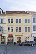 |
Residential building in closed development | Altmarkt 6 (old town) (map) |
After 1853 | Residential house in closed development; Part of the Altmarkt development with a late classicist facade, with a passage and a small atrium, of importance in terms of building history and urban development |
09222419 |
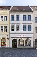 |
Residential building in closed development | Altmarkt 7 (old town) (map) |
After 1853 | Part of the Altmarkt development with a late classicist facade, ground floor torn open by a younger shop, of importance in terms of building history and urban development |
09222420 |
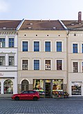 |
Residential house in closed development, with original shop front | Altmarkt 8 (old town) (map) |
After 1853 | Part of the Altmarkt development with a simple late classical facade, of importance in terms of building history and urban planning |
09222421 |
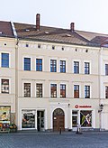 |
Residential house in closed development, with two original shop fronts | Altmarkt 9 (old town) (map) |
After 1853 | Part of the Altmarkt development with a late classical facade, emphasized by the arched portal, of importance in terms of building history and urban development |
09222422 |
 More pictures |
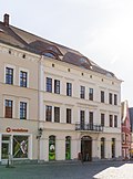
Residential building (No. 10a), courtyard building attached to the south (No. 10b), south-eastern courtyard building (No. 10c) and the residential building on the pond promenade in the south-eastern area of the property (No. 10d) | Altmarkt 10a, 10b, 10c, 10d (old town) (map) |
After 1853 | Front building 10a stately, classically structured building, residential building Teichpromenade (10d) with a long side in the course of the former city wall, attached to it so-called cat tower, this part of the city fortifications, see Teichpromenade Obj |
09222423 |
 More pictures |
Residential house in closed development, with restaurant | Altmarkt 11 (old town) (map) |
18th century | Gable-independent baroque building, of architectural and local significance |
09222368 |
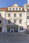 |
Residential house in closed development, with original shop front and writing | Altmarkt 15 (old town) (map) |
1st half of the 18th century | Several times rebuilt baroque house, of architectural and urban importance |
09222427 |
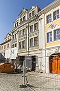 |
Residential house in closed development (Haus Schlockwerder) | Altmarkt 16 (old town) (map) |
Marked with 1712 | Representative baroque house with richly structured facade and roof houses, of architectural and urban importance |
09222426 |
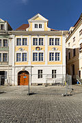 |
Residential building, free-standing to the right, with town hall (Goldenes Schiff) | Altmarkt 17 (old town) (map) |
Around 1720/1730 (residential house); 1st half of the 20th century (hall) | Representative residential building with richly structured façade and basket arch portal, town hall with stage and gallery, façade facing the bank alley with arched windows, of architectural and local importance |
09222425 |
| Frauenkirchhof (aggregate) | At the old cemetery (map) |
1544 ff. | All of the Frauenkirchhof (called Alter Friedhof) with the following individual monuments: Lückesches Grufthaus, enclosure wall with gate entrance, some baroque and two classicist tombs as well as a memorial stone to the German-Austrian War, the "Campaign 1866" (see individual monument 09222643) and the old tree population (garden monument) ; It is important in terms of building history, artistry, local history and landscape design |
09302379 |
|
 |
Lückesches Grufthaus, enclosure wall with gate entrance, some baroque and two classicist tombs as well as a memorial stone to the German-Austrian War , the "Campaign 1866" (individual memorials for ID No. 09302379) | At the old cemetery (map) |
1544 ff. (Cemetery), older churchyard; marked 1731 (Grufthaus) and abandoned in 1909; 1866 (memorial stone) | Individual features of the whole Frauenkirchhof (called old cemetery); Architecturally, artistically and locally of importance |
09222643 |
 |
House ( Umgebindehaus ) | At Seltenrein 2 (Altlöbau) (map) |
Late 18th century | Long column construction, of architectural and socio-historical importance |
09222745 |
 |
Rural house | At Seltenrein 4 (Altlöbau) (map) |
1st half of the 19th century | With boarded half-timbered upper storey, gable slated, of architectural significance |
09222746 |
| Gasthof Altlöbau with hall extension | At Seltenrein 10 (Altlöbau) (map) |
1st half of the 19th century (inn); End of the 19th century (ballroom); 10s of the 20th century (front building) | Structurally and locally of importance |
09222747 |
|
| Residential building | At Seltenrein 12 (Altlöbau) (map) |
1st half of the 19th century | Upper floor timber-framed boarded, historically important |
09222748 |
|
 |
Administration building | August-Bebel-Strasse 2 (map) |
1882 | House of the Amtshauptmannschaft (district administration), classicist structure, of architectural and local importance |
09299848 |
 More pictures |
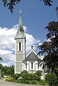
Catholic Church of the Name of the Virgin and rectory with garden and enclosure | August-Bebel-Strasse 6 (map) |
1896/1897 | Structurally and locally of importance |
09222525 |
| School building (Catholic school) | August-Bebel-Strasse 8 (map) |
1899 | Red brick building with a gable-crowned central projectile, corner ashlar, built as a Catholic denominational school, of architectural and local significance |
09222524 |
|
 |
Residential house in open development | August-Bebel-Strasse 9 (map) |
Around 1905 | With corner bay window, curved gable and tower top, important in terms of building history and urban planning |
09222527 |
 |
Rental villa ("Villa Daheim") | August-Bebel-Strasse 13 (map) |
Around 1900 | Clinker brick building with ornamental framework and rich ornamentation, of architectural and urban significance |
09222526 |
| Road bridge over the Löbau – Zittau railway line | Outer Bautzener Strasse (map) |
4th quarter of the 19th century | A granite arch, of architectural and technical significance |
09222764 |
|
 |
Apartment house in a corner and closed development, with shop | Outer Bautzener Strasse 1 (map) |
1908 | In the reform style of the time around 1910, important in terms of building history and urban planning |
09222478 |
| Apartment building in closed development, with original shop front | Outer Bautzener Strasse 1a (map) |
Around 1910 | In the reform style of the time around 1910, important in terms of building history and urban planning |
09222479 |
|
| Residential building in closed development | Outer Bautzener Strasse 3 (map) |
Around 1850 | Façade with Art Nouveau elements, younger shop fittings, of importance in terms of building history and urban planning |
09222480 |
|
| Apartment building in closed development, with original shop front | Outer Bautzener Strasse 7 (map) |
1890s | Clinker brick construction, of importance in terms of building history and urban development |
09222482 |
|
| Residential building in closed development | Outer Bautzener Strasse 8 (map) |
Around 1850 | Simple historicism building, of importance in terms of building history and urban planning |
09222490 |
|
| Apartment building in closed development | Outer Bautzener Strasse 9 (map) |
1890s | Historicism building with original front door, of importance in terms of building history and urban planning |
09222483 |
|
 |
Apartment building in closed development | Outer Bautzener Strasse 11 (map) |
Marked 1898 | Clinker brick building with original shop front and original front door, important in terms of building history and urban development |
09222485 |
| Apartment building in closed development | Outer Bautzener Strasse 13 (map) |
1890s | Clinker brick construction, of importance in terms of building history and urban development |
09222523 |
|
| Residential house, free-standing to the left | Outer Bautzener Strasse 14 (map) |
1824-1825 | Significant in terms of building history and urban development |
09222488 |
|
| Gasthof “Zum Lamm” and outbuildings | Outer Bautzener Strasse 16 (map) |
Marked 1822 | Formerly an inn with relaxation in front of the city gate, later a hotel, of architectural and local significance |
09222487 |
|
| Apartment building in closed development | Outer Bautzener Strasse 19 (map) |
Around 1905 | Façade with Art Nouveau elements, important in terms of building history and urban development |
09222520 |
|
 |
Apartment building in closed development | Outer Bautzener Strasse 21 (map) |
Around 1905 | Elaborate facade with Art Nouveau elements, of importance in terms of building history and urban planning |
09222519 |
 |
Apartment building in closed development | Outer Bautzener Strasse 23 (map) |
Around 1905 | Facade with rich floral decorative elements, of architectural and urban significance |
09222518 |
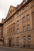 |
Apartment building in closed development | Outer Bautzener Strasse 25 (map) |
Around 1912 | Façade with pilasters and figurines, important in terms of building history and urban planning |
09221438 |
| Residential house with enclosure | Outer Bautzener Strasse 26 (map) |
Around 1925 | Objective architecture after 1910, with a side entrance area, of architectural significance |
09222563 |
|
 |
Apartment building in closed development | Outer Bautzener Strasse 27 (map) |
Around 1912 | Façade with pilasters and figurines, important in terms of building history and urban planning |
09222899 |
 |
Apartment building in closed development | Outer Bautzener Strasse 29 (map) |
Around 1912 | Façade with pilasters and figurines, important in terms of building history and urban planning |
09223170 |
 |
Apartment house in a corner and closed development | Outer Bautzener Strasse 31 (map) |
Around 1912 | Façade with pilasters and figurines, important in terms of building history and urban planning |
09222898 |
 More pictures |
Anker pasta factory Loeser & Richter with production and administration buildings, rear staircase tower by Hans Scharoun and partially preserved interior (e.g. furniture and doors), individual monuments for ID-NO. 09303655 | Outer Bautzener Strasse 32 (map) |
1899 (factory building); 1930s (stair tower) | Individual characteristics of the entity Anker-Pasta-Factory Loeser & Richter and Haus Schminke; The associated factory owner's villa “ Haus Schminke ” see Kirschallee 1b, of local, architectural, technical and scientific importance |
09222769 |
| Residential building in closed development | Outer Bautzener Strasse 39 (map) |
Marked 1898 | Historicism building, upper floors clinker, of architectural and urban significance |
09222564 |
|
| Tenement house as the end of the closed development | Outer Bautzener Strasse 41 (map) |
1890s | Elaborate historicism facade, clinker brick upper floors, of architectural and urban significance |
09222561 |
|
| Five town barns in a closed row | Outer Bautzener Strasse 41 (behind) (map) |
1st half of the 19th century | Significant in terms of building history and economic history |
09222562 |
|
| Tenement house ("Haus Christa") | Outer Bautzener Strasse 43 (map) |
Around 1900 | Historicizing facade with stucco ornamentation, upper floors partly clinker brick, wooden balconies, of importance in terms of building history and urban development |
09222768 |
|
| Road bridge | Outer Zittauer Strasse (map) |
Marked 1824, changed | Two granite arches, important in terms of building history and technology. Created in 1824 with the new Zittauer Landstrasse |
09222786 |
|
 More pictures |
Holy Spirit Church (catechism church) with surrounding church square | Outer Zittauer Strasse (Mühlenstrasse) (map) |
Marked 1712, the core building is late Gothic | Structurally and locally of importance |
09222594 |
| Residential building | Äussere Zittauer Strasse 4 (map) |
2nd quarter of the 19th century | Without a rear part of the building, a classicist building with extensive plastering, significant in terms of building history and urban planning |
09222588 |
|
| Residential building | Äussere Zittauer Strasse 6 (map) |
Around 1800 | Designed for closed development, part of the late baroque street with the original front door and mansard gable roof, of importance in terms of building history and urban development |
09222609 |
|
| Residential building with a wooden freight elevator inside | Outer Zittauer Strasse 7 (map) |
18th century | Probably a former warehouse building, with a baroque portal, of architectural significance |
09222587 |
|
| Residential building in closed development | Outer Zittauer Strasse 8 (map) |
Around 1800 | Part of the late baroque street with the original front door and mansard gable roof, of importance in terms of building history and urban development |
09222608 |
|
| Residential building in closed development | Outer Zittauer Strasse 10 (map) |
Mid 19th century | Simple historicism building with a gable triangle, of importance in terms of building history and urban planning |
09222607 |
|
| Residential building in closed development | Outer Zittauer Strasse 11 (map) |
18th century | Part of the late baroque street with the original front door and mansard gable roof, of importance in terms of building history and urban development |
09222589 |
|
| Residential building in closed development | Outer Zittauer Strasse 12 (map) |
2nd half of the 18th century | Part of the late baroque street with a mansard gable roof, of importance in terms of building history and urban development |
09222606 |
|
| Residential building in closed development | Outer Zittauer Strasse 13 (map) |
Around 1800 | Part of the late baroque street with a mansard gable roof, of importance in terms of building history and urban development |
09222590 |
|
| Residential building in closed development | Outer Zittauer Strasse 14 (map) |
2nd half of the 18th century | Part of the late baroque street with the original front door and mansard gable roof, of importance in terms of building history and urban development |
09222605 |
|
| Residential house, freestanding to the right | Outer Zittauer Strasse 15 (map) |
Around 1800 | Part of the late baroque street with a mansard gable roof, of importance in terms of building history and urban development |
09222591 |
|
| Residential house, free-standing to the left | Outer Zittauer Strasse 16 (map) |
18th century | Part of the late baroque street with a mansard gable roof, of importance in terms of building history and urban development |
09222604 |
|
| Arch bridge | Outer Zittauer Strasse 28 (behind) (map) |
Marked 1752 | Quarry stone, marked 1752, located at the confluence of the Seltenrein and Katzbach rivers, of architectural significance |
09222603 |
|
| Residential building in closed development | Outer Zittauer Strasse 29 (map) |
18th century | Part of the late baroque street with a mansard gable roof, of importance in terms of building history and urban development |
09222601 |
|
| Residential building in closed development | Outer Zittauer Strasse 30 (map) |
Early 19th century | Part of the late baroque street with a gable roof, of importance in terms of building history and urban development |
09222599 |
|
| Residential house, freestanding to the right | Outer Zittauer Strasse 31 (map) |
Marked with 1811 (in the keystone) | Part of the late baroque street with a basket arched door and a mansard hipped roof, of importance in terms of building history and urban development |
09222600 |
|
| Detached house to the left and arched bridge | Äussere Zittauer Strasse 32 (map) |
17th century | Baroque building with a steep pitched roof, of architectural and urban significance. Arch bridge behind the house |
09222598 |
|
| Residential house in open development | Äussere Zittauer Strasse 40 (map) |
18th century | Part of the late baroque street with a mansard gable roof, of importance in terms of building history and urban development |
09222593 |
|
| Residential house in open development | Outer Zittauer Strasse 47 (map) |
1905/1910 | Example of objectified architecture with economical structuring elements, important in terms of building history and urban planning |
09222780 |
|
| Residential building | Outer Zittauer Strasse 50 (map) |
Around 1910 | Objectified architecture with a gabled central projectile and decorative framework, of importance in terms of building history and urban planning |
09222783 |
|
| Double apartment building in open development | Äussere Zittauer Strasse 52, 52a (map) |
Around 1900 | With bay windows and decorative framework, of architectural and urban significance |
09222782 |
|
| Apartment house in open development and corner location, with fencing | Outer Zittauer Strasse 54 (map) |
1910s | Elaborate building with two gable risalits, corner tower and decorative framework, of architectural and urban significance |
09222781 |
|
 |
Residential building in closed development | Badergasse 1 (old town) (map) |
18th century | Baroque building, facing the street, noteworthy in terms of architectural history and urban development |
09222369 |
 |
Residential building in closed development | Badergasse 3 (map) |
18th century | Baroque building, facing the street, noteworthy in terms of architectural history and urban development |
09222370 |
 |
Residential house in closed development, with drive-through construction (Alte Baderei) | Badergasse 5 (old town) (map) |
Marked 1714, house older | Mighty baroque building with a basket arch portal, inscribed in the keystone with “IOH. CASP. GRAFE Ano 1714 ”, of architectural and local significance |
09222366 |
| Residential building in closed development | Bahnhofstrasse 1 (old town) (map) |
18th century (residential house); Passage 1713 (information) | With shop fitting and groin vaulted passage, changed, historically and urbanistically significant |
09222413 |
|
 More pictures |
Residential house in corner location and closed development, a house with rear building at Nicolaiplatz 3 (old pharmacy) | Bahnhofstraße 2, Nicolaiplatz 3 (old town) (map) |
Marked with 1611 | Core building redesigned around 1900, of architectural, urban and local significance |
09222447 |
| Apartment building in closed development with original shop front and rear building | Bahnhofstrasse 3 (old town) (map) |
1890s (apartment building); 19th century (outbuilding) | Historicism facade with clinker bricks, back building facing the promenade ring, of architectural and urban significance |
09222412 |
|
| Residential house in closed development, with original shop front | Bahnhofstrasse 4 (old town) (map) |
18th century | Part of the baroque street, later redesigned, of importance in terms of building history and urban planning |
09222449 |
|
| Residential house in a corner and closed development | Bahnhofstrasse 5 (map) |
18th century | Part of the baroque street, important in terms of building history and urban development |
09300050 |
|
 |
Residential house in closed development, with shop fitting | Bahnhofstrasse 6 (old town) (map) |
18th century | Part of the baroque street with the original front door, of architectural and urban significance |
09222484 |
 |
Apartment building in a corner and half-open development, with a rear building | Bahnhofstrasse 8 (map) |
1890s | Smoothed facade, only in the mansard area of the roof stucco, free-form sculpture on the corner side of the house, of importance in terms of the history of the building and the appearance of the street |
09222538 |
| Residential house in closed development, with shop fitting | Bahnhofstrasse 9 (map) |
Marked with 1901 | High-quality and balanced façade from around 1900, important in terms of building history and urban planning |
09222541 |
|
| Residential house in closed development, with shop fitting | Bahnhofstrasse 11 (map) |
Around 1850 | Historicism facade with original door, of architectural and urban importance |
09222542 |
|
| Residential building in closed development | Bahnhofstrasse 15 (map) |
2nd third of the 19th century | Emphasis on the facade by a gabled central projection, with modern shop fittings, of importance in terms of building history and urban planning |
09222543 |
|
| Double tenement house in closed development | Bahnhofstrasse 16, 16b (map) |
Marked 1900 | Elaborate facade with elements of the reform style, distinctive entrance area, disfiguring shop fittings, of importance in terms of building history and the street scene |
09222573 |
|
| Residential building in closed development | Bahnhofstrasse 17 (map) |
Around 1850 | With modern shop fittings, historicism facade with multiple grooved windows and pronounced window roofing, of importance in terms of building history and urban planning |
09222544 |
|
| Gazebo and retaining wall | Bahnhofstrasse 18 (located on Blumenstrasse) (map) |
Late 19th century | Clinker brick building with wood decoration and original front door, of architectural significance |
09222632 |
|
| Apartment building in closed development | Bahnhofstrasse 18 (map) |
3rd quarter of the 19th century | Historicism facade with original wooden gate, more recent shop fittings, of importance in terms of building history and urban planning |
09222572 |
|
 |
Residential, office, sales and warehouse in closed development, with an extension to Gartenstrasse | Bahnhofstrasse 19 (map) |
1863 | Representative corner building with neo-renaissance facade with rich architectural structure, built for the Löbauer yarn dealer Eduard Rönsch by master carpenter Köhler and master bricklayer Schmidt, historically important in terms of building history, shaping the streetscape and local history |
09222545 |
| Residential building in closed development | Bahnhofstrasse 20 (map) |
3rd quarter of the 19th century | Balanced late classicist facade, with modern shop fittings, important in terms of building history and urban development |
09222571 |
|
 |
Residential house in closed development, with lettering | Bahnhofstrasse 22 (map) |
Around 1800 | Letters: “Bicycles Karl Küntzel Motorräder”, shop front from the 1930s on the ground floor, significant in terms of building history and urban planning |
09300051 |
 |
Residential house in closed development, with original shop front | Bahnhofstrasse 23 (map) |
2nd third of the 19th century | Simple facade, important in terms of building history and urban planning |
09222548 |
 |
Apartment building in closed development, with original shop front | Bahnhofstrasse 24 (map) |
Marked 1897 | Clinker construction, important in terms of building history and urban planning |
09222570 |
 |
Apartment building in closed development, with partly original shop front | Bahnhofstrasse 25 (map) |
1890s | Clinker brick building with elaborate facade decoration, emphasis of the center by bay windows, of importance in terms of building history and urban development |
09222549 |
 |
Apartment building in a formerly closed development, with the original shop front | Bahnhofstrasse 26 (map) |
Marked 1898 | Clinker brick building with stucco ornamentation, of importance in terms of building history and urban development |
09222569 |
 |
Apartment building in closed development | Bahnhofstrasse 27 (map) |
1890s | Clinker brick building with a balanced facade, rich window roofing, modern shop fitting, of architectural and urban importance |
09222550 |
 |
Apartment building in closed development, with original shop front | Bahnhofstrasse 29 (map) |
Marked 1896 | Representative clinker brick building with rich facade decorations, emphasis of the center by bay-like balconies over two upper floors, of architectural and urban significance |
09222551 |
| Apartment building in closed development | Bahnhofstrasse 32 (map) |
1865 | Simple historicism facade, of importance in terms of building history and urban planning |
09222621 |
|
 |
Residential building in closed development, corner house (former film theater) | Bahnhofstrasse 34, 36 (map) |
1860 | Façade with bay windows and Ionic pillars above the entrance area, original doors, of importance in terms of building history and the appearance of the street |
09222618 |
 More pictures |
Reception building of the Löbau station (with the so-called king's room), plus the support structure of the platform roof (tracks 1 and 4) and underpass including covered track exit (individual monuments to ID no. 08992544) | Bahnhofstrasse 35 (map) |
1844-1847 | Individual features of the entity railway Löbau – Zittau; Significant in terms of building history, local history, railway history and traffic history, railway station in the arched style of the 19th century |
09222574 |
 More pictures |
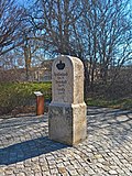
milestone | Bahnhofstrasse 35 (in front of) (map) |
1859 | Individual monument of the whole of the Royal Saxon Milestones ; Sandstone block, rounded at the top, of significance in terms of traffic history |
09222729 |
 |
Apartment house in a corner and closed development | Bahnhofstrasse 38 (map) |
3rd quarter of the 19th century | Facade with plastered rustics and stucco decorations, original front door, of architectural and urban significance |
09222617 |
| Residential building in closed development | Bahnhofstrasse 40 (map) |
3rd quarter of the 19th century | Formerly part of the button factory J. Ernst KG, with remnants of the original furnishings, including wood paneling in the entrance hall and front door, of architectural and urban significance |
09222619 |
|
 |
Apartment building in a formerly closed development | Bahnhofstrasse 44 (map) |
3rd quarter of the 19th century | Rich façade with round arch structure and stucco ornamentation, accentuated by two elevated side projections, of importance in terms of building history and urban planning |
09222616 |
| Apartment building in closed development | Bahnhofstrasse 46 (map) |
3rd quarter of the 19th century | Historicism facade with pilasters, of importance in terms of building history and urban planning |
09222615 |
|
| Apartment building in closed development | Bahnhofstrasse 48 (map) |
3rd quarter of the 19th century | Simple facade emphasized by two raised side elevations, of importance in terms of building history and urban development |
09222614 |
|
 More pictures |
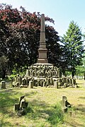
Park (garden monument) with a memorial to those who fell in the Franco-Prussian War 1870/1871 and Kaiser Wilhelm monument (Friedenshain, former Siegeshain) | Beethovenstrasse (on Löbauer Berg) (map) |
1895 (German-French War Memorial); 1896-1897 (park); 1905 (Kaiser Wilhelm Monument) | Victory monument Granite obelisk on pedestal, with basalt blocks and inscription; Significant in terms of local history, landscape design and garden art |
09222818 |
| Railway bridge | Beethovenstrasse (map) |
1845/1847 | Dresden – Görlitz railway line ; Bridge in granite stones, of importance in terms of traffic and building history |
09299763 |
|
| Residential house with enclosure | Beethovenstrasse 6 (map) |
1920s | Traditional rectangular building in the Heimat style, with a hipped roof, historically important |
09222791 |
|
| Residential building | Beethovenstrasse 8 (map) |
1920s | Reform style, important in terms of building history |
09222789 |
|
| Residential building | Beethovenstrasse 10 (map) |
Around 1930 | Traditionally designed rectangular building with a hipped roof, expressionistic decorative elements, of architectural significance |
09222790 |
|
| Residential house with enclosure | Beethovenstrasse 12 (map) |
Around 1930 | Traditionally designed rectangular building with a hipped roof, expressionistic decorative elements, of architectural significance |
09222788 |
|
| Residential house with enclosure | Beethovenstrasse 14 (map) |
Around 1930 | Traditional building with expressionistic design elements, of importance in terms of building history |
09222787 |
|
| House (Margothof) | Beethovenstrasse 20 (map) |
18th century (residential house); 1863 (newly established) | Baroque building with a central projection with triangular gable and crooked hip roof, of architectural significance |
09299764 |
|
| Gas station with gas pump | Beethovenstrasse 26 (map) |
1930s | Massive construction and covered gas pump, both with a hipped roof, original, typical 30s architecture, of architectural and local significance |
09299765 |
|
 More pictures |
Municipal spa with park and enclosure (König-Albert-Bad) | Blumenstrasse 2 (map) |
1875-1876 | Long building with loggias and double flight of stairs, of architectural and local importance |
09222634 |
| Residential building | Blumenstrasse 4 (map) |
3rd quarter of the 19th century | Rustic plasterwork and multiple cornices, important in terms of building history and urban development |
09222633 |
|
| Residential house, to the right in closed development | Blumenstrasse 10 (map) |
4th quarter of the 19th century | Significant in terms of building history and urban development |
09222631 |
|
| Residential house, to the left in closed development | Blumenstrasse 12 (map) |
3rd quarter of the 19th century | With figurative and ornamental terracotta decorative elements, of importance in terms of building history and urban planning |
09222629 |
|
| Residential house, to the right in closed development | Blumenstrasse 16 (map) |
3rd quarter of the 19th century | Façade with terracotta reliefs, important in terms of building history and urban development |
09222630 |
|
| Tenement house | Böttchergasse 6 (map) |
Around 1905 | With corner turrets, of importance in terms of building history and urban planning |
09222469 |
|
| Double tenement house, with enclosure | Breitscheidstrasse 14, 16 (map) |
Around 1905/1910 | Significant in terms of building history and urban development |
09222686 |
|
 |
Double tenement house | Breitscheidstrasse 18, 20 (map) |
Around 1905/1910 | With a richly structured roof zone, of importance in terms of building history and urban planning |
09222684 |
 |
Double tenement house | Breitscheidstrasse 22, 24 (map) |
Around 1905/1910 | With two gable projections and built-in shops, important in terms of building history and urban development |
09222683 |
 |
Double tenement house with enclosure | Breitscheidstrasse 30, 32 (map) |
Marked 1910 | Changed, of importance in terms of building history and urban planning |
09223174 |
 |
Residential house, corner house | Breitscheidstrasse 34 (map) |
Around 1910 | Head building of the street, important in terms of building history and urban planning |
09222682 |
| Administration and production building of the Löbau consumer association | Breitscheidstrasse 36 (map) |
1927 | With a relief representation above the corner entrance, apart from the figurative representation here the designation "Founded in 1898, KVL, 1927", of significance in terms of building history and local history |
09222681 |
|
| Villa-like house with fencing | Breitscheidstrasse 44 (map) |
Marked 1911 | Facade with elaborate stucco decoration, of importance in terms of building history |
09222674 |
|
 |
Remains of the city wall in the area of Brücknerring and the Nikolaiplatz / Bahnhofstrasse ticket booth as well as a memorial stone for two deserters shot by the Nazis in the last weeks of the war on Brunnenstrasse (individual memorials for ID No. 09223137) | Brücknerring (old town) (map) |
15th century (city wall); after 1945 (memorial stone) | Individual features of the aggregate ring system and city fortifications; of importance in terms of building history, urban planning and local history |
09303379 |
| Residential house in semi-open development | Brücknerring 1 (map) |
1855 (according to the new plate) | Back building at Johannisstraße 29, of architectural significance |
09300113 |
|
| House ("The Saxon Postillon") | Brücknerring 2 (map) |
18th century, postillon from 1785 | Building with a mansard roof and baroque portal with basket arch, of architectural and local importance |
09222645 |
|
 More pictures |
Brückner villa with villa garden and garden enclosure with three gates | Brücknerring 8 (map) |
Marked with 1901 | Stately neo-baroque building with tower and wooden extensions, original furnishings, of architectural and gardening significance |
09222641 |
| Residential building | Brücknerring 12 (map) |
1890s | Clinker brick building with echoes of the Swiss style, of architectural significance |
09222664 |
|
| Residential building | Brücknerring 14 (map) |
Marked 1909 | Façade with stucco decorations, important from an architectural point of view |
09222640 |
|
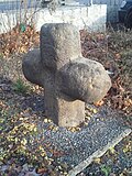 |
Murder and Atonement Cross | Clara-Zetkin-Strasse (corner of Walter-Vetter-Strasse) (map) |
15./16. century | Sandstone, of local history |
09223139 |
| Double house in a corner | Clara-Zetkin-Strasse 10, 11 (map) |
1920s | With plaster ornament, of architectural significance |
09222713 |
|
 More pictures |
villa | Dehsaer Strasse 2 (map) |
Around 1905 | Elaborate historicism building with art nouveau elements, of architectural and artistic importance |
09222767 |
| Residential house in semi-open development | Dehsaer Strasse 2a (map) |
Around 1905 | Building unit with Schillerstraße 1, representative facade, of architectural importance |
09222766 |
|
| Stable house with barn part | Ebersdorfer Weg 6 (map) |
Early 19th century | Half-timbered, historically and socially important |
09222785 |
|
| Murder and Atonement Cross | Ebersdorfer Weg 7 (near) (map) |
15./16. century | Sandstone, of local history |
09223140 |
|
| Residential house in closed development, corner house, with original shop front | Eichelgasse 1 (old town) (map) |
3rd quarter of the 19th century | Balanced historicism facade, of importance in terms of building history and urban planning |
09222345 |
|
| Residential house in closed development, corner house | Eichelgasse 2 (old town) (map) |
18th century | Baroque building, later remodeled, with shop fitting, important in terms of building history and urban development |
09222336 |
|
| Residential house, of the type in closed development | Eichelgasse 4 (old town) (map) |
Early 19th century | Significant in terms of building history and urban development |
09222337 |
|
| Residential building in closed development | Eichelgasse 5 (old town) (map) |
Mid 19th century | Significant in terms of building history and urban development |
09222344 |
|
| Residential building in closed development | Eichelgasse 6 (old town) (map) |
1st half of the 19th century | Significant in terms of building history and urban development |
09222338 |
|
| Residential building in closed development | Eichelgasse 7 (old town) (map) |
1st half of the 19th century | Significant in terms of building history and urban development |
09222343 |
|
| Residential building in closed development | Eichelgasse 8 (old town) (map) |
Mid 19th century | Significant in terms of building history and urban development |
09222339 |
|
 |
Residential house in closed development, corner house | Eichelgasse 9 (old town) (map) |
18th century | Significant in terms of building history and urban development |
09222342 |
| Residential house in closed development, with shop fitting | Eichelgasse 10 (old town) (map) |
Mid 19th century | Significant in terms of building history and urban development |
09222340 |
|
 |
Residential house in closed development, corner house | Eichelgasse 12 (old town) (map) |
Late 18th century | Significant in terms of building history and urban development |
09222341 |
 More pictures |
Hotel and restaurant "Stadt Löbau" in a corner location | Elisenstrasse 1 (map) |
Marked 1913 | Large plastered building, first building around 1850 "Gasthaus Feldschlößchen", of architectural and local significance |
09222676 |
| Railway bridge across the street (individual monument for ID no. 08992544) | Friedhofstrasse (map) |
4th quarter of the 19th century | Individual monument of the entity railway Löbau – Zittau; Railway history and traffic history of importance, arch bridge made of granite stones |
09222736 |
|
| Löbau cemetery (aggregate) | Friedhofstrasse 3 (map) |
1890s | Totality of Löbau cemetery: neoclassical chapel with memorial plaque for the fallen from 1870/71, cemetery administration building, laying out hall, eight tombs and four grave structures, soldier burial site for the fallen from the First and Second World Wars and the Soviet military cemetery as well as the enclosure with a wrought iron gate (see 0922 also single monument ), Cemetery design (garden monument) and the cemetery as a whole; Architecturally, artistically and locally of importance |
09302340 |
|
| Neoclassical chapel with a memorial plaque for the fallen from 1870/71, cemetery administration building, funeral hall, eight tombs and four grave systems, soldier burial grounds for the fallen soldiers of the First and Second World Wars and the Soviet military cemetery as well as the enclosure with a wrought iron gate (individual memorials for ID No. 09302340) | Friedhofstrasse 3 (map) |
Around 1880 (cemetery chapel); 1942–1945 (Soviet military cemetery) | Individual features of the whole cemetery; Architecturally, artistically and locally of importance |
09222582 |
|
| Apartment building, free-standing to the left | Friedhofstrasse 5 (map) |
Marked with 1902 | Façade with stucco ornaments, of importance in terms of building history and urban planning |
09222581 |
|
| Apartment building in a corner, free-standing to the right | Friedhofstrasse 7 (map) |
1900/1905 | Façade with Art Nouveau elements, important in terms of building history and urban development |
09222580 |
|
| House and two side buildings of a farm | Friedhofstrasse 26 (map) |
Late 18th century | Residential house with two baroque portals, of architectural and economic importance |
09222578 |
|
| Residential house in closed development, corner house | Gartenstrasse 1 (map) |
Around 1870 | Significant in terms of building history and urban development |
09222546 |
|
| Commercial building | Gartenstrasse 3 (map) |
Around 1910 | Probably a photo studio, historically significant |
09300054 |
|
| Officers' casino, house 13 (individual monument for ID no.09302383) | Georgewitzer Strasse 25 (map) |
1913-1915 | Individual monument of the whole Jägerkaserne; of military and local history of importance |
09222718 |
|
| Factory owner's villa | Georgewitzer Strasse 62 (map) |
Around 1890 | Belonging to the former felt factory, facade with neo-renaissance style elements, of architectural and local significance |
08960559 |
|
| Baroque house (soap factory) | Gewandhausgäßchen 1 (map) |
18th century | Back building of Innere Zittauer Straße 11, of architectural significance |
08975876 |
|
| Multi-family house with enclosure | Goethestrasse 1, 3 (map) |
1920s | Architecturally important |
09222529 |
|
| Villa with enclosure | Goethestrasse 2 (map) |
Around 1900 | Neo-Baroque design language, important in terms of building history |
09222530 |
|
 |
Apartment building in closed development | Goethestrasse 5 (map) |
Around 1912 | Original front door, of architectural and urban significance |
09222897 |
| Apartment house in a corner and closed development | Goethestrasse 6 (map) |
Around 1912 | Original front door, of architectural and urban significance |
09222531 |
|
| Apartment building in closed development | Goethestrasse 7 (map) |
Around 1912 | Original front door and shop front, important in terms of building history and urban planning |
09222896 |
|
| Residential building in closed development | Goethestrasse 8 (map) |
Around 1912 | Significant in terms of building history and urban development |
09222532 |
|
| Apartment building in closed development, corner house | Goethestrasse 9 (map) |
1930s | Original front door, of architectural and urban significance |
09222895 |
|
| Residential house in closed development, with enclosure | Goethestrasse 10 (map) |
1914/1915 (information) | Significant in terms of building history and urban development |
09222533 |
|
| Residential house, head building in closed development, with outbuildings and fencing | Goethestrasse 12 (map) |
Around 1912 | Significant in terms of building history and urban development |
09222534 |
|
| Two railway bridges | Görlitzer Strasse (map) |
Marked 1846 | Dresden – Görlitz railway line; Bridges parallel and close to each other, each with a segmental arch made of almost regular granite stones, of significance in terms of railway history |
09222796 |
|
 |
Residential and administrative building of the slaughterhouse with enclosure | Görlitzer Strasse 5 (Breitscheidstrasse 1) (map) |
Between 1894 and 1900 | Clinker brick, with an elaborate design, clinker wall enclosure with covered posts also along Breitscheidstraße 1, of architectural and local significance |
09223171 |
 |
Villa-like house, two outbuildings and an enclosure | Görlitzer Strasse 8 (map) |
Marked 1880 | Architecturally important |
09222714 |
| Residential house in open development | Güterstrasse 7 (map) |
Around 1900 | Three-storey with a mansard roof and neo-baroque stucco, historically important |
09222677 |
|
| Villa-like house in open development (Villa Martha) | Güterstrasse 12 (map) |
1890s, changed | Architecturally important |
09222678 |
|
| Factory building of the shoe and felt goods factory Gebr. Nedon und Loewen men's shoes | Handwerkerstraße 13, 15 (map) |
Marked 1897 | Today a residential building, large brick building with pilaster strips facing the Handwerkerstraße, of architectural and local significance |
09222584 |
|
| Car depot and fire brigade tower | Hartmannstrasse 2 (map) |
Late 19th century | Clinker brick tower, of local historical importance |
09222504 |
|
| Children's home | Hartmannstrasse 4 (map) |
Late 19th century | Two-storey clinker brick building with a wooden extension, sophisticated design, of importance in terms of building history |
09222503 |
|
 |
Villa Sanssouci and garden enclosure | Hartmannstrasse 5 (map) |
1889 | Elaborate sandstone block construction, largely original equipment, of importance in terms of architectural history, artistry and the appearance of the street |
09222501 |
| Residential house in open development | Hartmannstrasse 6 (map) |
Around 1912 | Plastered building in the reform style of the time around 1910, home of the governor (district administrator), of local and architectural significance |
09222556 |
|
| Double apartment building in open development, with fencing | Hartmannstrasse 9, 11 (map) |
1890s | Upper storeys in clinker brick in the German neo-renaissance, of architectural significance |
09222558 |
|
| Apartment house in open development and corner location | Hartmannstrasse 15 (map) |
1900/1905 | With ornamental framework and corner turrets, moderately historicizing, of architectural significance |
09222559 |
|
| Rural house | Herwigsdorfer Strasse 1 (map) |
18th century | Architecturally important |
09222648 |
|
| Mill house (Mühle Tiefendorf) | Herwigsdorfer Strasse 2 (map) |
19th century | Later it was the material warehouse of VEB Lausitzer Granit, of economic and architectural importance |
09304182 |
|
| Residential building | Herwigsdorfer Strasse 3 (map) |
Early 19th century | Rural building with a half-timbered upper floor, of architectural significance |
09222649 |
|
| Residential building | Herwigsdorfer Strasse 17 (map) |
Around 1800 | Rural building with a half-timbered upper floor, of architectural significance |
09222793 |
|
| Forester's house | Herwigsdorfer Strasse 31 (map) |
Around 1900 | Clinker brick building in the Swiss style, of architectural significance |
09222792 |
|
| Apartment building in a formerly closed development, with the original shop front | Innere Bautzner Strasse 3 (old town) (map) |
1890s | Upper floors clinker, of architectural and urban significance |
09222373 |
|
| Residential house in closed development and three rear buildings grouped around an inner courtyard (Stadtpfeiferhaus) | Innere Bautzner Strasse 4 (old town) (map) |
Marked with 1712 (corridor vault) | Without an extension in the 1950s, it is of importance in terms of building history and local history |
09222375 |
|
 |
Residential house in closed development, with original shop front | Innere Zittauer Straße 1 (old town) (map) |
2nd quarter of the 19th century, core older | Original front door, of architectural and urban significance |
09222335 |
 |
Residential house in closed development, corner house | Innere Zittauer Straße 2 (old town) (map) |
After 1853 | With modern shop fittings, of importance in terms of building history and urban planning |
09222347 |
| Residential building in closed development | Innere Zittauer Straße 3 (old town) (map) |
2nd quarter of the 19th century | Original front door, of architectural and urban significance |
09222334 |
|
 |
Residential house in closed development ( towel house ) | Innere Zittauer Straße 4 (old town) (map) |
Early 18th century | Narrow gable-independent building with curved gable, built-in shop, of importance in terms of building history and urban planning |
09222348 |
 |
Residential building in closed development | Innere Zittauer Straße 5 (old town) (map) |
3rd quarter of the 19th century | With modern shop fittings and original front door, of importance in terms of building history and urban planning |
09222333 |
| Residential house in closed development, with original shop front | Innere Zittauer Straße 6 (old town) (map) |
18th century | Original front door and iron door, important in terms of building history and urban planning |
09222349 |
|
| Residential house in closed development, with original shop front | Innere Zittauer Straße 7 (old town) (map) |
3rd quarter of the 19th century | Original front door, of architectural and urban significance |
09222332 |
|
 |
Residential house in closed development, with shop fitting | Innere Zittauer Straße 8 (old town) (map) |
18th century | Significant in terms of building history and urban development |
09222350 |
| Residential building in closed development | Innere Zittauer Straße 9 (old town) (map) |
Before 1850 | Facade probably smoothed, of importance in terms of building history and urban planning |
09222331 |
|
 |
Residential house in development closed to the right, three candle arches to No. 12 and paving of Katzenturmgäßchen | Innere Zittauer Straße 10 (old town) (map) |
Around 1700 | Significant in terms of building history and urban development |
09222351 |
| Residential house in closed development, with the original shop front from 1900 | Innere Zittauer Straße 11 (old town) (map) |
End of the 18th century, core building older, rear building 18th century | Basket arch portal and original door, baroque rear building, see Gewandhausgäßchen 1, important in terms of building history and urban development |
09222330 |
|
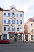 |
Tenement house with Johannisapotheke in a building closed to the left | Innere Zittauer Straße 12 (old town) (map) |
Around 1905 | Elaborate facade with gable and stucco ornamentation in Art Nouveau style, with the original shop front and front door, of importance in terms of building history and urban planning |
09222352 |
| Apartment building in closed development, with original shop front | Innere Zittauer Straße 13 (old town) (map) |
After 1850 | Original front door, of architectural and urban significance |
09222329 |
|
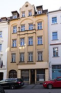 |
Apartment building in closed development, with original shop front | Innere Zittauer Straße 14 (old town) (map) |
Around 1905 | Original front door, of architectural and urban significance |
09222353 |
| Apartment building in closed development, with original shop front | Innere Zittauer Straße 15 (old town) (map) |
2nd half of the 19th century | Original front door, of architectural and urban significance |
09222328 |
|
 |
Apartment building with pharmacy (Mohren drugstore) in closed development and back building | Innere Zittauer Straße 16 (old town) (map) |
Marked 1892, core structure older | Neo-Baroque facade with rich window decorations and a Moor figure, original shop front, of architectural and urban importance |
09222354 |
| Apartment building in development open to the right, with original shop front | Innere Zittauer Straße 17, 19 (old town) (map) |
1st half of the 19th century | Significant in terms of building history and urban development |
09222327 |
|
 |
Apartment building in closed development, with original shop front | Innere Zittauer Straße 18 (old town) (map) |
1890s | Original front door; Of importance in terms of building history and urban planning |
09222355 |
 |
Residential house in closed development and rear building in the city wall | Innere Zittauer Straße 20 (old town) (map) |
End of the 18th century (residential building); 1920s (Secret Annex) | Front building with original shop front, rear building with avant-garde 1920s architecture, important in terms of building history and urban planning |
09222356 |
 |
Trading house in a corner (Gewandhaus) | Innere Zittauer Straße 21 (old town) (map) |
1825 | Cubic two-storey building, stands on the walls of the St. Catherine's Chapel, of importance in terms of building history, local history and the appearance of the square |
09222326 |
 |
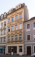
Residential building in closed development | Innere Zittauer Straße 22 (old town) (map) |
18th century | Significant in terms of building history and urban development |
09222358 |
 |
Apartment building in closed development, with original shop front | Innere Zittauer Straße 24 (old town) (map) |
1890s | Significant in terms of building history and urban development |
09222359 |
 |
Apartment building in closed development, with original shop front | Innere Zittauer Straße 26 (old town) (map) |
1890s | Original front door, of architectural and urban significance |
09222360 |
 |
Tenement house with original shop front in closed development and rear building | Innere Zittauer Straße 28 (old town) (map) |
Marked 1833 (tenement house); 1890s (Secret Annex) | Significant in terms of building history and urban development |
09222361 |
 |
Apartment building in closed development with shop fitting | Innere Zittauer Straße 30 (old town) (map) |
1890s | Original front door, of architectural and urban significance |
09222362 |
 |
Apartment building, end of the street in a closed development, with the original shop front | Innere Zittauer Straße 32 (old town) (map) |
1890s | Original front door, of architectural and urban significance |
09222363 |
Remarks
- This list is not suitable for deriving binding statements on the monument status of an object. As far as a legally binding determination of the listed property of an object is desired, the owner can apply to the responsible lower monument protection authority for a notice.
- The official list of cultural monuments is never closed. It is permanently changed through clarifications, new additions or deletions. A transfer of such changes to this list is not guaranteed at the moment.
- The monument quality of an object does not depend on its entry in this or the official list. Objects that are not listed can also be monuments.
- Basically, the property of a monument extends to the substance and appearance as a whole, including the interior. Deviating applies if only parts are expressly protected (e.g. the facade).
swell
- List of listed monuments of the State Office for the Preservation of Monuments in Saxony, as of April 15, 2014
- Monument map of Saxony , accessed on January 9, 2019
- Görlitz district geoportal , accessed on January 9, 2019
Web links
Commons : Kulturdenkmale in Löbau - Collection of pictures
