List of cultural monuments in Löbau (J – Z)
The list of cultural monuments in Löbau (J-Z) contains the cultural monuments of the Saxon city of Löbau , which were recorded by the State Office for Monument Preservation of Saxony until January 2019 (excluding archaeological cultural monuments) and whose street name begins with the corresponding first letter. The notes are to be observed.
This list is a partial list of the list of cultural monuments in Löbau .
List of cultural monuments
| image | designation | location | Dating | description | ID |
|---|---|---|---|---|---|
 More pictures |
Hunter barracks | Jägerstrasse 1, 2, 3, 4, 5, 6, 7, 7a, 9; Georgewitzer Strasse 25; Wilhelm-Leuschner-Platz 1, 2, 3, 4, 5; James-von-Moltke-Strasse 2, 4, 6; Theodor-Körner-Strasse 1a (map) |
1913 to 1915 | All of the Jäger barracks with the following individual monuments: team house with southern garden area (Jägerstraße 1 - Obj. 09222721), team house with southern garden area (Jägerstraße 3 - Obj. 09222720), team house (Wilhelm-Leuschner-Platz 1 - Obj. 09222722), staff building and enclosure wall of the eastern barracks area with main driveway, pedestrian entrances and further driveways (Jägerstraße 2 - Obj. 09222717), barracks building with horse stables (Wilhelm-Leuschner-Platz 5 - Obj. 09222726), team house (Wilhelm-Leuschner-Platz 4 - Obj. 09222725), officers' mess (Georgewitzer Straße 25 - Obj. 09222718), main or officers' house (Jägerstraße 4, 6 - Obj. 09222719), barracks building (Wilhelm-Leuschner-Platz 2 - Obj. 09222723) and riding hall (Wilhelm-Leuschner-Platz 3 - Obj. 09222724) as well as the following parts: three officers' houses at James-von-Moltke-Straße 2, 4 and 6, north-western horse stable Theodor-Körner-Straße 1a, opposite low fitting forge (Wilhelm-Leuschner-Platz, without newer extension, parcel 889/51), the small courtyard with area and all buildings in the southwest, including Jägerstrasse 5, 7 and 7a, 9, 11, and the parade ground; of military and local history of importance |
09302383 |
| Team house, house 1, with a southern garden area (individual monument for ID no.09302383) | Jägerstrasse 1 (map) |
1913 to 1915 | Individual monument of the whole Jägerkaserne; of military and local history of importance |
09222721 |
|
 |
Staff building, house 6 as well as the enclosure wall around the entire barracks area with main driveway, pedestrian entrances and further driveways (individual monuments to ID no. 09302383) | Jägerstrasse 2 (map) |
1913-1914 | Individual features of the aggregate Jägerkaserne; of military and local history of importance |
09222717 |
| Team house, house 2, with a southern garden area (individual monument for ID no.09302383) | Jägerstrasse 3 (map) |
1913-1915 | Individual monument of the whole Jägerkaserne; of military and local history of importance |
09222720 |
|
| Main or officer's residence, house 14 (individual monument for ID no.09302383) | Jägerstrasse 4, 6 (map) |
1913-1915 | Individual monument of the whole Jägerkaserne; of military and local history of importance |
09222719 |
|
| Residential building in closed development | Jahnstrasse 5d (map) |
Around 1900 | Significant in terms of building history and urban development |
09222623 |
|
| Tenement building, front building of the street | Jahnstrasse 6 (map) |
1900/1905 | Façade with Art Nouveau ornamentation, important in terms of building history and urban planning |
09222624 |
|
| Factory building (August Förster GmbH, grand piano and piano construction) | Jahnstrasse 8 (map) |
1899 | Large, three-storey plastered building with a mansard roof, one component with a tower top, see also Jahnstraße 12, of architectural and local importance |
09222797 |
|
 |
Factory owner's villa with entrance gate (Villa Förster) | Jahnstrasse 12 (map) |
1920 (information) | Original equipment, originally “Funkenburg”, see also Jahnstraße 8, of architectural and local significance |
09222638 |
| Rectory with enclosure (superintendent) | Johannisplatz 1, 3 (old town) (map) |
3rd quarter of the 19th century | Elaborate neo-renaissance facade, of architectural and local significance |
09222454 |
|
 |
Residential house, south of the Johanniskirche | Johannisplatz 2, 4 (old town) (map) |
16./17. century | Johanniskirche as an old monastery church of the Franciscans or parish school, since the monastery also served school purposes (only) from 1565, plastered building with a crooked hipped roof, of architectural and local significance |
09222460 |
 More pictures |
Franciscan monastery church; Johanniskirche | Johannisplatz 6 (old town) (map) |
Around 1330 | Gothic hall church donated to the city by Emperor Maximilian in 1565 for school purposes, German and Wendish church services also took place here, changes in 1840, including a flat ceiling, of importance in terms of building history and local history |
09222458 |
 More pictures |
Municipal secondary school with school auditorium | Johannisplatz 10 (old town) (map) |
1870s | Representative building with an auditorium that has been preserved true to the original, of architectural and local significance (district music school) |
09222456 |
 |
Residential building, free-standing to the left | Johannisstrasse 1 (old town) (map) |
18th century | Significant in terms of building history and urban development |
09222406 |
 More pictures |
School and adjacent stairs (Preuskerschule) | Johannisstrasse 1a (old town) (map) |
1855 (according to the new plate) | Building in the round arch style of the 19th century (neo-Gothic echoes) in Schinkel style, architect Carl August Schramm , of importance in terms of building history, local history and the street scene (today the Technical Town Hall) |
09222461 |
 |
House in a corner, with an entrance gate built on the left | Johannisstraße 2 (old town) (map) |
Marked 1724 (in the arch, extension); 1803-1805 | Palais-like building with a central projection and triangular gable, of importance in terms of architectural history, urban planning and the street scene |
09222438 |
 |
Residential building in closed development | Johannisstraße 3 (old town) (map) |
18th century | Significant in terms of building history and urban development (city museum) |
09222405 |
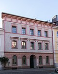 |
Residential building in closed development | Johannisstraße 4 (old town) (map) |
1st third of the 19th century | Significant in terms of building history and urban development |
09222437 |
 More pictures |
Residential house in closed development (city museum) | Johannisstrasse 5 (old town) (map) |
17th century | With two basket arch portals, important in terms of building history and urban planning |
09222404 |
 |
Residential building in closed development | Johannisstraße 6 (old town) (map) |
Around 1800 | Significant in terms of building history and urban development |
09222436 |
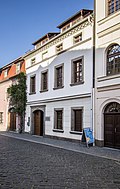 |
Residential building in closed development | Johannisstraße 7 (old town) (map) |
2nd quarter of the 19th century | Significant in terms of building history and urban development |
09222403 |
 |
Residential building in closed development | Johannisstraße 9 (old town) (map) |
2nd third of the 19th century | Late classicist facade with arched windows, of architectural and urban significance |
09222402 |
 |
Residential building in closed development | Johannisstraße 10 (old town) (map) |
Mid 19th century | Significant in terms of building history and urban development |
09222434 |
| Residential building in closed development | Johannisstraße 11 (old town) (map) |
2nd third of the 19th century | Significant in terms of building history and urban development |
09222401 |
|
 |
Residential building in closed development | Johannisstraße 12 (old town) (map) |
Mid 19th century | Significant in terms of building history and urban development |
09222433 |
| Residential building in closed development | Johannisstraße 13 (old town) (map) |
2nd third of the 19th century | Late classicist facade with arched windows, of architectural and urban significance |
09222400 |
|
 |
Residential building in closed development | Johannisstraße 16 (old town) (map) |
2nd quarter of the 19th century | With original front door, of architectural and urban significance |
09222432 |
 |
Residential building, end of the street | Johannisstraße 18 (old town) (map) |
2nd quarter of the 19th century | Significant in terms of building history and urban development |
09222391 |
| Residential house in closed development, with original shop front | Johannisstraße 21 (old town) (map) |
Mid 19th century | Of importance in urban planning |
09222396 |
|
| Residential building in closed development | Johannisstraße 25 (old town) (map) |
Mid 19th century | Of importance in urban planning |
09222394 |
|
| Residential building in closed development | Johannisstraße 29 (old town) (map) |
Mid-19th century (core building older) | For the rear building, see Brücknerring 1, of importance in terms of urban development |
09222392 |
|
 |
Brewery / brewhouse, in a corner | Johannisstraße 31 (old town) (map) |
2nd quarter of the 19th century | Large, two-and-a-half-storey building at the head of the building, of significance in terms of both architectural and local history |
09222390 |
| Residential stable house and barn of a farm | Kirchweg 7 (Altlöbau) (map) |
2nd half of the 19th century | Significant in terms of building history and economic history |
09222763 |
|
 More pictures |
Anker pasta factory Loeser & Richter and Haus Schminke (entity) | Kirschallee 1b (map) |
1904 (villa garden); 1930s (playground) | Aggregate of the anchor pasta factory Loeser & Richter and Haus Schminke with the following individual monuments: pasta factory with production and administration buildings, rear staircase tower by Hans Scharoun and partially preserved interior (see individual monument 09222769) and manufacturer's villa with partially original furnishings (see individual monument 09222770), villa garden and orchards (garden monuments) as well as orchards and break gardens as parts of the whole; Haus Schminke is an internationally outstanding example of classical modernism, reinforced concrete construction in the "organic style", architect: Hans Scharoun (Berlin), garden by Herta Hammerbacher (Berlin), of importance in terms of local history, building history, art history, technology history, scientific, artistic and gardening |
09303655 |
 More pictures |
Haus Schminke: factory owner's villa with partly original furnishings (individual monuments to ID no.09303655) | Kirschallee 1b (map) |
1930-1933 | Individual characteristics of the entity Anker-Pasta-Factory Loeser & Richter and Haus Schminke; For the associated factory, see Äußere Bautzener Straße 32, an internationally outstanding example of classical modernism, reinforced concrete construction in the “organic style”, architect: Hans Scharoun, Berlin, significant in terms of building history, art history, artistically, scientifically and locally |
09222770 |
| Residential building | Körbigsdorfer Weg 2 (map) |
Early 19th century | Rural building with a half-timbered upper floor, of architectural significance |
09222716 |
|
| Residential stable house | Körbigsdorfer Weg 6 (map) |
Around 1800 | Half-timbered upper floor, historically important |
09222715 |
|
| Row of tenement houses with shops in closed development | Lessingstraße 2, 4 (Pestalozzistraße 9) (map) |
1956 (information) | Large building with three house numbers, Lessingstraße 2 and 4 connected by a large gate entrance, Pestalozzistraße 9 im Winkel, shop fitting there, of importance in terms of building history and urban planning |
09222510 |
|
| Apartment building in closed development | Lessingstrasse 6 (map) |
1905/1910 | Significant in terms of building history and urban development |
09222511 |
|
| villa | Lessingstrasse 7 (map) |
1920s | With elements of reform style and all the original details, of architectural significance |
09303361 |
|
| Apartment building in closed development | Lessingstrasse 8 (map) |
Around 1910 | Significant in terms of building history and urban development |
09222512 |
|
| Apartment building in closed development | Lessingstrasse 10 (map) |
Around 1910 | Significant in terms of building history and urban development |
09222513 |
|
| villa | Lessingstrasse 11 (map) |
Around 1910 | With echoes of the Heimatstil, of importance in terms of building history |
09222517 |
|
| Apartment building in closed development | Lessingstrasse 12 (map) |
Around 1910 | Significant in terms of building history and urban development |
09222514 |
|
| Apartment building in closed development | Lessingstrasse 14 (map) |
Around 1910 | Significant in terms of building history and urban development |
09222515 |
|
| Apartment building in closed development, corner house | Lessingstrasse 16 (map) |
Around 1910 | Significant in terms of building history and urban development |
09222516 |
|
 More pictures |
Löbauer Berg (entity) | Löbauer Berg 1, 2 (map) |
1929/1930 (small quarry with rock garden) | Totality of Löbauer Berg with the following individual monuments: observation tower with cast iron enclosure, toboggan run with the bricked outer wall, mountain house with retaining walls and remains of former outbuildings, granite staircase from the mountain house in a north-westerly direction, steps of the prince and the warrior memorial from 1927 (see individual monument 09222820, Löbauer Berg 1, 2), Gasthaus Honigbrunnen with forecourt, retaining walls and fencing (see individual monument 09222819, Löbauer Berg 4) and the following parts of the whole: as geological or prehistoric features the Great Stone Sea, the two small stone quarries, one of which was built in 1929/30 by the Humboldt Association with a rock garden with mountain flora provided, the large quarry, the Judenkuppe, also the old toboggan run, the black angle, the coffee fountain, the Turnerbank, the Brücknerstein from 1942 and the Engwichtstein from 1854 with writing and cross. The entity outlined by the Honigbrunnenstraße with outer beech avenue, the Honigbrunnen with the entire associated area (parcel 1182/3), the Turmweg, the path leading east to the parking lot between the mountains shortly before its end, a piece of the Fernsehturmstraße (formerly Grenzweg), then an imaginary line below the Great Stone Sea to the Small Ring, from there going outwards along Karl-Michel-Weg to Beethovenstrasse and finally back to Honigbrunnenstrasse; of importance in terms of building history, local history and regional history. |
09303062 |
 More pictures |
Lookout tower with cast iron enclosure (König-Friedrich-August-Turm), toboggan run with the bricked outer cheek, mountain house with retaining walls and remnants of former outbuildings, granite stairs from the mountain house in a north-westerly direction, steps of the prince and the warrior memorial from 1927 (individual memorials to ID no. 09303062) | Löbauer Berg 1, 2 (map) |
1738 (accommodation and viewing hut as well as remains of the outbuildings of the viewing hut); marked 1854 (observation tower); 1898 (granite stairs from the Berghaus); 1927 (war memorial) | Individual features of the entity Löbauer Berg; of importance in terms of building history and local history |
09222820 |
 More pictures |
Gasthaus Honigbrunnen with forecourt, retaining walls and fencing (individual monuments to ID no. 09303062) | Löbauer Berg 4 (map) |
1841; marked 1896 | Individual features of the entity Löbauer Berg; first restoration, large, multi-part clinker brick building with wooden components, of importance in terms of architectural, local and regional history |
09222819 |
| Residential house in open development | Martin-Luther-Strasse 2 (map) |
1920s | High-quality plastered construction with Art Deco plaster ornaments, important in terms of building history |
09222585 |
|
| Residential house in open development | Martin-Luther-Strasse 3 (map) |
Marked 1927 | Objectified architecture after 1900 with stylized ornamentation, of importance in terms of building history |
09222583 |
|
 More pictures |
System with locomotive shed and administration building (individual monument for ID no. 08992544) | Maschinenhausstrasse 2 (map) |
Mid 19th century | Individual monument of the entity railway Löbau – Zittau; Significant in terms of building history, railway history and traffic history, sophisticated design |
09223094 |
| Two bridges over the Seltenrein | Mühlenstrasse (map) |
19th century | Brick arches made of quarry stone, of architectural significance |
09222647 |
|
| Road bridge over the Löbauer Wasser , with an inscription board | Mühlenstrasse (map) |
Marked with 1676 (inscription panel) | Three-arched vault bridge made of quarry stone masonry, of importance in terms of building history, technology history and the street scene |
09222646 |
|
| Residential building in closed development | Mühlenstrasse 3 (map) |
18th century | Baroque building with a gable roof and bat dormers, of architectural and urban importance |
09222597 |
|
| Residential building in closed development | Mühlenstrasse 5 (map) |
18th century | Baroque building, later redesigned, of importance in terms of architectural history and urban development |
09222596 |
|
| Mill building | Neue Sorge 7 (near Goldammergässchen) (map) |
18th century | Located at the confluence of the Seltenrein and Katzbach rivers, baroque building with a crooked hip roof, of historical importance |
09299766 |
|
| Steindeckerbrücke | New concern 7 (at) (card) |
19th century | Consisting of three granite pavers, with old iron railings, located at the confluence of the Seltenrein and Katzbach rivers, historically important |
09222376 |
|
| Six town barns in a closed row | New concern 11, 13, 15, 17, 19, 21 (map) |
18./19. century | Significant in terms of building history and economic history |
09222613 |
|
| Town square | Neumarkt (map) |
18th century | Of importance in terms of urban development history |
09305912 |
|
 More pictures |
Post mileage | Neumarkt (map) |
Marked 1725 (copy 1956) | Copy of a Saxon distance column , marked 1725, made of sandstone, in a dominant position on Neumarkt. It has the typical shape of an obelisk on a base, with a pair of coats of arms as well as an "AR" monogram and post horn mark. The column was made in 1724/25 by the Zittau master stonemason Gottlob Friedrich Engler and the Zittau sculptor Gottlob Kretzschmar and originally stood at the Bautzner Tor, but was demolished. In 1953 the coat of arms was rediscovered. The Ebersbach sculptor Hempel made a copy of the column on the initiative of the “Philately” working group. The original coat of arms was not used and is considered lost. In 1971 the color of the column was redesigned by master painter Rimpel (Löbau). |
09222476 |
 |
Apartment building in closed development, corner house | Neumarkt 1 (old town) (map) |
Around 1870 | Part of the Neumarkt development, elaborate historicism facade with stylistic elements of the neo-renaissance, gable sculpture, of importance in terms of building history, urban planning and the appearance of the square |
09222372 |
 |
Apartment building in closed development, with restaurant "Alter Krug", corner house | Neumarkt 3 (old town) (map) |
Marked with 1902 | Part of the Neumarkt development, clinker brick facade with Art Nouveau ornamentation, of importance in terms of building history, urban planning and shaping the square |
09222371 |
| Residential house and angled residential and farm buildings with upper arbor on the back | Neumarkt 4 (map) |
Mid 19th century (side building); 2nd half of the 19th century (residential building) | Located below street level, evidence of the former development on Neumarkt, of architectural significance |
09223176 |
|
 |
House in a corner | Neumarkt 5 (map) |
Marked 1897 | Part of the Neumarkt development, clinker brick building with roof houses, of importance in terms of building history and urban development |
09222463 |
| Residential building in closed development | Neumarkt 6 (map) |
Around 1850 | Part of the Neumarkt development, plastered construction with a simple round arch style, partly with plastered ashlars, of importance in terms of building history and urban development |
09222464 |
|
| Residential building in closed development | Neumarkt 7 (map) |
Marked 1928, core building older | Part of the Neumarkt development, later redesigned, simple plastered building with expressionistic design elements, modern shop fittings, of importance in terms of building history and urban planning |
09222465 |
|
| Residential building in closed development | Neumarkt 8 (map) |
Around 1850 | Part of the Neumarkt development with a simple late classicist facade, of importance in terms of building history and urban development |
09222466 |
|
| Residential house, freestanding to the right | Neumarkt 9 (map) |
3rd quarter of the 19th century | Part of the Neumarkt development with a balanced late classicist facade, of architectural and urban significance |
09222467 |
|
| Alte Post, later Gasthof Zum Stern | Neumarkt 11 (map) |
1st third of the 19th century | Long building with an elevated, bulged middle section, as part of the older Neumarkt development of architectural and local significance |
09222473 |
|
 |
Apartment building in closed development | Neumarkt 12 (map) |
3rd quarter of the 19th century | Historicism facade with pilasters and an original front door, of importance in terms of building history and urban development |
09222474 |
 |
Residential building in closed development | Neumarkt 13 (map) |
Around 1800 | Part of the older Neumarkt development, of importance in terms of building history and urban development |
09222475 |
 |
Residential building in closed development | Neumarkt 14 (map) |
Around 1800 | Part of the older Neumarkt development, of importance in terms of building history and urban development |
09222477 |
| Road bridge over the Seltenrein | Neusalzaer Strasse (map) |
Marked 1844 | With inscription plaque, granite cuboid, of architectural significance |
09222575 |
|
| Apartment building in closed development | Neusalzaer Strasse 4 (map) |
1880s | Simple historic facade, of architectural and urban importance |
09222472 |
|
| Administration building (employment office) | Neusalzaer Strasse 5 (map) |
1920s | Striking plastered building with hipped roof and expressionistic design elements, of importance in terms of building history and the street scene |
09222470 |
|
| Apartment building in closed development | Neusalzaer Strasse 6 (map) |
1880s | Simple historicism facade, of importance in terms of building history and urban planning |
08975877 |
|
| Apartment house in a corner | Neusalzaer Strasse 7 (map) |
1890s | Historic clinker brick building with excessive corner formation, of importance in terms of building history and urban development |
09222586 |
|
| Property with residential house and outbuildings | Neusalzaer Strasse 53 (map) |
1930s | Local style, a lot of decorative framework, shutters, roof extensions as towers with pike ends, rarely significant in terms of architectural history |
09303859 |
|
 More pictures |
Residential and commercial building (fur house) | Nicolaiplatz 1 (old town) (map) |
Marked 1905 | Representative building with Art Nouveau facade, head building of a street, of importance in terms of architectural history, urban planning and the street picture |
09222450 |
 |
Residential building in closed development | Nicolaiplatz 2 (old town) (map) |
Around 1850 | Simple historicism facade, of importance in terms of building history and urban planning |
09222451 |
 |
Residential house in corner location and closed development, a house with rear building at Nicolaiplatz 3 (old pharmacy) | Nicolaiplatz 3, main address: Bahnhofstraße 2 (old town) (map) |
Marked with 1611 | Core building redesigned around 1900, of architectural, urban and local significance |
09222447 |
 |
House in a corner with a pharmacy | Nicolaiplatz 3a (old town) (map) |
Marked with 1712 (probably) | Baroque building, of architectural and local significance |
09222448 |
 More pictures |
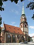
Nikolaikirche | Nicolaiplatz 4 (old town) (map) |
13th century (choir) | Evangelical, two-aisled city parish church, in the core a late Gothic hall church with west tower, neo-Gothic reconstruction by Möckel, of importance in terms of building history, local history and the setting of the square |
09222892 |
| Rectory | Nicolaiplatz 5 (old town) (map) |
18th century | Belonging to Nikolaikirche, of architectural and local importance |
09222455 |
|
| Two houses | Nicolaiplatz 6, main address: Nicolaistraße 12 (old town) (map) |
Around 1880 | Front corner house to Nicolaistraße, cornices at the height of the window sill, flat roof with jamb, further building attached to the east, simple architectural structure with window coverings, significance of building history |
09303448 |
|
| Two houses | Nicolaiplatz 7, main address: Nicolaistraße 12 (old town) (map) |
Around 1880 | Front corner house to Nicolaistraße, cornices at the height of the window sill, flat roof with jamb, further building attached to the east, simple architectural structure with window coverings, significance of building history |
09303448 |
|
 |
Residential building in closed development | Nicolaistraße 1 (old town) (map) |
Around 1905, 18th century portal | Façade with Art Nouveau plaster ornaments, older core structure with basket arch portal, modern shop fitting, of importance in terms of building history and urban planning |
09222414 |
| Residential house in closed development, remains of the original shop front | Nicolaistraße 2 (old town) (map) |
3rd quarter of the 19th century | Historicism facade with strong cornices and ornamental gables, of importance in terms of building history and urban planning |
09222444 |
|
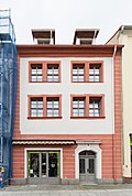 |
Residential house in closed development and rear building | Nicolaistraße 3 (old town) (map) |
1st half of the 18th century | Part of the older development on Nicolaistraße with basket arch portal, younger shop fitting, of importance in terms of building history and urban planning |
09222415 |
| Residential house in closed development and rear building | Nicolaistraße 4 (old town) (map) |
Mid-19th century (older in core); 18th century (Secret Annex) | Residential building with simple historicism facade, older in the core, basket arch portal to the rear, rear building with basket arch portal and walled-up arcades, of importance in terms of building history and urban planning |
09222445 |
|
 |
Residential house in closed development, with original shop front | Nicolaistraße 5 (old town) (map) |
18th century (core building) | Historicism façade, older in the core, of importance in terms of building history and urban development |
09222416 |
| Residential house in closed development, with original shop front | Nicolaistraße 6 (old town) (map) |
3rd quarter of the 19th century | Late classicist facade, of architectural and urban importance |
09224912 |
|
 |
Residential and commercial building in closed development and corner location, with original shop front | Nicolaistraße 7, Rittergasse 1 (old town) (map) |
Around 1910 | Built in the reform style of the time around 1910, a house at Rittergasse 1, of importance in terms of building history, urban planning and shaping the street scene |
09222417 |
 |
Residential house in closed development, with original shop front | Nicolaistraße 8 (old town) (map) |
3rd quarter of the 19th century | Late classicist facade, of architectural and urban importance |
09224913 |
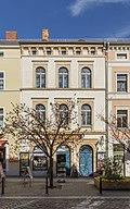 |
Residential building in closed development | Nicolaistraße 10 (old town) (map) |
3rd quarter of the 19th century | Late classicist façade in the arched style, with the original front door, of architectural and urban importance |
09224914 |
 |
Two houses | Nicolaistraße 12, additional address Nicolaiplatz 6 and 7 (old town) (map) |
Around 1880 | Front corner house to Nicolaistraße, cornices at the height of the window sill, flat roof with jamb, further building attached to the east, simple architectural structure with window coverings, significance of building history |
09303448 |
| Residential stable house, barn, side building with Kumthalle and attached barn of a four-sided courtyard, with courtyard paving (monastery property) | Oelsa 1 (map) |
Marked 1852 (quarry stone barn); marked 1854, certainly older (residential stable house) | Stable house upper floor half-timbered, of architectural, economic and local significance |
09299767 |
|
| Residential stable house and two barns in a four-sided courtyard | Oelsa 10 (map) |
Late 18th century, a barn younger | Stable house upper floor half-timbered, a half-timbered barn and a massive barn, of architectural and economic importance |
09222802 |
|
| Former stable house | Oelsa 15 (map) |
Around 1800 | Upper floor half-timbered clad, of architectural and economic importance |
09222800 |
|
| Residential stable house, side building and two barns of a four-sided courtyard | Oelsa 19 (map) |
1793 (stable house); marked 1850 (gate entrance); marked 1866 (barn); 1905 (side building, information) | Significant in terms of building history and economic history and shaping the streetscape |
09222817 |
|
| Former stable house and two barns in a four-sided courtyard | Oelsa 20 (map) |
Around 1800 (stable house); first barn 1910s (information) | Significant in terms of building history and economic history |
09222806 |
|
| Residential building | Oelsa 23 (map) |
1st half of the 19th century | Rural building with half-timbered upper storey, half-timbered, important from an architectural point of view |
09222816 |
|
| Residential stable house | Oelsa 24 (map) |
Early 19th century | Upper floor half-timbered plastered, gable slated, important from an architectural point of view |
09223095 |
|
| Residential building | Oelsa 43 (map) |
1st half of the 19th century | Rural building with half-timbered upper storey, eaves side boarded up, gable slated, important from an architectural point of view |
09222807 |
|
| Residential stable house and angled side building of a farm | Oelsa 45 (map) |
Mid-19th century increase, marked 1897 (increase) | Stable house with half-timbered upper floor, of architectural and economic importance |
09222808 |
|
| Residential stable house and two barns on a farm | Oelsa 49, 49a (map) |
From 1800 (residential stable house); 1915 information (barn); 1923 information (barn) | Stable house with half-timbered upper floor, of architectural and economic importance |
09222811 |
|
| House with integrated barn part and wood pump | Oelsa 57 (map) |
1st half of the 19th century | Part of the barn, half-timbered, is important from an architectural point of view |
09222810 |
|
| Residential stable house and side building of a farm | Oelsa 61 (map) |
Mid 19th century | Stable house with half-timbered upper floor, of architectural and economic importance |
09222815 |
|
| Stable house of a farm | Oelsa 65 (map) |
Marked with 1821? (Residential stable house); 19th century (farm) | Architecturally important |
09222814 |
|
| House and outbuildings | Oelsaer Straße 21 (Altlöbau) (map) |
2nd half of the 19th century | Upper floor half-timbered house, of architectural significance |
09222744 |
|
| Residential stable house with attached barn part (half-timbered) and two side buildings of a farm | Oelsaer Straße 35 (Altlöbau) (map) |
Around 1800 | Significant in terms of building history and economic history |
09222743 |
|
| Apartment building, freestanding to the right, corner house | Pestalozzistraße 1 (map) |
1890s | Clinker brick building with corner bay window, important in terms of building history and urban planning |
09222471 |
|
| Row of tenement houses with shops in closed development | Pestalozzistraße 9 (main address: Lessingstraße 2, 4) (map) |
1956 (information) | Large building with three house numbers, Lessingstraße 2 and 4 connected by a large gate entrance, Pestalozzistraße 9 im Winkel, shop fitting there, of importance in terms of building history and urban planning |
09222510 |
|
| Apartment building in closed development | Pestalozzistraße 11 (map) |
Around 1905 | Art Nouveau facade with original front door, of importance in terms of building history and urban development |
09222508 |
|
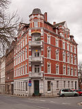 |
Apartment building, freestanding to the right, corner house | Pestalozzistraße 12 (map) |
1890s | Historicism building with clinker brick facade and corner store, of importance in terms of building history and urban planning |
09222486 |
| Apartment building in closed development | Pestalozzistraße 13 (map) |
1900/1905 | Sandstone block building with rich art nouveau ornamentation and original front door, of architectural and urban significance |
09222507 |
|
 |
Insurance building in open development (Deutsche Versicherungs-Aktiengesellschaft) | Pestalozzistraße 14 (map) |
1905/1910 | Reform style of the time around 1910, significant in terms of building history |
09222502 |
| Apartment building in closed development, corner house | Pestalozzistraße 15 (map) |
1890s | Elaborate clinker brick facade, corner accentuation by three gabled houses, of architectural and urban significance |
09222506 |
|
 More pictures |
School building with gym, II. (New) citizen school | Pestalozzistraße 17 (map) |
Marked 1897 | Mighty clinker brick building in the style of the German neo-renaissance, with separate entrances for girls and boys, of architectural and local significance |
09222535 |
| Residential house in open development, with enclosure | Pestalozzistraße 20 (map) |
1905/1910 | Reform style of the time around 1910, with decorative half-timbering, wooden porches and richly structured roof zone, important in terms of building history |
09222565 |
|
 More pictures |
School building with gym (Geschwister-Scholl-Schule, Königliches Lehrerseminar Löbau) | Pestalozzistraße 21 (map) |
Marked 1875; Extension 1906–1907 | Two large building wings, the older building on Pestalozzistraße designated 1875, the younger building on August-Bebel-Straße 1906–1907, new wing added in 1927, according to information, two-part gymnasium in the courtyard, of architectural and local significance |
09222528 |
 |
Post office | Poststrasse 1 (map) |
Signed 1887–1888 | Elaborate, two-storey clinker brick building with gable projections in the style of the German neo-renaissance, of architectural and local importance |
09222497 |
 |
Tenement house with restaurant "Bergquell-Klause" in closed development, corner house | Poststrasse 2 (map) |
1890s | Clinker brick construction, of importance in terms of building history and urban development |
09222536 |
 More pictures |
Residential and commercial building, free-standing to the right, corner building | Poststrasse 3 (map) |
1880s | Clinker brick building in the style of the neo-renaissance, of importance in terms of building history and the appearance of the streets |
09222498 |
 |
Apartment building in closed development, with shop | Poststrasse 4 (map) |
Around 1900 | Clinker brick building with decorative ornamentation, of importance in terms of building history and urban planning |
09222553 |
 More pictures |
Apartment building, free-standing to the left | Poststrasse 6 (map) |
Marked 1892 | Clinker brick building with built-in shops, niche figures on the gable end, of importance in terms of building history and urban planning |
09222554 |
 More pictures |
Administration building (tax office) | Poststrasse 8 (map) |
Right part 1890s | Historic clinker brick building (the younger building on the left is not a monument), historically important |
09222555 |
 |
Residential house in open development | Poststrasse 13 (map) |
Around 1870 | Historicist facade with late Classicist echoes, of architectural and urban importance |
09222560 |
| Apartment building, formerly in closed development | Poststrasse 14 (map) |
1890s | Upper storeys clinker brick, emphasis on the center by flat central projections, of importance in terms of building history and urban planning |
09222557 |
|
 |
Residential house in open development | Poststrasse 15 (map) |
Around 1820 | Classicist building, of importance in terms of building history and urban planning |
09299849 |
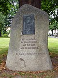 |
Memorial stone for Martin Luther with Luther oak | Promenadenring, on Bahnhofstrasse (old town) (map) |
Marked 1933 | Boulder with a relief plate, of local significance |
09222411 |
 |
Weather pillar (Humboldt pillar) | Promenadenring, on Bahnhofstrasse (old town) (map) |
2nd half of the 19th century | Free-standing sandstone tower with thermometer and barometer, up. from the Humboldt Association, of local and technological importance |
09222410 |
 |
Remains of the city wall in the property at Innere Bautzner Straße 6 and the system of paths along the promenade on the Promenadenring (individual monuments to ID No. 09223137) | Promenadenring (old town) (map) |
14th century (city wall); 19th century (promenade) | Individual features of the aggregate ring system and city fortifications; of importance in terms of building history, urban planning and local history |
09302051 |
 |
Residential building | Promenade Ring 1 (map) |
2nd half of the 18th century | Large classical building on the promenade ring, of architectural significance |
08975873 |
 More pictures |
Post mileage | Corner of Promenadenring 2 (in front) / Bahnhofstraße (map) |
Marked with 1725 (copy 1993) | Copy of a Saxon post-distance column marked 1725, made of sandstone, in a dominant position on the promenade ring. It is in the typical form of an obelisk, with a Saxon-Polish coat of arms as well as an "AR" monogram and post horn mark. The column was made in 1724/25 by the Zittau master stonemason Gottlob Friedrich Engler and the Zittau sculptor Gottlob Kretzschmar and originally stood at the Görlitzer Tor, but was demolished around 1820. The original coat of arms of the column from the former Görlitzer Tor was used in the reconstruction of the column from the Zittauer Tor. The copy standing today on the promenade ring was made in 1993, where the piece of coat of arms is wrong. |
09304977 |
 |
District Court | Promenadenring 3 (old town) (map) |
2nd quarter of the 19th century | Classicist building, is connected to the district prison, see also Rittergasse 9, of architectural and local significance |
09222377 |
 |
Memorial stone for the victims of the pogrom night | Promenadenring 3, next to (old town) (map) |
1980s (presumably) | Seven-armed candlestick on a base, sandstone, with the inscription: “9. November / 1938 / MEMORIAL / NEVER FORGET " |
09222494 |
 |
Apartment building in closed development | Promenade ring 6 (map) |
Marked with 1901 | Elaborate clinker brick building with stucco ornamentation, shop fittings, some in the 19th century, of importance in terms of building history and urban development |
09222537 |
 |
Two houses, No. 8 free-standing to the right, No. 10 in a closed development, form a unit | Promenadenring 8, 10 (old town) (map) |
Around 1800 | Broadly laid out late baroque building, basket arch portal with wrought iron rose tendril, of architectural significance |
09222495 |
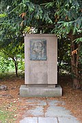 |
Memorial stone for Ernst Thälmann | Promenadenring 10, opposite (old town) (map) |
1950s | Granite stone with bronze relief and inscription, in memory of Ernst Thälmann (1886-1944), chairman of the Communist Party of Germany and victim of fascism, with the symbol of the young pioneers (GDR children's organization), historically significant |
09222492 |
| Printing and publishing building (Cooperative Printing House Ostsachsen) | Promenadenring 12 (map) |
Marked 1923–1924 | In the Heimat style, portal with Art Deco elements, of importance in terms of local history and urban planning |
09300056 |
|
 |
Residential building | Promenadenring 14 (map) |
Around 1860 | Classicist design with plaster ashlars and pilasters, important in terms of building history and urban planning |
09222894 |
 More pictures |
Residential and commercial building in a corner | Promenadenring 16 (map) |
1900/1905 | Late historical facade with Art Nouveau elements, of importance in terms of architectural history, urban planning and the appearance of the square |
09222462 |
 |
Residential and commercial building in closed development and corner location, with original shop front | Rittergasse 1, main address: Nicolaistraße 7 (old town) (map) |
Around 1910 | Built in the reform style of the time around 1910, a house at Rittergasse 1, of importance in terms of building history, urban planning and shaping the street scene |
09222417 |
| Residential house in closed development, corner house | Rittergasse 2 (old town) (map) |
Around 1800 | Significant in terms of building history and urban development |
09222387 |
|
 |
Residential house in closed development, corner house | Rittergasse 3 (old town) (map) |
18th century | Ground floor broken up by shops, of importance in terms of building history and urban planning |
09222388 |
 |
Residential house in closed development, with original shop front | Rittergasse 5 (old town) (map) |
18th century | Simple building with an old front door, of significance in terms of architectural history and urban planning |
09222446 |
 More pictures |
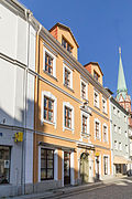
Residential building in closed development | Rittergasse 6 (old town) (map) |
Marked with 1712 | Representative building with basket arch portal and original front door, of architectural and urban importance |
09222386 |
 |
Residential house in half-open development, corner house | Rittergasse 7 (old town) (map) |
Around 1750 | Baroque building with basket arch portal and mansard roof, of importance in terms of architectural history and urban development |
09222382 |
| Residential building in closed development | Rittergasse 8 (old town) (map) |
Marked with 1713 in the keystone | Baroque building with basket arch portal, of importance in terms of building history and urban planning |
09222385 |
|
| Prison with connecting wing to the district court | Rittergasse 9 (old town) (map) |
2nd quarter of the 19th century | Classicist building, is in connection with the district court, see also Promenadenring 3, of architectural and local significance |
09222378 |
|
 |
Residential house in closed development, commercial connecting building and rear building | Rittergasse 10 (old town) (map) |
Marked with 1829 (in the keystone of the portal) | Connecting building with arcades and high upper floor windows, here the production site of the first Försterklavier, rear building to the promenade ring, of architectural and local significance |
09222384 |
| Residential building, free-standing to the left | Rittergasse 12 (old town) (map) |
1st half of the 19th century | With modern shop fittings, of importance in terms of building history and urban planning |
09222383 |
|
| Apartment building in corner position, with memorial plaque Robert Berndt | Robert-Berndt-Strasse 2 (map) |
Around 1905 | Late historical facade, of architectural and urban significance |
09222685 |
|
| Double apartment building in open development | Robert-Berndt-Strasse 3, 5 (map) |
Around 1905/1910 | Late historical facade, smoothed, of architectural and urban significance |
09222696 |
|
 |
Apartment building with shop in closed development, corner house | Sachsenstrasse 1 (map) |
Marked 1897 | Representative, late-historical clinker brick facade with corner bay window and tower attachment, of importance in terms of architectural history, urban planning and the street scene |
09222552 |
| House in a corner | Schillerstrasse 1 (map) |
Around 1905 | Building unit with Dehsaer Straße 2a, stately, richly structured structure with the same roof landscape, of importance in terms of building history and the appearance of the street |
09222765 |
|
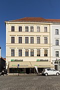 |
Residential house in closed development, corner house | Schulgasse 2 (old town) (map) |
Mid 19th century | Representative building on the Altmarkt, of architectural and urban importance |
09222441 |
| Residential building in closed development | Schulgasse 3 (old town) (map) |
Mid 19th century | Arched façade, important in terms of building history and urban planning |
09222442 |
|
| Residential building, free-standing to the right, and rear building | Schulgasse 5 (old town) (map) |
3rd quarter of the 19th century (residential building); marked 1903 (outbuilding) | Stately historicism facade, of architectural and urban importance |
09222443 |
|
| Residential building in closed development | Schulgasse 6 (old town) (map) |
3rd quarter of the 19th century | Historicism facade, of importance in terms of building history and urban planning |
09222440 |
|
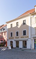
| Residential building in closed development | Schulgasse 8 (old town) (map) |
Mid 19th century | With old lettering: bakery Otto Mitschke pastry shop, important in terms of building history and urban development |
09222439 |
|
 |
Residential house, free-standing to the left, corner house | Sporgasse 2 (old town) (map) |
1st half of the 18th century | With a granite passage portal between No. 2 and 4, baroque building on the Altmarkt, of architectural and urban significance |
09222381 |
| Residential building, free-standing to the right | Sporgasse 5 (old town) (map) |
18th century | Smoothed facade with basket arch door, of importance in terms of building history and urban development |
09222379 |
|
 More pictures |
Monument to the Wars of Liberation of 1813 | Stadionweg (near the stadium) (map) |
Marked with 1903 | Erected on the 90th anniversary of the battle between the French and the allied Poles and Russians, which took place near Ebersdorf on September 9, 1813, a semicircular rock memorial with a cross made of cannon balls and an inscription in 1813 and a boulder with an inscription, of local historical importance |
09223093 |
| Granite wall, driveway and grandstand of the stadium | Stadionweg (map) |
1949 | Structurally and locally of importance |
08975874 |
|
| Row of houses, consisting of three houses, with fencing | Stauffenbergstrasse 1, 3, 5 (map) |
Around 1912 | Facade with plaster decoration, of importance in terms of building history |
09222712 |
|
| Road bridge | Street of Youth (Map) |
Marked 1951 (reconstruction) | Three-arched vault bridge made of quarry stone masonry over the Seltenrein and Zittau suburbs, of importance in terms of building history, technology history and the street scene |
09222794 |
|
| Residential house in open development | Street of Youth 2 (map) |
1st half of the 19th century (right part); around 1910 (residential building) | On the ground floor formerly a restaurant, presumably a former inn, large building complex with different construction times, of architectural significance |
09223090 |
|
| Residential house in open development | Teichgasse 1 (map) |
18th century | Baroque building with mansard roof and stairs to the Seltenrein, of architectural significance |
09300114 |
|
 |
All remains of the medieval city wall with defense tower (so-called cat tower) and path system of the promenade on the pond promenade (individual monuments to ID no. 09223137) | Pond promenade (old town) (map) |
14th century (city wall and powder tower); 19th century (promenade) | Individual features of the aggregate ring system and city fortifications; of importance in terms of building history, urban planning and local history |
09222364 |
 |
barn | Theaterplatz (Am Alten Friedhof) (Map) |
18th century | With two gates and a stately broken roof with a cripple hip, important in terms of the history of the building and the appearance of the square |
09222642 |
 More pictures |
Post mileage | Theaterplatz (map) |
Marked with 1725 (copy 1993) | Copy of a Saxon post-distance column marked 1725, made of sandstone, in a dominant position on the Theaterplatz. It has the typical shape of an obelisk, with a pair of Saxon-Polish coats of arms as well as an "AR" monogram and post horn mark. The column was made in 1724/25 by the Zittau master stonemason Gottlob Friedrich Engler and the Zittau sculptor Gottlob Kretzschmar and originally stood at the Zittau Gate, but was demolished around 1820. At the instigation of Director Sandt, master stonemason Wokurka made a copy of the column. This was set up around 1926 at the former restaurant "Zum Rundteil". The original coat of arms of the column from the former Görlitzer Tor was used in the reconstruction of the column and non-original inscriptions were attached. In 1945 the column was destroyed in an accident. Some fragments were stored in the museum. The copy standing today on Theaterplatz was made in 1993, where the arrangement of the inscriptions and the coat of arms are wrong. |
09222325 |
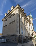 |
Reicheltsche Villa with enclosure | Theaterplatz 2 (old town) (map) |
3rd quarter of the 19th century | Representative building in neo-baroque style with rich stucco ornamentation, of importance in terms of architectural history, architectural design and the street scene |
09222389 |
 More pictures |
House and angled outbuilding | Theaterplatz 4 (map) |
18th century | House with a broken roof with a crippled hip, of architectural significance |
09299850 |
| Apartment building in open development, corner location | Theobald-Hofmann-Strasse 1 (map) |
1905/1910 | Façade with plaster ornamentation and gable projections, of architectural significance |
09223172 |
|
| Apartment building in open development, corner location | Theobald-Hofmann-Strasse 2 (map) |
1905/1910 | With corner turrets and gable projections, changed, historically significant |
09223173 |
|
| Residential building in closed development | Töpferberg 2 (map) |
Early 19th century | Significant in terms of building history and urban development |
09222610 |
|
| Residential house, free-standing to the left | Töpferberg 5 (map) |
1880s | Plastered facade with stucco ornamentation, of importance in terms of building history and urban planning |
09222611 |
|
| Advertising pillar | Vorwerkstrasse (map) |
Around 1900 | Concrete with an original, floral entwined crown |
09304186 |
|
| Tenement house | Vorwerkstrasse 8 (map) |
Around 1900, smoothed | Façade with decorative trusses, of architectural significance |
09222659 |
|
 More pictures |
Apartment building, to the right of the type in closed development, corner house | Weißenberger Strasse 1 (map) |
1890s | Representative historicism facade, clinker brick, of architectural and urban importance |
09222666 |
 |
Apartment building to the right in closed development, corner house, with enclosure | Weißenberger Strasse 5 (map) |
1890s | Historicism facade in clinker construction, of importance in terms of building history and urban development |
09222667 |
| Apartment building in closed development | Weißenberger Strasse 23 (map) |
1930s | Typical design language of the 1930s, important in terms of building history and urban planning |
09222699 |
|
| Tenement house, to the right in a closed development | Weißenberger Strasse 27 (map) |
Around 1920 | Part of a symmetrical row development, important in terms of building history and urban planning |
09222701 |
|
| Apartment building in closed development | Weißenberger Strasse 29 (map) |
Around 1920 | Part of a symmetrical row development, important in terms of building history and urban planning |
09222702 |
|
| fountain | Wettiner Platz (map) |
1920s | Flat bowl fountain with a profiled edging, of importance for the place |
09222627 |
|
| Memorial stone for the victims of fascism | Wettiner Platz (map) |
After 1945 | Granite bowl with copper lid on a stone base, inscription: "Honor the dead, duty the living", historically significant |
09222626 |
|
| Residential house in closed development, with restaurant "Hackerbräu" and shops, corner house | Wettiner Platz 1, 2 (map) |
1867 | High-quality plastered construction with later Art Deco plaster ornamentation, of importance in terms of building history and urban planning |
09222635 |
|
| Residential house in closed development, corner house | Wettiner Platz 3 (map) |
1880s | Balanced historicism facade with pilasters and delicate decorative elements, of importance in terms of building history and urban planning |
09222628 |
|
 |
Apartment house in the type of closed development, corner house | Wettiner Platz 5 (map) |
1890s | Clinker brick facade with stucco elements, of importance in terms of building history and urban planning |
09222567 |
| Team house, house 3 (individual monument for ID no.09302383) | Wilhelm-Leuschner-Platz 1 (map) |
1913-1915 | Individual monument of the whole Jägerkaserne ; of military and local history of importance |
09222722 |
|
 |
Barracks building, House 17 (individual monument for ID No. 09302383) | Wilhelm-Leuschner-Platz 2 (map) |
1913-1915 | Individual monument of the whole Jägerkaserne; of military and local history of importance |
09222723 |
| Reithalle, house 18 (single monument for ID no.09302383) | Wilhelm-Leuschner-Platz 3 (map) |
1913-1915 | Individual monument of the whole Jägerkaserne; of military and local history of importance |
09222724 |
|
| Team house, house 12 (individual monument for ID no.09302383) | Wilhelm-Leuschner-Platz 4 (map) |
1913-1915 | Individual monument of the whole Jägerkaserne; of military and local history of importance |
09222725 |
|
| Barracks building with former horse stables, house 11 (individual monument for ID no.09302383) | Wilhelm-Leuschner-Platz 5 (map) |
1913-1915 | Individual monument of the whole Jägerkaserne; of military and local history of importance |
09222726 |
Remarks
- This list is not suitable for deriving binding statements on the monument status of an object. As far as a legally binding determination of the listed property of an object is desired, the owner can apply to the responsible lower monument protection authority for a notice.
- The official list of cultural monuments is never closed. It is permanently changed through clarifications, new additions or deletions. A transfer of such changes to this list is not guaranteed at the moment.
- The monument quality of an object does not depend on its entry in this or the official list. Objects that are not listed can also be monuments.
- Basically, the property of a monument extends to the substance and appearance as a whole, including the interior. Deviating applies if only parts are expressly protected (e.g. the facade).
swell
- List of listed monuments of the State Office for the Preservation of Monuments in Saxony, as of April 15, 2014
- Monument map of Saxony , accessed on January 9, 2019
- Görlitz district geoportal , accessed on January 9, 2019
Web links
Commons : Kulturdenkmale in Löbau - Collection of pictures
