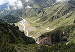
List of natural monuments in Ratschings
The list of natural monuments in Ratschings ( Racines in Italian ) contains the 23 objects designated as natural monuments in the area of the municipality of Racines in South Tyrol .
The basis is the official directory of natural monuments in South Tyrol, which can be viewed on the Internet (as of January 23, 2015). These can be botanical, geological or hydrological natural monuments. The order in this list is based on the ID; alternatively, it can also be sorted by name.
list
| photo | Surname | Location | description |
|---|---|---|---|
| Spruce at the Fiechterhof ID: 073_G01 |
46 ° 52 ′ 51 ″ N, 11 ° 22 ′ 33 ″ E |
Botanical natural monument: spruce |
|
| Sweet chestnut at the Schoaterhof ID: 073_G02 |
46 ° 52 ′ 50 ″ N, 11 ° 22 ′ 19 ″ E |
Botanical natural monument: chestnut |
|

|
Sweet chestnut in the castle courtyard of Wolfsthurn ID: 073_G03 |
46 ° 53 ′ 35 "N, 11 ° 20 ′ 56" E |
Botanical natural monument: chestnut |

|
Gilfenklamm ID: 073_G04 |
46 ° 52 ′ 38 "N, 11 ° 22 ′ 3" E |
Hydrological natural monument: gorge |

|
Burkhardsklamm ID: 073_G05 |
46 ° 56 ′ 14 "N, 11 ° 15 ′ 26" E |
Hydrological natural monument: waterfall |

|
Aglsboden ID: 073_G06 |
46 ° 56 ′ 27 ″ N, 11 ° 15 ′ 5 ″ E |
Hydrological natural monument: river delta |

|
Upper Aglsfalls ID: 073_G07 |
46 ° 57 ′ 2 ″ N, 11 ° 14 ′ 7 ″ E |
Hydrological natural monument: waterfall |

|
Pfurnsee ID: 073_G08 |
46 ° 57 ′ 17 ″ N, 11 ° 15 ′ 17 ″ E |
Hydrological natural monument: lake |

|
Übeltalsee ID: 073_G09 |
46 ° 57 ′ 14 "N, 11 ° 12 ′ 40" E |
Hydrological natural monument: lake |
| Lower Moar Egetsee ID: 073_G10 |
46 ° 54 '24 "N, 11 ° 12' 42" E |
Hydrological natural monument: lake |
|
| Middle Moar Egetsee ID: 073_G11 |
46 ° 54 ′ 37 "N, 11 ° 12 ′ 56" E |
Hydrological natural monument: lake |
|
| Upper Moar Egetsee ID: 073_G12 |
46 ° 54 '44 "N, 11 ° 13' 8" E |
Hydrological natural monument: lake |
|
| Inner dairy farm Egetsee ID: 073_G13 |
46 ° 55 ′ 4 "N, 11 ° 12 ′ 33" E |
Hydrological natural monument: lake |
|
| Middle Senner Egetsee ID: 073_G14 |
46 ° 55 ′ 16 "N, 11 ° 12 ′ 33" E |
Hydrological natural monument: lake |
|
| Outer Senner Egetseen ID: 073_G15 |
46 ° 55 '53 "N, 11 ° 13' 11" E |
Hydrological natural monument: lake |
|
| Troubled Lake ID: 073_G16 |
46 ° 55 '54 "N, 11 ° 13' 35" E |
Hydrological natural monument: lake |
|
| Butsee ID: 073_G17 |
46 ° 51 ′ 56 "N, 11 ° 12 ′ 56" E |
Hydrological natural monument: lake |
|
| Geseebe ID: 073_G18 |
46 ° 55 ′ 23 "N, 11 ° 19 ′ 49" E |
Hydrological natural monument: lake |
|
| Rusterau ID: 073_G19 |
46 ° 53 ′ 4 "N, 11 ° 25 ′ 4" E |
Hydrological natural monument: wetland |
|
| Sprengmoos ID: 073_G20 |
46 ° 52 ′ 39 "N, 11 ° 21 ′ 40" E |
Hydrological natural monument: wetland |
|
| Kerschbaummoos ID: 073_G21 |
46 ° 53 ′ 35 ″ N, 11 ° 20 ′ 0 ″ E |
Hydrological natural monument: wetland |
|
| Untergerinemoos ID: 073_G22 |
46 ° 54 ′ 51 ″ N, 11 ° 18 ′ 19 ″ E |
Hydrological natural monument: wetland |
|
| Achenrain Gorge ID: 073_G23 |
46 ° 54 ′ 17 "N, 11 ° 19 ′ 44" E |
Hydrological natural monument: gorge |
Notes / legend
| Photo: | Photography of the natural monument. Click the photo generates an enlarged view. There are also two symbols: |
| ID | Identifier at the Nature, Landscape and Spatial Development department of the South Tyrolean regional administration |
Web links
Commons : Natural monuments in Ratschings - Collection of images, videos and audio files
- Complete directory of the natural monuments of South Tyrol
- Country browser of the South Tyrolean administration
- Landscape plan of the municipality of Ratschings . Office for Landscape Ecology, Autonomous Province of Bolzano - South Tyrol (PDF file)