List of natural monuments in Laion
The list of natural monuments in Laion ( Lajon in Italian ) contains the 18 objects designated as natural monuments in the area of the municipality of Laion in South Tyrol .
The basis is the official directory of natural monuments in South Tyrol, which can be viewed on the Internet (as of January 23, 2015). These can be botanical, geological or hydrological natural monuments. The order in this list is based on the ID; alternatively, it can also be sorted by name.
See also the list of architectural monuments in Laion .
list
| photo | Surname | Location | description |
|---|---|---|---|

|
a maple near Fonteklaus ID: 040_G01 |
46 ° 38 ′ 23 "N, 11 ° 35 ′ 35" E |
Botanical natural monument: maple |

|
an oak near the moor at Tassis ID: 040_G02 |
46 ° 38 ′ 11 "N, 11 ° 35 ′ 2" E |
Botanical natural monument: An oak under the edge of the forest above the maize field A second oak is located at 46 ° 38 ′ 10.3 ″ N , 11 ° 34 ′ 54.3 ″ E on the edge of the path under the maize field |

|
a sweet chestnut near Lusenegg ID: 040_G03 |
46 ° 38 ′ 1 ″ N, 11 ° 34 ′ 7 ″ E |
Botanical natural monument: chestnut |

|
a walnut tree at Tommele ID: 040_G04 |
46 ° 37 ′ 21 ″ N, 11 ° 33 ′ 39 ″ E |
Botanical natural monument: walnut tree |

|
a sweet chestnut at Mair am Bach ID: 040_G05 |
46 ° 37 '18 "N, 11 ° 33' 36" E |
Botanical natural monument: chestnut |

|
a horse chestnut in Unterfins ID: 040_G06 |
46 ° 36 ′ 5 ″ N, 11 ° 32 ′ 27 ″ E |
Botanical natural monument: horse chestnut |

|
a sweet chestnut at Gasser ID: 040_G07 |
46 ° 36 ′ 10 ″ N, 11 ° 32 ′ 55 ″ E Lajen Ried |
Botanical natural monument: chestnut |

|
two sweet chestnuts at the sub-book fields ID: 040_G08 |
46 ° 36 ′ 9 ″ N, 11 ° 33 ′ 0 ″ E |
Botanical natural monument: chestnut A second sweet chestnut is located at 46 ° 36 ′ 9.8 ″ N , 11 ° 33 ′ 0.1 ″ E on the road to Lajen |

|
a sweet chestnut at Vogelweider ID: 040_G09 |
46 ° 36 '16 "N, 11 ° 32' 56" E |
Botanical natural monument: chestnut The index card 040_G09 may have been created incorrectly |

|
a sweet chestnut at Oberbuchfelder ID: 040_G10 |
46 ° 36 ′ 14 ″ N, 11 ° 33 ′ 0 ″ E |
Botanical natural monument: chestnut |

|
a sweet chestnut at Moser (also Wimmer) ID: 040_G11 |
46 ° 36 ′ 29 "N, 11 ° 34 ′ 50" E |
Botanical natural monument: chestnut (extinct) |

|
a walnut tree in the Bäcknangerle ID: 040_G12 |
46 ° 36 '36 "N, 11 ° 33' 55" E |
Botanical natural monument: walnut tree |

|
a walnut tree at the sacristan's ID: 040_G13 |
46 ° 36 ′ 15 "N, 11 ° 35 ′ 32" E |
Botanical natural monument: walnut tree |

|
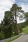
two red pines below Rabans ID: 040_G14 |
46 ° 36 ′ 3 ″ N, 11 ° 37 ′ 0 ″ E |
Botanical natural monument: Föhre |

|
a sweet chestnut at the Untertschutsch ID: 040_G15 |
46 ° 36 ′ 3 "N, 11 ° 34 ′ 56" E |
Botanical natural monument: chestnut |

|
Cold holes in Pontives ID: 040_G16 |
46 ° 35 ′ 28 "N, 11 ° 38 ′ 12" E |
Geological natural monument: ice hole |

|
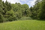
Pliegermoos ID: 040_G17 |
46 ° 36 ′ 3 ″ N, 11 ° 34 ′ 10 ″ E |
Hydrological natural monument: wetland |

|
Tanürzmoos ID: 040_G18 |
46 ° 36 ′ 21 ″ N, 11 ° 35 ′ 25 ″ E |
Hydrological natural monument: wetland |

|
Feldzutterhexlmoos ID: 040_G19 |
46 ° 36 ′ 32 "N, 11 ° 36 ′ 18" E |
Hydrological natural monument: wetland |
Notes / legend
| Photo: | Photography of the natural monument. Click the photo generates an enlarged view. There are also two symbols: |
| ID | Identifier at the Nature, Landscape and Spatial Development department of the South Tyrolean regional administration |
Web links
- Complete directory of the natural monuments of South Tyrol
- Country browser of the South Tyrolean administration
- Landscape plan of the municipality of Laion . Office for Landscape Ecology, Autonomous Province of Bolzano - South Tyrol (PDF file)