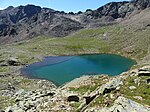
List of natural monuments in Schnals
The list of natural monuments in Schnals ( Senales in Italian ) contains the 25 objects designated as natural monuments in the area of the municipality of Schnals in South Tyrol .
The basis is the official directory of natural monuments in South Tyrol, which can be viewed on the Internet (as of January 23, 2015). These can be botanical, geological or hydrological natural monuments. The order in this list is based on the ID; alternatively, it can also be sorted by name.
list
| photo | Surname | Location | description |
|---|---|---|---|
| 1 larch ID: 090_G01 |
46 ° 43 ′ 15 "N, 10 ° 51 ′ 27" E |
Botanical natural monument: larch |
|

|
Finailsee ID: 090_G02 |
46 ° 45 ′ 44 "N, 10 ° 48 ′ 51" E |
Hydrological natural monument: lake |
| Mastaunbachfall ID: 090_G03 |
46 ° 43 ′ 3 ″ N, 10 ° 51 ′ 26 ″ E |
Hydrological natural monument: waterfall |
|
| Seaber Lacke ID: 090_G04 |
46 ° 44 ′ 2 "N, 10 ° 47 ′ 32" E |
Hydrological natural monument: pond / pond |
|
| Saxalber See ID: 090_G05 |
46 ° 40 ′ 36 "N, 10 ° 54 ′ 7" E |
Hydrological natural monument: lake |
|

|
Penauder Lake District ID: 090_G06 |
46 ° 40 ′ 10 "N, 10 ° 50 ′ 24" E |
Hydrological natural monument: lake |

|
Black paints ID: 090_G07 |
46 ° 43 ′ 6 "N, 10 ° 46 ′ 57" E |
Hydrological natural monument: lake |
| Lazauner Moose ID: 090_G08 |
46 ° 45 ′ 9 ″ N, 10 ° 45 ′ 40 ″ E |
Hydrological natural monument: wetland |
|
| Lakes near the Grubalm ID: 090_P01 |
46 ° 45 ′ 28 "N, 11 ° 0 ′ 24" E |
Hydrological natural monument: pond / pond |
|

|
Lake south of the Wild Hat ID: 090_P02 |
46 ° 44 ′ 16 "N, 10 ° 52 ′ 50" E |
Hydrological natural monument: pond / pond |
| Waterfall at the Eishof ID: 090_P03 |
46 ° 44 ′ 56 "N, 10 ° 58 ′ 27" E |
Hydrological natural monument: waterfall |
|
| Waterfall at the Rableidalm ID: 090_P04 |
46 ° 45 ′ 8 "N, 10 ° 57 ′ 26" E |
Hydrological natural monument: waterfall |
|
| Waterfall south of the Grafferner ID: 090_P05 |
46 ° 44 ′ 58 "N, 10 ° 53 ′ 31" E |
Hydrological natural monument: waterfall |
|
| Waterfall south of the Grafferner ID: 090_P06 |
46 ° 44 ′ 59 "N, 10 ° 53 ′ 2" E |
Hydrological natural monument: waterfall |
|
| Waterfall near Nassereith ID: 090_P07 |
46 ° 43 ′ 19 ″ N, 10 ° 56 ′ 2 ″ E |
Hydrological natural monument: waterfall |
|
| Kessel also ID: 090_P08 |
46 ° 45 ′ 56 "N, 11 ° 0 ′ 54" E |
Hydrological natural monument: glacier |
|
| Pfosser Furthermore ID: 090_P09 |
46 ° 46 ′ 20 "N, 10 ° 55 ′ 18" E |
Hydrological natural monument: glacier |
|

|
Count or stick ID: 090_P10 |
46 ° 45 ′ 32 "N, 10 ° 53 ′ 16" E |
Hydrological natural monument: glacier |
| West Texel also ID: 090_P11 |
46 ° 43 ′ 37 "N, 10 ° 58 ′ 17" E |
Hydrological natural monument: glacier |
|
| Texel also ID: 090_P12 |
46 ° 43 ′ 38 "N, 10 ° 58 ′ 43" E |
Hydrological natural monument: glacier |
|
| Rotwand Ferner ID: 090_P13 |
46 ° 44 ′ 2 "N, 10 ° 59 ′ 5" E |
Hydrological natural monument: glacier |
|
| Klein Trüb Ferner ID: 090_P14 |
46 ° 44 ′ 17 "N, 10 ° 59 ′ 27" E |
Hydrological natural monument: glacier |
|
| Nördlicher Trüb Ferner ID: 090_P15 |
46 ° 44 ′ 21 ″ N, 10 ° 59 ′ 44 ″ E |
Hydrological natural monument: glacier |
|
| Schrottner Ferner ID: 090_P16 |
46 ° 44 ′ 27 "N, 11 ° 0 ′ 28" E |
Hydrological natural monument: glacier |
|

|
Eastern pillar also ID: 090_P17 |
46 ° 44 ′ 51 "N, 11 ° 1 ′ 44" E |
Hydrological natural monument: glacier |
Notes / legend
| Photo: | Photography of the natural monument. Click the photo generates an enlarged view. There are also two symbols: |
| ID | Identifier at the Nature, Landscape and Spatial Development department of the South Tyrolean regional administration |
Web links
Commons : Natural monuments in Schnals - Collection of images, videos and audio files
- Complete directory of the natural monuments of South Tyrol
- Country browser of the South Tyrolean administration
- Landscape plan of the municipality of Schnals . Office for Landscape Ecology, Autonomous Province of Bolzano - South Tyrol (PDF file)