List of natural monuments in Castelrotto
The list of natural monuments in Castelrotto (Ladin Ciastel , Italian Castelrotto ) contains the 38 objects designated as natural monuments in the area of the municipality of Castelrotto in South Tyrol .
The basis is the official directory of natural monuments in South Tyrol, which can be viewed on the Internet (as of January 23, 2015). These can be botanical, geological or hydrological natural monuments. The order in this list is based on the ID; alternatively, it can also be sorted by name.
list
| photo | Surname | Location | description |
|---|---|---|---|

|
A fir tree at the Kastelruth guesthouse ID: 033_G10 |
46 ° 34 ′ 4 ″ N, 11 ° 33 ′ 27 ″ E |
Botanical natural monument: Fir tree with a large trunk diameter and a widely spreading crown The fir tree no longer stands (observation on August 15, 2015) |

|
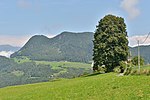
A chestnut tree near Tesimo ID: 033_G11 |
46 ° 34 ′ 21 ″ N, 11 ° 32 ′ 43 ″ E |
Botanical natural monument: chestnut with a large trunk diameter and a broad crown |
|
A linden tree at the Sattler-Hof ID: 033_G12 |
46 ° 33 ′ 23 "N, 11 ° 31 ′ 42" E |
Botanical natural monument: Linden tree with a peculiar trunk |

|
A yew tree at Unterporzhof ID: 033_G13 |
46 ° 33 ′ 7 ″ N, 11 ° 31 ′ 1 ″ E |
Botanical natural monument: exceptionally large yew tree |
|
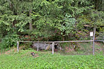
Ice hole at Madrunglhof ID: 033_G14 |
46 ° 33 '46 "N, 11 ° 31' 39" E |
Geological natural monument: ice hole, once used to cool food |
|
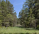
Planning moor ID: 033_G15 |
46 ° 35 ′ 4 "N, 11 ° 33 ′ 51" E |
Hydrological natural monument: swampy terrain with a muddy valley |

|
Moosbichlmoos ID: 033_G16 |
46 ° 34 '46 "N, 11 ° 33' 23" E |
Hydrological natural monument: moored valley in a saddle position |

|
Radlmoos ID: 033_G17 |
46 ° 34 ′ 49 ″ N, 11 ° 33 ′ 15 ″ E |
Hydrological natural monument: small valleys with marshland area and artificially created pond |

|
Glormoos ID: 033_G18 |
46 ° 34 ′ 48 ″ N, 11 ° 33 ′ 0 ″ E |
Hydrological natural monument: elongated moor |

|
Kreuzmoos ID: 033_G19 |
46 ° 34 ′ 55 "N, 11 ° 32 ′ 45" E |
Hydrological natural monument: fen near a saddle |

|
Londermoos ID: 033_G20 |
46 ° 34 ′ 51 ″ N, 11 ° 32 ′ 28 ″ E |
Hydrological natural monument: mossed slope flattening |

|
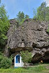
Panid wetland ID: 033_G21 |
46 ° 34 ′ 49 "N, 11 ° 36 ′ 33" E |
Hydrological natural monument: area in the transition between moist mineral soil and fen |
|
Volcanic tuffs ID: 033_G22 |
46 ° 32 ′ 40 "N, 11 ° 32 ′ 35" E |
Geological natural monument: outcrops of volcanic deposits |
|
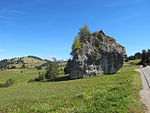
Erratic Dolomite Block Cionstoan ID: 033_L01 |
46 ° 32 '24 "N, 11 ° 37' 32" E |
Geological natural monument: huge dolomite block with overhanging wall surfaces |

|
Witches chair on Bullaccia ID: 033_L02 |
46 ° 33 ′ 48 "N, 11 ° 36 ′ 47" E |
Geological natural monument: pentagonal augite - porphyrite columns |
|
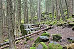
Witches' chairs above Tiosels ID: 033_L03 |
46 ° 33 ′ 55 "N, 11 ° 35 ′ 18" E |
Geological natural monument: stone seats in the shape of armchairs |
|
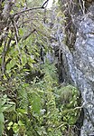
Busc dei Selvans, northwest of Bulla ID: 033_L04 |
46 ° 34 ′ 1 ″ N, 11 ° 37 ′ 37 ″ E |
Geological natural monument: approx. One meter wide crevasse cave ascending to the right of the Schnürlsteig |
|
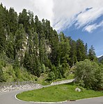
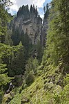
Wildlife guide hole above Gschtatsch ID: 033_L05 |
46 ° 32 ′ 38 "N, 11 ° 35 ′ 13" E |
Geological natural monument: cave with an entrance approx. 1.7 meters high and 60 centimeters wide |
|
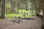
Piscadoi waterfall at Pizbach ID: 033_L06 |
46 ° 33 ′ 38 "N, 11 ° 40 ′ 53" E |
Hydrological natural monument: approx. 60 meter high waterfall |
|
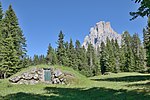
Sulfur spring above Tirler ID: 033_L07 |
46 ° 30 '47 "N, 11 ° 39' 50" E |
Hydrological natural monument: two sulfur springs, one with a wooden well |
|
Cunfin soil sources with corresponding ban area ID: 033_L08 |
46 ° 32 ′ 0 ″ N, 11 ° 42 ′ 7 ″ E |
Hydrological natural monument: two contained springs; the second source is at 46 ° 32 ′ 6.8 " N , 11 ° 42 ′ 9.7" E ; the ban area includes the entire Langkofel- and Plattkofelkar |
| Single group of spruce trees at the Hoferalm ID: 033_L09 |
46 ° 32 ′ 49 "N, 11 ° 40 ′ 35" E |
Botanical natural monument: group of spruce trees consisting of six trees , four of which are fused together at the base, the other two are fused together on their trunk |
|
| Erosion canyon with waterfall ID: 033_P01 |
Hydrological natural monument: |
||
| Erosion canyon with waterfall ID: 033_P02 |
Hydrological natural monument: |
||
| Erosion canyon with waterfall ID: 033_P03 |
Hydrological natural monument: |
||
| Canyon and waterfall in the Tschapit area ID: 033_P04 |
Hydrological natural monument: |
||
| Canyon and waterfall in the Tschapit area ID: 033_P05 |
Hydrological natural monument: |
||

|
Peterlunger-Lock ID: 033_P06 |
46 ° 30 ′ 48 ″ N, 11 ° 37 ′ 16 ″ E |
Hydrological natural monument: |

|
Ladinser Moos ID: 033_P07 |
46 ° 31 ′ 34 "N, 11 ° 37 ′ 29" E |
Hydrological natural monument: |
| Bad Ratzes sources ID: 033_P08 |
Hydrological natural monument: |
||
| Accumulations of water bodies ID: 033_P09 |
Hydrological natural monument: |
||
| Traces of a coral reef ID: 033_P10 |
Geological natural monument: |
||
| Volcanic formations ID: 033_P11 |
Geological natural monument: |
||
| Fossil sites in the Raiblerschichten on the edge of the Schlern plateau ID: 033_P12 |
Geological natural monument: |
||
| Lafreider Höhl, Frötschbach Gorge ID: 033_P13 |
Geological natural monument: |
||
| Chapit discovery sites ID: 033_P14 |
Geological natural monument: |
||
| Chapit discovery sites ID: 033_P15 |
Geological natural monument: |
||
| Sites on the black slopes ID: 033_P16 |
Geological natural monument: |
Notes / legend
| Photo: | Photography of the natural monument. Click the photo generates an enlarged view. There are also two symbols: |
| ID | Identifier at the Nature, Landscape and Spatial Development department of the South Tyrolean regional administration |
Web links
Commons : Natural monuments in Castelrotto - Collection of images, videos and audio files
- Complete directory of the natural monuments of South Tyrol
- Country browser of the South Tyrolean administration
- Landscape plan of the municipality of Castelrotto . Office for Landscape Ecology, Autonomous Province of Bolzano - South Tyrol (PDF file)