List of architectural monuments in Laion
The list of architectural monuments in Laion ( Italian Laion ) contains the 49 objects designated as architectural monuments in the area of the municipality of Laion in South Tyrol .
The basis is the official directory of the monuments in South Tyrol, which can be viewed on the Internet. These can be, for example, sacred buildings , residential houses, farms and aristocratic residences. The order in this list is based on the designation, alternatively it can also be sorted according to the address or the date on which it was placed under protection.
list
| photo | designation | Location | registration | description | Metadata |
|---|---|---|---|---|---|

|
Ausservelgschlir in Ried ID: 15579 |
46 ° 36 '5 "N, 11 ° 32' 39" E |
April 29, 1982 (BLR-LAB 2352) |
Rural house / farm |
KG: Lajen building plot: 359
|

|
Waidbruck station ID: 50124 |
46 ° 36 ′ 4 "N, 11 ° 31 ′ 58" E |
April 5, 2004 (BLR-LAB 1083) |
Waidbruck railway station; the coordinates on the left in the Location column refer to the main building; The water station is located at 46 ° 36 '5.9 " N , 11 ° 31' 59.1" O . |
KG: Lajen building plot: 379/1, 380/1
|

|
Wayside shrine in Albions ID: 15585 |
46 ° 37 '23 "N, 11 ° 33' 35" E |
April 29, 1982 (BLR-LAB 2352) |
Wayside shrine |
KG: Lajen building plot: 86/1 basic plot : 5032
|

|
Wayside shrine in the Lajener Ried ID: 15584 |
46 ° 36 '11 "N, 11 ° 32' 52" E |
April 29, 1982 (BLR-LAB 2352) |
Wayside shrine |
KG: Lajen basic parcel: 4556/2
|

|
Brugger in Waidbruck ID: 15577 |
46 ° 35 ′ 58 "N, 11 ° 31 ′ 58" E |
July 24, 1950 (MD) |
Rural house / farm |
KG: Lajen building plot: 348
|

|
Buchner in Ried ID: 15582 |
46 ° 36 '8 "N, 11 ° 32' 59" E |
April 29, 1982 (BLR-LAB 2352) |
Rural house / farm |
KG: Lajen building plot: 362
|

|
Fonteklaus with Rochus Chapel ID: 15540 |
46 ° 38 ′ 23 "N, 11 ° 35 ′ 35" E |
July 24, 1950 (MD) |
Raised hide |
KG: Lajen building plot: 40, 41
|

|
Frühmesserhaus ID: 15556 |
46 ° 36 '31 "N, 11 ° 33' 48" E |
10 Mar 1978 (BLR-LAB 1573) |
Rural house / farm |
KG: Lajen building plot: 146
|

|
Gasser in Ried ID: 15580 |
46 ° 36 '10 "N, 11 ° 32' 54" E |
April 29, 1982 (BLR-LAB 2352) |
Rural house / farm |
KG: Lajen building plot: 360
|

|
Gasthaus Krone ID: 15559 |
46 ° 36 ′ 32 "N, 11 ° 33 ′ 50" E |
10 Mar 1978 (BLR-LAB 1573) |
Inn |
KG: Lajen building plot: 155
|

|
Gasthaus Sonne ID: 15560 |
46 ° 36 '32 "N, 11 ° 33' 54" E |
10 Mar 1978 (BLR-LAB 1573) |
Inn |
KG: Lajen building plot: 1070, 159 basic plot: 2688
|
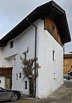
| Hatzes ID: 50621 |
46 ° 36 ′ 31 "N, 11 ° 34 ′ 42" E |
July 31, 2018 (BLR-LAB 765) |
farm |
KG: Lajen building plot: 188/1
|
|
|
Hofer in Albions ID: 15546 |
46 ° 37 '24 "N, 11 ° 33' 37" E |
Jan. 25, 1985 (BLR-LAB 313) |
Rural house / farm |
KG: Lajen building plot: 97
|

|
Hohenhaus ID: 15552 |
46 ° 36 '35 "N, 11 ° 33' 53" E |
10 Mar 1978 (BLR-LAB 1573) |
Rural house / farm |
KG: Lajen building plot: 135, 951
|

|
Huber in Albions ID: 15544 |
46 ° 37 '24 "N, 11 ° 33' 39" E |
April 29, 1982 (BLR-LAB 2352) |
Rural house / farm |
KG: Lajen building plot: 92
|

|
Innervogelweider in Ried ID: 15574 |
46 ° 36 ′ 15 "N, 11 ° 32 ′ 56" E |
Nov. 12, 1990 (BLR-LAB 6878) |
Rural house / farm |
KG: Lajen building plot: 337
|

|
Ischgl in Albions ID: 15547 |
46 ° 37 ′ 27 "N, 11 ° 33 ′ 41" E |
July 24, 1950 (MD) |
Rural house / farm |
KG: Lajen building plot: 102/1
|
|
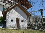
Chapel at Gschloier ID: 15583 |
46 ° 36 ′ 18 "N, 11 ° 32 ′ 22" E |
Nov. 12, 1990 (BLR-LAB 6878) |
chapel |
KG: Lajen basic parcel: 795
|

|
Maria Einsiedeln chapel with wayside shrine ID: 15555 |
46 ° 36 ′ 34 "N, 11 ° 34 ′ 0" E |
10 Mar 1978 (BLR-LAB 1573) |
chapel |
KG: Lajen building plot: 139
|

|
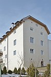
Kofler in Ried ID: 15571 |
46 ° 36 '18 "N, 11 ° 33' 23" E |
April 29, 1982 (BLR-LAB 2352) |
Rural house / farm |
KG: Lajen building plot: 321
|
|
Krenmair ID: 15563 |
46 ° 36 '30 "N, 11 ° 33' 54" E |
April 29, 1982 (BLR-LAB 2352) |
Raised hide |
KG: Lajen building plot: 175/3
|

|
Lusenegg ID: 15542 |
46 ° 38 ′ 2 "N, 11 ° 34 ′ 6" E |
July 24, 1950 (MD) |
Raised hide |
KG: Lajen building plot: 46
|

|
Mair ID: 15551 |
46 ° 36 '36 "N, 11 ° 33' 51" E |
10 Mar 1978 (BLR-LAB 1573) |
Rural house / farm |
KG: Lajen building plot: 134/1
|

|
Mair to Tassis ID: 15541 |
46 ° 38 ′ 5 "N, 11 ° 34 ′ 50" E |
April 29, 1982 (BLR-LAB 2352) |
Rural house / farm |
KG: Lajen building plot: 42/2
|

|
Mairhofer ID: 15561 |
46 ° 36 ′ 33 "N, 11 ° 33 ′ 58" E |
July 24, 1950 (MD) |
Raised hide |
KG: Lajen building plot: 161/2
|

|
Mason ID: 15553 |
46 ° 36 '35 "N, 11 ° 33' 55" E |
10 Mar 1978 (BLR-LAB 1573) |
Rural house / farm |
KG: Lajen building plot: 137
|

|
Ansitz Lusenegg adjoining building ID: 18137 |
46 ° 38 ′ 2 "N, 11 ° 34 ′ 6" E |
July 4, 1994 (BLR-LAB 3724) |
Rural house / farm |
KG: Lajen building plot: 47
|

|
Oberbuchfelder in Ried ID: 15572 |
46 ° 36 ′ 9 ″ N, 11 ° 33 ′ 13 ″ E |
April 29, 1982 (BLR-LAB 2352) |
Rural house / farm |
KG: Lajen building plot: 333
|

|
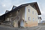
Oberfinser in Ried ID: 15576 |
46 ° 36 ′ 13 ″ N, 11 ° 32 ′ 29 ″ E |
April 29, 1982 (BLR-LAB 2352) |
Rural house / farm |
KG: Lajen building plot: 343
|
|
Penn in Albions ID: 15548 |
46 ° 37 ′ 28 "N, 11 ° 33 ′ 42" E |
July 24, 1950 (MD) |
Rural house / farm |
KG: Lajen building plot: 103
|

|
Parish church of St. Laurentius with cemetery ID: 15557 |
46 ° 36 ′ 28 "N, 11 ° 33 ′ 48" E |
10 Mar 1978 (BLR-LAB 1573) |
church |
KG: Lajen building plot: 149 basic plot: 2532
|

|
Parish church of St. Peter with cemetery chapel and cemetery in St. Peter ID: 15567 |
46 ° 36 ′ 9 ″ N, 11 ° 36 ′ 36 ″ E |
April 29, 1982 (BLR-LAB 2352) |
church |
KG: Lajen building plot: 228, 229 basic plot: 3944
|

|
Prantschur in St. Peter ID: 15566 |
46 ° 36 ′ 21 ″ N, 11 ° 36 ′ 44 ″ E |
Nov. 12, 1990 (BLR-LAB 6878) |
Rural house / farm |
KG: Lajen building plot: 224
|

|
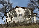
Rabans with Maria-Schnee-Kapelle in St. Peter ID: 15568 |
46 ° 36 ′ 2 ″ N, 11 ° 37 ′ 7 ″ E |
Jan. 31, 1980 (BLR-LAB 505) |
Rural house / farm |
KG: Lajen building plot: 245, 246
|
|
Rafreid in St. Peter ID: 15569 |
46 ° 35 ′ 51 ″ N, 11 ° 37 ′ 4 ″ E |
April 29, 1982 (BLR-LAB 2352) |
Rural house / farm |
KG: Lajen building plot: 273
|

|
Clerk ID: 15554 |
46 ° 36 ′ 36 "N, 11 ° 33 ′ 56" E |
10 Mar 1978 (BLR-LAB 1573) |
Rural house / farm |
KG: Lajen building plot: 138
|

|
St. Bartholomew in Tanürz ID: 15565 |
46 ° 36 ′ 15 "N, 11 ° 35 ′ 32" E |
April 29, 1982 (BLR-LAB 2352) |
church |
KG: Lajen building plot: 206
|

|
St. Jakob and Valentin in Tschöfas ID: 15564 |
46 ° 36 ′ 33 "N, 11 ° 34 ′ 44" E |
April 29, 1982 (BLR-LAB 2352) |
church |
KG: Lajen building plot: 192
|

|
St. John the Baptist in Freins ID: 15549 |
46 ° 37 ′ 51 ″ N, 11 ° 35 ′ 29 ″ E |
April 29, 1982 (BLR-LAB 2352) |
church |
KG: Lajen building plot: 119
|

|
St. Katharina im Lajener Ried ID: 15575 |
46 ° 36 '12 "N, 11 ° 32' 49" E |
October 12, 1987 (BLR-LAB 6180) |
church |
KG: Lajen building plot: 342
|

|
St. Nicholas with cemetery in Albions ID: 15545 |
46 ° 37 '24 "N, 11 ° 33' 40" E |
April 29, 1982 (BLR-LAB 2352) |
church |
KG: Lajen building plot: 93 basic plot: 1227
|

|
Tommele in Albions ID: 15543 |
46 ° 37 '22 "N, 11 ° 33' 40" E |
April 29, 1982 (BLR-LAB 2352) |
Rural house / farm |
KG: Lajen building plot: 80
|

|
Tschutscher ID: 15562 |
46 ° 36 ′ 32 "N, 11 ° 34 ′ 1" E |
July 24, 1950 (MD) |
Rural house / farm |
KG: Lajen building plot: 163
|

|
Our Lady ID: 15558 |
46 ° 36 '32 "N, 11 ° 33' 49" E |
10 Mar 1978 (BLR-LAB 1573) |
church |
KG: Lajen building plot: 154
|

|
Sub-book fields in Ried ID: 15581 |
46 ° 36 ′ 9 ″ N, 11 ° 32 ′ 56 ″ E |
April 29, 1982 (BLR-LAB 2352) |
Rural house / farm |
KG: Lajen building plot: 361
|

|
Unterfinser in Ried ID: 15578 |
46 ° 36 ′ 5 "N, 11 ° 32 ′ 28" E |
April 29, 1982 (BLR-LAB 2352) |
Rural house / farm |
KG: Lajen building plot: 356
|

|
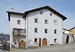
Untertschutscher in Ried ID: 15570 |
46 ° 36 ′ 3 ″ N, 11 ° 34 ′ 59 ″ E |
April 29, 1982 (BLR-LAB 2352) |
Rural house / farm |
KG: Lajen building plot: 294
|
|
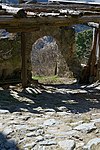
Tenth ID: 15550 |
46 ° 36 '34 "N, 11 ° 33' 51" E |
10 Mar 1978 (BLR-LAB 1573) |
Rural house / farm |
KG: Lajen building plot: 133
|
|
Zoi in Ried ID: 15573 |
46 ° 36 '5 "N, 11 ° 33' 14" E |
April 29, 1982 (BLR-LAB 2352) |
Rural house / farm |
KG: Lajen building plot: 336 |
If no coordinates are known for a monument, the cadastral data at the time it was placed under protection are given as a substitute. These are neither official nor necessarily up-to-date.
The addresses taken from the State Monuments Office may be out of date.
| Photo: | Photograph of the monument. Click the photo generates an enlarged view. There are also two symbols: |
| ID | Identifier at the South Tyrolean Monuments Office |
| KG | Cadastral parish |
| MD | Ministerial Decree |
| BLR-LAB | Decision of the state government - state committee decision |
Web links
- Monument browser of the South Tyrolean Monuments Office