List of architectural monuments in Salurn
The list of architectural monuments in Salurn ( Italian: Salorno ) contains the 48 objects designated as architectural monuments in the area of the municipality of Salurn in South Tyrol .
The basis is the official directory of the monuments in South Tyrol, which can be viewed on the Internet. These can be, for example, sacred buildings , residential houses, farms and aristocratic residences. The order in this list is based on the designation, alternatively it can also be sorted according to the address or the date on which it was placed under protection.
list
| photo | designation | Location | registration | description | Metadata |
|---|---|---|---|---|---|

|
Old shooting range ID: 16871 |
46 ° 14 ′ 15 "N, 11 ° 12 ′ 33" E |
June 16, 1975 (BLR-LAB 2907) |
Shooting range |
KG: Salurn building plot: 50
|

|
Benefit house ID: 16873 |
46 ° 14 '15 "N, 11 ° 12' 31" E |
June 16, 1975 (BLR-LAB 2907) |
Widum / Canon House |
KG: Salurn building plot: 55/1
|
|
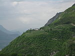
Crozzol ID: 50535 |
46 ° 15 ′ 31 ″ N, 11 ° 14 ′ 50 ″ E |
May 10, 2010 (BLR-LAB 777) |
Rural house / farm |
KG: Salurn building plot: 268, 269, 270, 271
|
| Dornach ID: 16893 |
46 ° 14 ′ 29 ″ N, 11 ° 13 ′ 41 ″ E |
May 3, 1989 (BLR-LAB 2450) |
Raised hide |
KG: Salurn building plot: 165/1, 165/2, 165/3, 165/4
|
|

|
Former Gasthof Schwarzer Adler ID: 50551 |
46 ° 14 ′ 27 "N, 11 ° 12 ′ 35" E |
July 25, 2011 (BLR-LAB 1132) |
Inn |
KG: Salurn building plot: 128/1
|

|
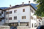
Garibaldistraße 13 ID: 16860 |
Garibaldistraße 13 46 ° 14 ′ 19 ″ N, 11 ° 12 ′ 49 ″ E |
June 16, 1975 (BLR-LAB 2907) |
De Campi residence
Urban residential building |
KG: Salurn building plot: 4
|
|
Gelministraße 2c-4-6 ID: 16880 |
Gelministraße 2c-4-6 46 ° 14 ′ 22 ″ N, 11 ° 12 ′ 37 ″ E |
June 16, 1975 (BLR-LAB 2907) |
Urban residential building |
KG: Salurn building plot: 88/1, 88/4
|

|
Gelministraße 9 ID: 16876 |
Gelministraße 9 46 ° 14 ′ 24 ″ N, 11 ° 12 ′ 34 ″ E |
Jan 17, 1951 (MD) |
Urban residential building |
KG: Salurn building plot: 76
|
| Goethestrasse 3 ID: 16864 |
Goethestrasse 3 46 ° 14 ′ 18 ″ N, 11 ° 12 ′ 46 ″ E |
June 16, 1975 (BLR-LAB 2907) |
Urban residential building |
KG: Salurn building plot: 26, 27, 28
|
|

|
Goethestrasse 5 ID: 16865 |
Goethestrasse 5 46 ° 14 ′ 17 ″ N, 11 ° 12 ′ 47 ″ E |
June 16, 1975 (BLR-LAB 2907) |
Urban residential building |
KG: Salurn building plot: 30
|

|
Goethestrasse 7 ID: 16866 |
Goethestrasse 7 46 ° 14 ′ 17 ″ N, 11 ° 12 ′ 47 ″ E |
Jan 17, 1951 (MD) |
Urban residential building |
KG: Salurn building plot: 33, 850
|
|
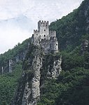
Haderburg ID: 16901 |
46 ° 14 ′ 8 ″ N, 11 ° 12 ′ 22 ″ E |
June 16, 1975 (BLR-LAB 2907) |
Castle ruins |
KG: Salurn land parcel: 1628/1
|
| House on Titschen ID: 16872 |
46 ° 14 ′ 13 ″ N, 11 ° 12 ′ 35 ″ E |
May 3, 1989 (BLR-LAB 2450) |
Urban residential building |
KG: Salurn building plot: 52/1
|
|

|
Hausmann ID: 16889 |
46 ° 14 '25 "N, 11 ° 12' 39" E |
Jan 17, 1951 (MD) |
Urban residential building |
KG: Salurn building plot: 123
|

|
Hoffenburg ID: 16884 |
46 ° 14 ′ 20 "N, 11 ° 12 ′ 41" E |
Jan 17, 1951 (MD) |
Urban residential building |
KG: Salurn building plot: 109/1, 109/2, 109/3
|

|
Hofkeller ID: 16869 |
46 ° 14 ′ 14 "N, 11 ° 12 ′ 40" E |
June 16, 1975 (BLR-LAB 2907) |
Urban residential building |
KG: Salurn building plot: 48
|

|
Josef-Noldin-Strasse 1-3 ID: 16882 |
Josef-Noldin-Strasse 1-3 46 ° 14 ′ 22 ″ N, 11 ° 12 ′ 41 ″ E |
Jan 17, 1951 (MD) |
Urban residential building |
KG: Salurn building plot: 105
|

|
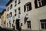
Josef-Noldin-Strasse 9-11 ID: 16881 |
Josef-Noldin-Strasse 9-11 46 ° 14 ′ 23 ″ N, 11 ° 12 ′ 39 ″ E |
Jan 17, 1951 (MD) |
Urban residential building |
KG: Salurn building plot: 100, 102
|
|
Josef-Noldin-Strasse 20 ID: 16888 |
Josef-Noldin-Strasse 20 46 ° 14 ′ 24 ″ N, 11 ° 12 ′ 40 ″ E |
June 16, 1975 (BLR-LAB 2907) |
Urban residential building |
KG: Salurn building plot: 121
|
|
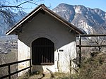
Calvary Chapel with Stations of the Cross ID: 16899 |
46 ° 14 '24 "N, 11 ° 13' 22" E |
June 16, 1975 (BLR-LAB 2907) |
chapel |
KG: Salurn building plot: 340, 341, 342, 343, 344, 345, 346, 347, 349
|

|
Leitach in Buchholz ID: 18175 |
46 ° 15 ′ 27 ″ N, 11 ° 15 ′ 43 ″ E Fraction: Buchholz |
30th Mar 1992 (BLR-LAB 1529) |
Rural house / farm |
KG: Salurn building plot: 248/1 basic plot: 2453/1, 2542
|

|
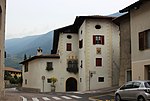
Loreto Chapel ID: 16862 |
46 ° 14 ′ 20 "N, 11 ° 12 ′ 57" E |
June 16, 1975 (BLR-LAB 2907) |
chapel |
KG: Salurn building plot: 18/1
|
|
Loretostraße 6 ID: 16861 |
Loretostrasse 6 46 ° 14 ′ 20 ″ N, 11 ° 12 ′ 49 ″ E |
Jan 17, 1951 (MD) |
Wohlgemuth residence in Wendelstein
Urban residential building |
KG: Salurn building plot: 10/1
|
|
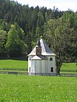
The Visitation of Mary in the Meadow ID: 50269 |
46 ° 16 ′ 35 "N, 11 ° 16 ′ 56" E Fraction: Gfrill |
June 16, 1975 (BLR-LAB 2907) |
church |
KG: Gfrill building plot: 41
|

|
Murenweg 2 ID: 16877 |
Murenweg 2 46 ° 14 ′ 23 ″ N, 11 ° 12 ′ 35 ″ E |
June 16, 1975 (BLR-LAB 2907) |
Urban residential building |
KG: Salurn building plot: 78
|

|
Oberkerschbaum with Maria Snow Chapel in Buchholz ID: 16897 |
46 ° 15 ′ 24 ″ N, 11 ° 15 ′ 29 ″ E Fraction: Buchholz |
June 16, 1975 (BLR-LAB 2907) |
Rural house / farm |
KG: Salurn building plot: 254
|

|
Parish Church of St. Andrew ID: 16859 |
46 ° 14 ′ 21 ″ N, 11 ° 12 ′ 47 ″ E |
June 16, 1975 (BLR-LAB 2907) |
church |
KG: Salurn building plot: 1/1, 1/2
|

|
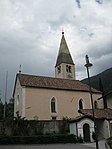
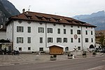
Parish Church of St. Margareth ID: 50267 |
46 ° 16 ′ 19 ″ N, 11 ° 17 ′ 0 ″ E Fraction: Gfrill |
June 16, 1975 (BLR-LAB 2907) |
church |
KG: Gfrill building plot: 6
|
|
Parish Church of St. Ursula in Buchholz ID: 16894 |
46 ° 14 ′ 48 ″ N, 11 ° 14 ′ 29 ″ E Fraction: Buchholz |
June 16, 1975 (BLR-LAB 2907) |
church |
KG: Salurn building plot: 200
|
|
Pfarrwidum ID: 16887 |
46 ° 14 ′ 20 "N, 11 ° 12 ′ 43" E |
June 16, 1975 (BLR-LAB 2907) |
Widum / Canon House |
KG: Salurn building plot: 119/1
|

|
Town hall ID: 16886 |
46 ° 14 ′ 20 "N, 11 ° 12 ′ 44" E |
June 16, 1975 (BLR-LAB 2907) |
Administration building (formerly Khol residence) |
KG: Salurn building plot: 118/1
|

|
Romstrasse 9 ID: 16890 |
Romstrasse 9-11, Trientstrasse 20 46 ° 14 ′ 26 ″ N, 11 ° 12 ′ 34 ″ E |
Jan 17, 1951 (MD) |
Urban residential building |
KG: Salurn building plot: 131/1, 131/3
|
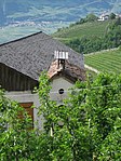
| Schlossweg 14 ID: 16867 |
Schlossweg 14 46 ° 14 ′ 16 ″ N, 11 ° 12 ′ 48 ″ E |
29 Aug 2011 (BLR-LAB 1229) |
Urban residential building |
KG: Salurn building plot: 35
|
|
|
St. Anna in Buchholz ID: 16896 |
46 ° 15 ′ 9 ″ N, 11 ° 15 ′ 7 ″ E Fraction: Buchholz |
July 25, 1977 (BLR-LAB 4986) |
chapel |
KG: Salurn building plot: 236
|

|
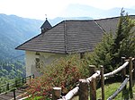
St. Josef am Friedhof ID: 16870 |
46 ° 14 '16 "N, 11 ° 12' 36" E |
June 16, 1975 (BLR-LAB 2907) |
church |
KG: Salurn building plot: 49
|
|
St. Karl bei Röll in Unterstein ID: 50268 |
46 ° 16 ′ 21 ″ N, 11 ° 16 ′ 43 ″ E Fraction: Gfrill |
June 16, 1975 (BLR-LAB 2907) |
church |
KG: Gfrill building plot: 12
|

|
St. John Nepomuk Church ID: 16895 |
46 ° 14 ′ 37 ″ N, 11 ° 13 ′ 39 ″ E |
June 16, 1975 (BLR-LAB 2907) |
church |
KG: Salurn building plot: 207
|
|
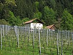
Thalhöfle ID: 50199 |
46 ° 15 ′ 20 ″ N, 11 ° 15 ′ 35 ″ E Fraction: Buchholz |
October 12, 1998 (BLR-LAB 4643) |
Rural house / farm |
KG: Salurn building plot: 249
|

|
Trientstrasse 15 ID: 16878 |
Trientstrasse 15 46 ° 14 ′ 26 ″ N, 11 ° 12 ′ 35 ″ E |
Jan 17, 1951 (MD) |
Urban residential building |
KG: Salurn building plot: 79
|
| Trientstraße 18 ID: 16891 |
Trientstrasse 22-24 46 ° 14 ′ 25 ″ N, 11 ° 12 ′ 34 ″ E |
Jan 17, 1951 (MD) |
Urban residential building |
KG: Salurn building plot: 132/1
|
|

|
Trientstrasse 19 ID: 16879 |
Trientstraße 19-21, Gelministraße 8 46 ° 14 ′ 25 ″ N, 11 ° 12 ′ 35 ″ E |
June 16, 1975 (BLR-LAB 2907) |
Inn |
KG: Salurn building plot: 85/2
|

|
Trientstrasse 34 ID: 16875 |
Trientstrasse 34 46 ° 14 ′ 23 ″ N, 11 ° 12 ′ 31 ″ E |
Jan 17, 1951 (MD) |
Inn |
KG: Salurn building plot: 71/1 basic plot : 2802
|

|
Trientstrasse 36 ID: 16892 |
Trientstrasse 36 46 ° 14 ′ 24 ″ N, 11 ° 12 ′ 32 ″ E |
May 3, 1989 (BLR-LAB 2450) |
Urban residential building |
KG: Salurn building plot: 135
|

|
Trientstrasse 51 ID: 16874 |
Trientstrasse 51 46 ° 14 ′ 16 ″ N, 11 ° 12 ′ 30 ″ E |
June 16, 1975 (BLR-LAB 2907) |
Urban residential building |
KG: Salurn building plot: 60, 66/1, 67/1, 67/2
|

|
Verdistrasse 22 ID: 16868 |
Verdistraße 22 46 ° 14 ′ 15 ″ N, 11 ° 12 ′ 48 ″ E |
June 16, 1975 (BLR-LAB 2907) |
Urban residential building |
KG: Salurn building plot: 41
|
|
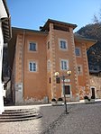
von Liebenstein (from Anderlan) ID: 16885 |
46 ° 14 ′ 19 ″ N, 11 ° 12 ′ 45 ″ E |
June 16, 1975 (BLR-LAB 2907) |
Raised hide |
KG: Salurn building plot: 113, 114, 115
|

|
from Gelmini ID: 16883 |
Schillerstrasse 2 46 ° 14 ′ 21 ″ N, 11 ° 12 ′ 38 ″ E |
Jan 17, 1951 (MD) |
Three-storey mansion with arched gate, stone-framed rectangular windows and oriel turrets. |
KG: Salurn building plot: 106/1, 106/2
|
| Zossenhof with farm buildings ID: 16863 |
46 ° 14 '17 "N, 11 ° 12' 48" E |
June 16, 1975 (BLR-LAB 2907) |
Rural house / farm |
KG: Salurn building plot: 23, 24/2, 24/3, 24/4, 24/5 |
If no coordinates are known for a monument, the cadastral data at the time it was placed under protection are given as a substitute. These are neither official nor necessarily up-to-date.
The addresses taken from the State Monuments Office may be out of date.
| Photo: | Photograph of the monument. Click the photo generates an enlarged view. There are also two symbols: |
| ID | Identifier at the South Tyrolean Monuments Office |
| KG | Cadastral parish |
| MD | Ministerial Decree |
| BLR-LAB | Decision of the state government - state committee decision |
Web links
- Monument browser of the South Tyrolean Monuments Office
- Historic buildings in Salurn